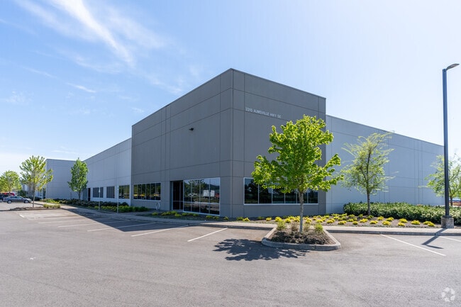
Property Record
3345 Aumsville Hwy Se, Salem, OR 97317

Property Detail
3345 Aumsville Hwy Se
355261
PP 2018-011 LOT 1 ACRES 9.16
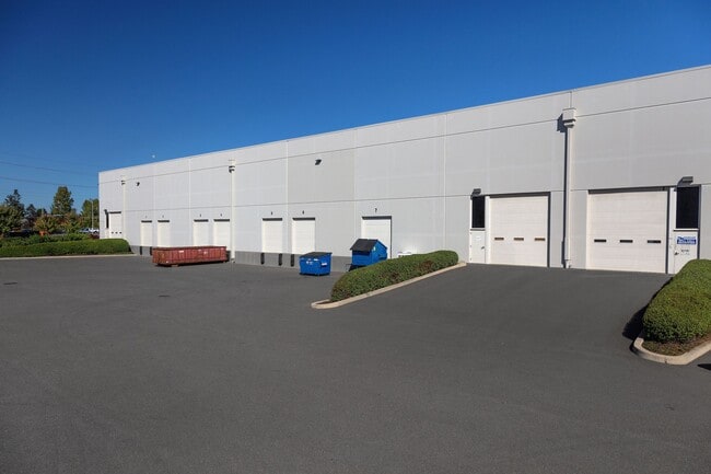
Officebuilding
Marion
EC
Oregon
B and X Area of moderate flood hazard, usually the area between the limits of the 100-year and 500-year floods.
1
2024
9.16 AC
2025
Marion County
001803
Portland
116,030 SF
Salem, OR
NEARBY LISTINGS FOR SALE OR LEASE
DEMOGRAPHICS near 3345 Aumsville Hwy Se
1 mile
3 mile
5 mile
2025 Total Population
4,686
44,890
158,555
2030 Population
4,741
45,611
160,332
Pop Growth 2025-2030
+ 1.17%
+ 1.61%
+ 1.12%
Average Age
40
39
39
2025 Total Households
1,815
14,910
56,951
HH Growth 2025-2030
+ 1.32%
+ 1.78%
+ 1.20%
Median Household Inc
$51,901
$73,273
$71,432
Avg Household Size
2.50
2.70
2.60
2025 Avg HH Vehicles
2.00
2.00
2.00
Median Home Value
$98,484
$388,681
$415,276
Median Year Built
1992
1984
1977
Nearby Places
Map Layers
Map Styles
 Street
 Aerial
Transit
 Traffic
 Biking
Places
Listings with unknown addresses are not visible on the map
- Restaurants
- Banks
- Shops
- Fitness
- Groceries
PUBLIC TRANSPORTATION
COMMUTER RAIL
Salem (Amtrak Cascades - Amtrak, Coast Starlight - Amtrak)
Drive
Walk
Distance
Salem (Amtrak Cascades - Amtrak, Coast Starlight - Amtrak)
10 min
4.6 mi
Freight Ports
Port of Portland
Drive
Walk
Distance
Port of Portland
68 min
52.1 mi
SALE & LEASE HISTORY
LISTING DATE
SALE/LEASE

Jun 09, 2023
For Lease
Feb 12, 2018
For Lease
Nearby Properties
Address
Land Use
TOTAL SIZE
Lot Size
Zoning
Address
Land Use
TOTAL SIZE
Lot Size
Zoning
1,018,020 SF
61.75 AC
EC
Address
Land Use
TOTAL SIZE
Lot Size
Zoning
257,350 SF
19.78 AC
PH
Address
Land Use
TOTAL SIZE
Lot Size
Zoning
466,506 SF
52.60 AC
EC
Address
Land Use
TOTAL SIZE
Lot Size
Zoning
412,248 SF
27.80 AC
Address
Land Use
TOTAL SIZE
Lot Size
Zoning
264,504 SF
28.17 AC
PS
Address
Land Use
TOTAL SIZE
Lot Size
Zoning
Address
Land Use
TOTAL SIZE
Lot Size
Zoning
341,320 SF
17.85 AC
PH
Address
Land Use
TOTAL SIZE
Lot Size
Zoning
158,880 SF
8.80 AC
RM2; RM1;
Address
Land Use
TOTAL SIZE
Lot Size
Zoning
33,560 SF
4.95 AC
CR
Address
Land Use
TOTAL SIZE
Lot Size
Zoning
152,237 SF
8.16 AC
RM2; RM1
Address
Land Use
TOTAL SIZE
Lot Size
Zoning
209,780 SF
19.85 AC
IC
Address
Land Use
TOTAL SIZE
Lot Size
Zoning
62,708 SF
30.21 AC
PH
Address
Land Use
TOTAL SIZE
Lot Size
Zoning
114,647 SF
5.72 AC
RM2; RM1
Address
Land Use
TOTAL SIZE
Lot Size
Zoning
193,237 SF
9.98 AC
IG
Address
Land Use
TOTAL SIZE
Lot Size
Zoning
25.68 AC
IG
Address
Land Use
TOTAL SIZE
Lot Size
Zoning
1,769,016 SF
20.58 AC
CR
Address
Land Use
TOTAL SIZE
Lot Size
Zoning
108,723 SF
7.12 AC
IC
Address
Land Use
TOTAL SIZE
Lot Size
Zoning
129,850 SF
19.66 AC
IBC
Address
Land Use
TOTAL SIZE
Lot Size
Zoning
85,536 SF
10.25 AC
PS
Address
Land Use
TOTAL SIZE
Lot Size
Zoning
310,408 SF
203.73 AC
PH; PE
Address
Land Use
TOTAL SIZE
Lot Size
Zoning
Address
Land Use
TOTAL SIZE
Lot Size
Zoning
118,239 SF
10.69 AC
IG
Address
Land Use
TOTAL SIZE
Lot Size
Zoning
187,873 SF
10.34 AC
RM2; IC
Address
Land Use
TOTAL SIZE
Lot Size
Zoning
136,853 SF
13.32 AC
IC
Address
Land Use
TOTAL SIZE
Lot Size
Zoning
72,325 SF
7.79 AC
IBC
Address
Land Use
TOTAL SIZE
Lot Size
Zoning
0.78 AC
PS
Address
Land Use
TOTAL SIZE
Lot Size
Zoning
167,956 SF
8.38 AC
RM2
Address
Land Use
TOTAL SIZE
Lot Size
Zoning
315,606 SF
18.68 AC
PH
The World's #1 Commercial Real Estate Marketplace
Connect with us
© 2026 CoStar Group
The information above has been obtained from sources believed reliable. While we do not doubt its accuracy we have not verified it and make no guarantee, warranty or representation about it. It is your responsibility to independently confirm its accuracy and completeness. Any projections, opinions, assumptions, or estimates used are for example only and do not represent the current or future performance of the property. The value of this transaction to you depends on tax and other factors which should be evaluated by your tax, financial, and legal advisors. You and your advisors should conduct a careful, independent investigation of the property to determine to your satisfaction the suitability of the property for your needs.