Property Record
332 Petaluma Ave, Sebastopol, CA 95472


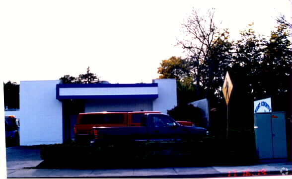

Property Detail
332 Petaluma Ave
004-071-014
MAP D5 139
Warehouse
Sonoma
CITYSE
California
C and X Area of minimal flood hazard, usually depicted on FIRMs as above the 500-year flood level.
17,19
2025
0.17 AC
2025
Sebastopol/Bodega
153406
North Bay/Santa Rosa
3,692 SF
Santa Rosa-Petaluma, CA
NEARBY LISTINGS FOR SALE OR LEASE
DEMOGRAPHICS near 332 Petaluma Ave
1 mile
3 mile
5 mile
2025 Total Population
7,200
16,108
56,993
2030 Population
7,059
15,394
55,598
Pop Growth 2025-2030
(1.96%)
(4.43%)
(2.45%)
Average Age
48
48
44
2025 Total Households
3,188
6,641
20,641
HH Growth 2025-2030
(1.91%)
(4.32%)
(2.73%)
Median Household Inc
$104,264
$105,995
$103,912
Avg Household Size
2.20
2.40
2.60
2025 Avg HH Vehicles
2.00
2.00
2.00
Median Home Value
$856,201
$951,399
$790,592
Median Year Built
1970
1971
1977
Nearby Places
Map Layers
Map Styles
 Street
 Aerial
Layers
 Traffic
 Biking
Places
Listings with unknown addresses are not visible on the map
- Restaurants
- Banks
- Shops
- Fitness
- Groceries
PUBLIC TRANSPORTATION
COMMUTER RAIL
Smart Santa Rosa Downtown (Main Line - Sonoma Marin Area Rail Transit)
Drive
Walk
Distance
Smart Santa Rosa Downtown (Main Line - Sonoma Marin Area Rail Transit)
10 min
6.6 mi
Smart Santa Rosa North (Main Line - Sonoma Marin Area Rail Transit)
Drive
Walk
Distance
Smart Santa Rosa North (Main Line - Sonoma Marin Area Rail Transit)
12 min
8.0 mi
AIRPORT
Charles M Schulz - Sonoma County
Drive
Walk
Distance
Charles M Schulz - Sonoma County
20 min
11.4 mi
Freight Ports
Port of Richmond
Drive
Walk
Distance
Port of Richmond
66 min
49.1 mi
Nearby Properties
Address
Land Use
TOTAL SIZE
Lot Size
Zoning
Address
Land Use
TOTAL SIZE
Lot Size
Zoning
83,274 SF
7.32 AC
Address
Land Use
TOTAL SIZE
Lot Size
Zoning
26,734 SF
9.55 AC
Address
Land Use
TOTAL SIZE
Lot Size
Zoning
1,630 SF
20 AC
Address
Land Use
TOTAL SIZE
Lot Size
Zoning
1,040 SF
2.32 AC
CITYSE
Address
Land Use
TOTAL SIZE
Lot Size
Zoning
93,969 SF
76.04 AC
Address
Land Use
TOTAL SIZE
Lot Size
Zoning
1,156 SF
21.15 AC
Address
Land Use
TOTAL SIZE
Lot Size
Zoning
15,627 SF
2.46 AC
Address
Land Use
TOTAL SIZE
Lot Size
Zoning
4,683 SF
20.11 AC
Address
Land Use
TOTAL SIZE
Lot Size
Zoning
3,442 SF
9.09 AC
AR5
Address
Land Use
TOTAL SIZE
Lot Size
Zoning
22,127 SF
0.40 AC
C3
Address
Land Use
TOTAL SIZE
Lot Size
Zoning
18,403 SF
0.68 AC
Address
Land Use
TOTAL SIZE
Lot Size
Zoning
25,800 SF
1.77 AC
Address
Land Use
TOTAL SIZE
Lot Size
Zoning
20,473 SF
1.02 AC
CITYSE
Address
Land Use
TOTAL SIZE
Lot Size
Zoning
23,572 SF
1.74 AC
CITYSE
Address
Land Use
TOTAL SIZE
Lot Size
Zoning
4,688 SF
1.74 AC
CD
Address
Land Use
TOTAL SIZE
Lot Size
Zoning
5,400 SF
56.30 AC
DA20
Address
Land Use
TOTAL SIZE
Lot Size
Zoning
16,316 SF
3.33 AC
M3
Address
Land Use
TOTAL SIZE
Lot Size
Zoning
33,240 SF
1 AC
MLPD
Address
Land Use
TOTAL SIZE
Lot Size
Zoning
43,968 SF
9.67 AC
Address
Land Use
TOTAL SIZE
Lot Size
Zoning
43,858 SF
2.35 AC
Address
Land Use
TOTAL SIZE
Lot Size
Zoning
1,158 SF
71.18 AC
LEA100
Address
Land Use
TOTAL SIZE
Lot Size
Zoning
4,100 SF
65.01 AC
LEA60
Address
Land Use
TOTAL SIZE
Lot Size
Zoning
47.64 AC
DA20
Address
Land Use
TOTAL SIZE
Lot Size
Zoning
46,285 SF
125.47 AC
Address
Land Use
TOTAL SIZE
Lot Size
Zoning
47,724 SF
3.33 AC
CITYSE
Address
Land Use
TOTAL SIZE
Lot Size
Zoning
1,048 SF
39 AC
DA20
Address
Land Use
TOTAL SIZE
Lot Size
Zoning
6,961 SF
9.77 AC
DA10
Address
Land Use
TOTAL SIZE
Lot Size
Zoning
11,300 SF
0.25 AC
CITYSE
Address
Land Use
TOTAL SIZE
Lot Size
Zoning
1,032 SF
20.47 AC
DA10
Address
Land Use
TOTAL SIZE
Lot Size
Zoning
33,446 SF
0.86 AC
The World's #1 Commercial Real Estate Marketplace
Connect with us
© 2026 CoStar Group
The information above has been obtained from sources believed reliable. While we do not doubt its accuracy we have not verified it and make no guarantee, warranty or representation about it. It is your responsibility to independently confirm its accuracy and completeness. Any projections, opinions, assumptions, or estimates used are for example only and do not represent the current or future performance of the property. The value of this transaction to you depends on tax and other factors which should be evaluated by your tax, financial, and legal advisors. You and your advisors should conduct a careful, independent investigation of the property to determine to your satisfaction the suitability of the property for your needs.