Property Record
3321 E Davis St, Conroe, TX 77301
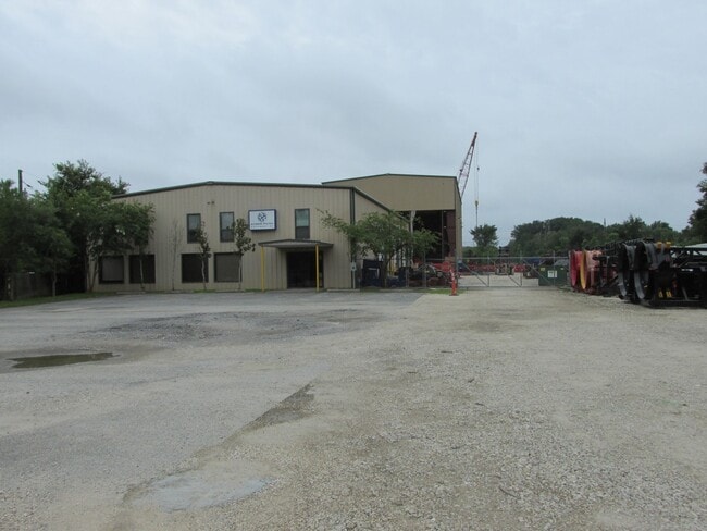


Property Detail
3321 E Davis St
5710-00-02900
S571000 - HARRIS MIKE, ACRES 2.4513, TRACT 2, LOT 5
Industrialgeneral
Montgomery
1
Texas
B and X Area of moderate flood hazard, usually the area between the limits of the 100-year and 500-year floods.
5
2024
2.45 AC
2025
The Woodlands/Conroe
693002
Houston
16,140 SF
Houston-Pasadena-The Woodlands, TX
NEARBY LISTINGS FOR SALE OR LEASE
DEMOGRAPHICS near 3321 E Davis St
1 mile
3 mile
5 mile
2025 Total Population
1,291
34,078
88,244
2030 Population
1,544
40,492
103,961
Pop Growth 2025-2030
+ 19.60%
+ 18.82%
+ 17.81%
Average Age
34
35
36
2025 Total Households
386
10,658
30,280
HH Growth 2025-2030
+ 20.21%
+ 19.50%
+ 18.70%
Median Household Inc
$82,727
$72,771
$68,958
Avg Household Size
3.20
3.10
2.80
2025 Avg HH Vehicles
2.00
2.00
2.00
Median Home Value
$251,851
$227,308
$262,052
Median Year Built
2010
2008
2003
Nearby Places
Map Layers
Map Styles
 Street
 Aerial
Transit
 Traffic
 Biking
Places
Listings with unknown addresses are not visible on the map
- Restaurants
- Banks
- Shops
- Fitness
- Groceries
PUBLIC TRANSPORTATION
AIRPORT
George Bush Intcntl/Houston
Drive
Walk
Distance
George Bush Intcntl/Houston
43 min
34.6 mi
Freight Ports
Port of Houston
Drive
Walk
Distance
Port of Houston
66 min
50.4 mi
SALE & LEASE HISTORY
LISTING DATE
SALE/LEASE

Mar 28, 2017
For Sale
Jul 22, 2021
For Sale
Dec 01, 2016
For Lease
Dec 01, 2016
For Sale
Apr 20, 2022
For Sale
Nearby Properties
Address
Land Use
TOTAL SIZE
Lot Size
Zoning
Address
Land Use
TOTAL SIZE
Lot Size
Zoning
322,082 SF
36.56 AC
1
Address
Land Use
TOTAL SIZE
Lot Size
Zoning
398,842 SF
23.75 AC
1
Address
Land Use
TOTAL SIZE
Lot Size
Zoning
619,770 SF
81.76 AC
Address
Land Use
TOTAL SIZE
Lot Size
Zoning
191,700 SF
19.41 AC
1
Address
Land Use
TOTAL SIZE
Lot Size
Zoning
326,478 SF
20.22 AC
Address
Land Use
TOTAL SIZE
Lot Size
Zoning
206,008 SF
107.61 AC
Address
Land Use
TOTAL SIZE
Lot Size
Zoning
376,980 SF
24.37 AC
1
Address
Land Use
TOTAL SIZE
Lot Size
Zoning
242,944 SF
179.58 AC
Address
Land Use
TOTAL SIZE
Lot Size
Zoning
186,100 SF
29.68 AC
1
Address
Land Use
TOTAL SIZE
Lot Size
Zoning
82,078 SF
61.15 AC
1
Address
Land Use
TOTAL SIZE
Lot Size
Zoning
262,564 SF
51.89 AC
1
Address
Land Use
TOTAL SIZE
Lot Size
Zoning
38,742 SF
249.26 AC
1
Address
Land Use
TOTAL SIZE
Lot Size
Zoning
159,185 SF
18.45 AC
1
Address
Land Use
TOTAL SIZE
Lot Size
Zoning
117,392 SF
27 AC
1
Address
Land Use
TOTAL SIZE
Lot Size
Zoning
143,641 SF
14.80 AC
1
Address
Land Use
TOTAL SIZE
Lot Size
Zoning
161,142 SF
493.71 AC
Address
Land Use
TOTAL SIZE
Lot Size
Zoning
187,426 SF
61.77 AC
1
Address
Land Use
TOTAL SIZE
Lot Size
Zoning
35,026 SF
3.24 AC
Address
Land Use
TOTAL SIZE
Lot Size
Zoning
82,280 SF
9.60 AC
1
Address
Land Use
TOTAL SIZE
Lot Size
Zoning
70,912 SF
5.07 AC
1
Address
Land Use
TOTAL SIZE
Lot Size
Zoning
82,560 SF
1
Address
Land Use
TOTAL SIZE
Lot Size
Zoning
78,110 SF
14 AC
1
Address
Land Use
TOTAL SIZE
Lot Size
Zoning
105,586 SF
16.24 AC
1
Address
Land Use
TOTAL SIZE
Lot Size
Zoning
155,890 SF
20 AC
Address
Land Use
TOTAL SIZE
Lot Size
Zoning
151,295 SF
10 AC
Address
Land Use
TOTAL SIZE
Lot Size
Zoning
63,366 SF
17.93 AC
1
Address
Land Use
TOTAL SIZE
Lot Size
Zoning
255 SF
254.02 AC
Address
Land Use
TOTAL SIZE
Lot Size
Zoning
33,476 SF
7.24 AC
1
Address
Land Use
TOTAL SIZE
Lot Size
Zoning
25,011 SF
8.57 AC
Address
Land Use
TOTAL SIZE
Lot Size
Zoning
132,252 SF
21.40 AC
1
The World's #1 Commercial Real Estate Marketplace
Connect with us
© 2026 CoStar Group
The information above has been obtained from sources believed reliable. While we do not doubt its accuracy we have not verified it and make no guarantee, warranty or representation about it. It is your responsibility to independently confirm its accuracy and completeness. Any projections, opinions, assumptions, or estimates used are for example only and do not represent the current or future performance of the property. The value of this transaction to you depends on tax and other factors which should be evaluated by your tax, financial, and legal advisors. You and your advisors should conduct a careful, independent investigation of the property to determine to your satisfaction the suitability of the property for your needs.