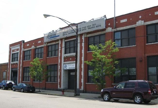
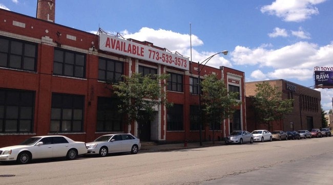
Property Record
3323 W Harrison St, Chicago, IL 60624

Current Lease Availabilities
NEARBY LISTINGS FOR SALE OR LEASE
Property Detail
3323 W Harrison St
16-14-402-050-0000
George K Schoenbergers
Industrialgeneral
Cook
X
Illinois
17031C0505J
10-17
2023
0.57 AC
2024
South Chicago
260800
Chicago
47,577 SF
Chicago-Naperville-Elgin, IL-IN-WI
DEMOGRAPHICS near 3323 W Harrison St
1 Mile
3 Mile
5 Mile
2024 Total Population
34,725
338,670
1,101,896
2029 Population
32,912
316,537
1,047,221
Pop Growth 2024-2029
(5.22%)
(6.54%)
(4.96%)
Average Age
36
36
37
2024 Total Households
13,082
128,360
465,669
HH Growth 2024-2029
(5.70%)
(6.61%)
(4.53%)
Median Household Inc
$23,444
$55,072
$81,793
Avg Household Size
2.50
2.50
2.30
2024 Avg HH Vehicles
1.00
1.00
1.00
Median Home Value
$230,443
$315,795
$383,881
Median Year Built
1949
1948
1955
Nearby Places
Map Layers
Map Styles
 Street
 Aerial
- Restaurants
- Banks
- Shops
- Fitness
- Groceries
PUBLIC TRANSPORTATION
TRANSIT/SUBWAY
Kedzie Station (Green Line) (Green Line - Chicago Transit Authority "L" Trains (The "L"))
DRIVE
WALK
Distance
Kedzie Station (Green Line) (Green Line - Chicago Transit Authority "L" Trains (The "L"))
2 min
20 min
0.9 mi
Pulaski Station (Blue Line - Forest Park Branch) (Blue Line - Chicago Transit Authority "L" Trains (The "L"))
DRIVE
WALK
Distance
Pulaski Station (Blue Line - Forest Park Branch) (Blue Line - Chicago Transit Authority "L" Trains (The "L"))
3 min
18 min
0.9 mi
COMMUTER RAIL
Kedzie Station (Union Pacific West Line - Northeast Illinois Regional Commuter Railroad (Metra))
DRIVE
WALK
Distance
Kedzie Station (Union Pacific West Line - Northeast Illinois Regional Commuter Railroad (Metra))
3 min
1.2 mi
Western Avenue Station (MD-N/MD-W/NCS) (Milwaukee District North Line - Northeast Illinois Regional Commuter Railroad (Metra), Milwaukee District West Line - Northeast Illinois Regional Commuter Railroad (Metra), North Central Service - Northeast Illinois Regional Commuter Railroad (Metra))
DRIVE
WALK
Distance
Western Avenue Station (MD-N/MD-W/NCS) (Milwaukee District North Line - Northeast Illinois Regional Commuter Railroad (Metra), Milwaukee District West Line - Northeast Illinois Regional Commuter Railroad (Metra), North Central Service - Northeast Illinois Regional Commuter Railroad (Metra))
6 min
2.4 mi
AIRPORT
Chicago Midway International
DRIVE
WALK
Distance
Chicago Midway International
14 min
7.7 mi
Chicago O'Hare International
DRIVE
WALK
Distance
Chicago O'Hare International
28 min
17.1 mi
Nearby Properties
Address
Land Use
TOTAL SIZE
Lot Size
Zoning
Address
Land Use
TOTAL SIZE
Lot Size
Zoning
1.44 AC
PD 30
Address
Land Use
TOTAL SIZE
Lot Size
Zoning
73,700 SF
0.48 AC
RM-6.5
Address
Land Use
TOTAL SIZE
Lot Size
Zoning
317,932 SF
0.97 AC
PD 1306
Address
Land Use
TOTAL SIZE
Lot Size
Zoning
131,800 SF
0.57 AC
PD 1344
Address
Land Use
TOTAL SIZE
Lot Size
Zoning
3.29 AC
PD 522
Address
Land Use
TOTAL SIZE
Lot Size
Zoning
2.67 AC
PD 522
Address
Land Use
TOTAL SIZE
Lot Size
Zoning
131,800 SF
0.43 AC
PD 1344
Address
Land Use
TOTAL SIZE
Lot Size
Zoning
0.82 AC
PD 1470
Address
Land Use
TOTAL SIZE
Lot Size
Zoning
0.37 AC
PD 1344
Address
Land Use
TOTAL SIZE
Lot Size
Zoning
0.66 AC
RS-3
Address
Land Use
TOTAL SIZE
Lot Size
Zoning
1,313,541 SF
44.90 AC
M2-2
Address
Land Use
TOTAL SIZE
Lot Size
Zoning
10,600 SF
0.25 AC
PD 1423
Address
Land Use
TOTAL SIZE
Lot Size
Zoning
250,681 SF
0.23 AC
PD 1360
Address
Land Use
TOTAL SIZE
Lot Size
Zoning
4.85 AC
PD 1505
Address
Land Use
TOTAL SIZE
Lot Size
Zoning
1,220,173 SF
26.53 AC
M2-2
Address
Land Use
TOTAL SIZE
Lot Size
Zoning
1.82 AC
PD 30
Address
Land Use
TOTAL SIZE
Lot Size
Zoning
171,768 SF
0.74 AC
PD 1306
Address
Land Use
TOTAL SIZE
Lot Size
Zoning
333,340 SF
Address
Land Use
TOTAL SIZE
Lot Size
Zoning
121,250 SF
0.84 AC
PD 30
Address
Land Use
TOTAL SIZE
Lot Size
Zoning
0.41 AC
DR-3
Address
Land Use
TOTAL SIZE
Lot Size
Zoning
800 SF
0.20 AC
PD 1423
Address
Land Use
TOTAL SIZE
Lot Size
Zoning
32,500 SF
0.56 AC
RT-4
Address
Land Use
TOTAL SIZE
Lot Size
Zoning
0.18 AC
PD 1344
Address
Land Use
TOTAL SIZE
Lot Size
Zoning
307,277 SF
9.90 AC
PMD 11
Address
Land Use
TOTAL SIZE
Lot Size
Zoning
0.15 AC
PD 1489
Address
Land Use
TOTAL SIZE
Lot Size
Zoning
0.14 AC
PD 1489
Address
Land Use
TOTAL SIZE
Lot Size
Zoning
2.74 AC
DS-3
Address
Land Use
TOTAL SIZE
Lot Size
Zoning
0.58 AC
B3-2
Address
Land Use
TOTAL SIZE
Lot Size
Zoning
1.97 AC
PD 30
Address
Land Use
TOTAL SIZE
Lot Size
Zoning
129,379 SF
1.57 AC
PD 1309
The World's #1 Commercial Real Estate Marketplace
Connect with us
© 2025 CoStar Group
The information above has been obtained from sources believed reliable. While we do not doubt its accuracy we have not verified it and make no guarantee, warranty or representation about it. It is your responsibility to independently confirm its accuracy and completeness. Any projections, opinions, assumptions, or estimates used are for example only and do not represent the current or future performance of the property. The value of this transaction to you depends on tax and other factors which should be evaluated by your tax, financial, and legal advisors. You and your advisors should conduct a careful, independent investigation of the property to determine to your satisfaction the suitability of the property for your needs.