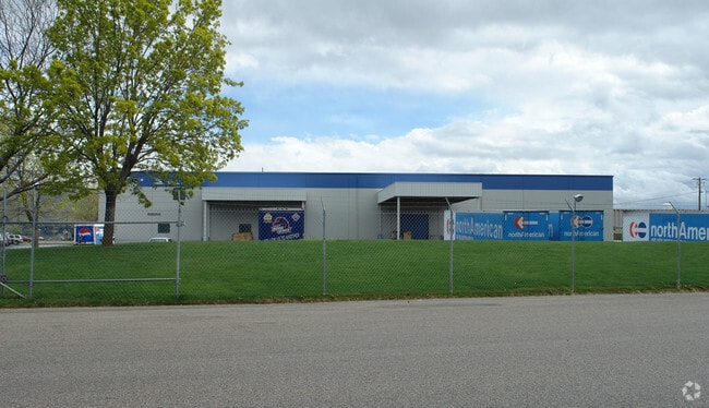
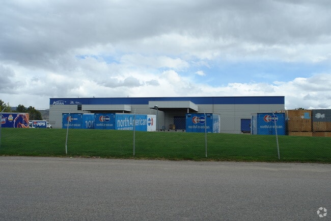
Property Record
3340 S Denver Way, Boise, ID 83705

Property Detail
3340 S Denver Way
R1894420080
LOT 4 BLK 2 DONKEY PARK SUB
Commercialbuilding
Ada
C-3D
Idaho
B and X Area of moderate flood hazard, usually the area between the limits of the 100-year and 500-year floods.
4
2025
2.96 AC
2025
Central Boise
001600
Boise City/Nampa
32,100 SF
Boise City, ID
NEARBY LISTINGS FOR SALE OR LEASE
DEMOGRAPHICS near 3340 S Denver Way
1 mile
3 mile
5 mile
2024 Total Population
9,061
73,822
146,237
2029 Population
9,410
77,645
153,550
Pop Growth 2024-2029
+ 3.85%
+ 5.18%
+ 5.00%
Average Age
41
39
40
2024 Total Households
4,022
32,943
63,550
HH Growth 2024-2029
+ 4.28%
+ 5.76%
+ 5.52%
Median Household Inc
$86,933
$79,668
$82,020
Avg Household Size
2.20
2.10
2.20
2024 Avg HH Vehicles
2.00
2.00
2.00
Median Home Value
$476,626
$526,639
$547,922
Median Year Built
1981
1986
1985
Nearby Places
Map Layers
Map Styles
 Street
 Aerial
Transit
 Traffic
 Biking
Places
Listings with unknown addresses are not visible on the map
- Restaurants
- Banks
- Shops
- Fitness
- Groceries
PUBLIC TRANSPORTATION
AIRPORT
Boise Air Trml/Gowen Field
Drive
Walk
Distance
Boise Air Trml/Gowen Field
12 min
5.8 mi
Nearby Properties
Address
Land Use
TOTAL SIZE
Lot Size
Zoning
Address
Land Use
TOTAL SIZE
Lot Size
Zoning
369,584 SF
1 AC
C-5DD
Address
Land Use
TOTAL SIZE
Lot Size
Zoning
635,403 SF
23.42 AC
C-1D
Address
Land Use
TOTAL SIZE
Lot Size
Zoning
900,981 SF
86.35 AC
ZC-263
Address
Land Use
TOTAL SIZE
Lot Size
Zoning
240,481 SF
1.79 AC
C-5DD/DA
Address
Land Use
TOTAL SIZE
Lot Size
Zoning
251,614 SF
12.62 AC
L-OD
Address
Land Use
TOTAL SIZE
Lot Size
Zoning
279,694 SF
2.09 AC
R-ODD/DA
Address
Land Use
TOTAL SIZE
Lot Size
Zoning
258,747 SF
3.30 AC
R-OD/DA
Address
Land Use
TOTAL SIZE
Lot Size
Zoning
413,253 SF
3.33 AC
R-OD/DA
Address
Land Use
TOTAL SIZE
Lot Size
Zoning
356,969 SF
49.72 AC
M-1D
Address
Land Use
TOTAL SIZE
Lot Size
Zoning
334,334 SF
3.21 AC
R-OD
Address
Land Use
TOTAL SIZE
Lot Size
Zoning
197,268 SF
10.95 AC
R-3D
Address
Land Use
TOTAL SIZE
Lot Size
Zoning
204,396 SF
0.82 AC
C-5DDC
Address
Land Use
TOTAL SIZE
Lot Size
Zoning
203,503 SF
7.93 AC
L-OD
Address
Land Use
TOTAL SIZE
Lot Size
Zoning
245,240 SF
5.40 AC
R-2D
Address
Land Use
TOTAL SIZE
Lot Size
Zoning
223,171 SF
0.85 AC
C-5DD/DA
Address
Land Use
TOTAL SIZE
Lot Size
Zoning
214,318 SF
13.77 AC
R-2D
Address
Land Use
TOTAL SIZE
Lot Size
Zoning
459,218 SF
1.79 AC
H-SD
Address
Land Use
TOTAL SIZE
Lot Size
Zoning
159,859 SF
0.80 AC
C-5DD/DA
Address
Land Use
TOTAL SIZE
Lot Size
Zoning
259,565 SF
4.07 AC
SP-02
Address
Land Use
TOTAL SIZE
Lot Size
Zoning
364,998 SF
40.53 AC
M-1D
Address
Land Use
TOTAL SIZE
Lot Size
Zoning
10.03 AC
R-3D
Address
Land Use
TOTAL SIZE
Lot Size
Zoning
205,522 SF
0.82 AC
C-5DD
Address
Land Use
TOTAL SIZE
Lot Size
Zoning
276,099 SF
8.70 AC
C-5DDC
Address
Land Use
TOTAL SIZE
Lot Size
Zoning
215,141 SF
5.25 AC
SP-01
Address
Land Use
TOTAL SIZE
Lot Size
Zoning
157,347 SF
7.97 AC
R-3
Address
Land Use
TOTAL SIZE
Lot Size
Zoning
216,371 SF
0.78 AC
C-5DDC
Address
Land Use
TOTAL SIZE
Lot Size
Zoning
237,251 SF
20.90 AC
M-1D
Address
Land Use
TOTAL SIZE
Lot Size
Zoning
144,785 SF
2.89 AC
L-OD
Address
Land Use
TOTAL SIZE
Lot Size
Zoning
220,160 SF
12.70 AC
M-1D
Address
Land Use
TOTAL SIZE
Lot Size
Zoning
247,435 SF
2.90 AC
C-2DC
The World's #1 Commercial Real Estate Marketplace
Connect with us
© 2026 CoStar Group
The information above has been obtained from sources believed reliable. While we do not doubt its accuracy we have not verified it and make no guarantee, warranty or representation about it. It is your responsibility to independently confirm its accuracy and completeness. Any projections, opinions, assumptions, or estimates used are for example only and do not represent the current or future performance of the property. The value of this transaction to you depends on tax and other factors which should be evaluated by your tax, financial, and legal advisors. You and your advisors should conduct a careful, independent investigation of the property to determine to your satisfaction the suitability of the property for your needs.