Property Record
178 Virginia Way, Jasper, GA 30143


Save to a Folder
{{folder.Name}}
{{folder.ListingIds.length}} Properties
{{folder.ListingIds.length}} Property
Create a New Folder
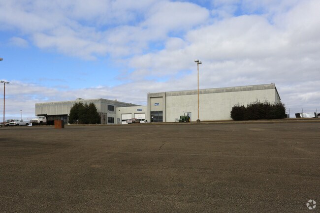
Property Detail
178 Virginia Way
Atlanta-Sandy Springs-Roswell, GA
PICKENS
041-000-016-000
Georgia
Commercialacreage
11.70 AC
C-2
Pickens County
B and X Area of moderate flood hazard, usually the area between the limits of the 100-year and 500-year floods.
Atlanta
54,599 SF
NEARBY LISTINGS FOR SALE OR LEASE
DEMOGRAPHICS near 178 Virginia Way
1 mile
3 mile
5 mile
2025 Total Population
805
10,907
18,853
2030 Population
873
11,773
20,473
Pop Growth 2025-2030
+ 8.45%
+ 7.94%
+ 8.59%
Average Age
41
42
43
2025 Total Households
295
4,174
7,267
HH Growth 2025-2030
+ 8.47%
+ 7.69%
+ 8.46%
Median Household Inc
$57,812
$62,492
$69,836
Avg Household Size
2.60
2.50
2.50
2025 Avg HH Vehicles
2.00
2.00
2.00
Median Home Value
$290,178
$309,971
$327,894
Median Year Built
1984
1993
1994
Nearby Places
Map Layers
Map Styles
 Street
 Aerial
Layers
 Traffic
 Biking
Places
Listings with unknown addresses are not visible on the map
- Restaurants
- Banks
- Shops
- Fitness
- Groceries
SALE & LEASE HISTORY
LISTING DATE
SALE/LEASE

Sep 24, 2016
For Sale
Oct 13, 2016
For Lease
Nearby Properties
Address
Land Use
TOTAL SIZE
Lot Size
Zoning
Address
Land Use
TOTAL SIZE
Lot Size
Zoning
96,642 SF
19.27 AC
C-2
Address
Land Use
TOTAL SIZE
Lot Size
Zoning
Address
Land Use
TOTAL SIZE
Lot Size
Zoning
149,347 SF
18.16 AC
C-2
Address
Land Use
TOTAL SIZE
Lot Size
Zoning
3,280 SF
140.59 AC
HB
Address
Land Use
TOTAL SIZE
Lot Size
Zoning
4,512 SF
22 AC
R-3
Address
Land Use
TOTAL SIZE
Lot Size
Zoning
40,482 SF
1.84 AC
CBD
Address
Land Use
TOTAL SIZE
Lot Size
Zoning
4,800 SF
31.59 AC
HB
Address
Land Use
TOTAL SIZE
Lot Size
Zoning
1,247 SF
10 AC
R-1
Address
Land Use
TOTAL SIZE
Lot Size
Zoning
24,408 SF
3.62 AC
M-1
Address
Land Use
TOTAL SIZE
Lot Size
Zoning
51,709 SF
6 AC
C-2
Address
Land Use
TOTAL SIZE
Lot Size
Zoning
66,768 SF
19.45 AC
R-1
Address
Land Use
TOTAL SIZE
Lot Size
Zoning
9,120 SF
12.06 AC
R-1
Address
Land Use
TOTAL SIZE
Lot Size
Zoning
42,200 SF
16.76 AC
HB
Address
Land Use
TOTAL SIZE
Lot Size
Zoning
10,000 SF
38.60 AC
HB
Address
Land Use
TOTAL SIZE
Lot Size
Zoning
82,500 SF
6.34 AC
C-2
Address
Land Use
TOTAL SIZE
Lot Size
Zoning
70,300 SF
5.06 AC
C-2
Address
Land Use
TOTAL SIZE
Lot Size
Zoning
104,608 SF
10.12 AC
C-2
Address
Land Use
TOTAL SIZE
Lot Size
Zoning
27,014 SF
5.76 AC
C-2
Address
Land Use
TOTAL SIZE
Lot Size
Zoning
14.75 AC
C-2
Address
Land Use
TOTAL SIZE
Lot Size
Zoning
20,689 SF
7.27 AC
C-2
Address
Land Use
TOTAL SIZE
Lot Size
Zoning
27,171 SF
7.03 AC
C-2
Address
Land Use
TOTAL SIZE
Lot Size
Zoning
5,952 SF
3.45 AC
R-3
Address
Land Use
TOTAL SIZE
Lot Size
Zoning
19,541 SF
3.12 AC
C-1
Address
Land Use
TOTAL SIZE
Lot Size
Zoning
9,670 SF
9.73 AC
C-2
Address
Land Use
TOTAL SIZE
Lot Size
Zoning
49,100 SF
4.19 AC
C-2
Address
Land Use
TOTAL SIZE
Lot Size
Zoning
20,461 SF
3.71 AC
M-1
Address
Land Use
TOTAL SIZE
Lot Size
Zoning
21,456 SF
2.36 AC
C-2
Address
Land Use
TOTAL SIZE
Lot Size
Zoning
14,736 SF
2.32 AC
CBD
Address
Land Use
TOTAL SIZE
Lot Size
Zoning
5,928 SF
5 AC
M-1
The World's #1 Commercial Real Estate Marketplace
Connect with us
© 2026 CoStar Group
The information above has been obtained from sources believed reliable. While we do not doubt its accuracy we have not verified it and make no guarantee, warranty or representation about it. It is your responsibility to independently confirm its accuracy and completeness. Any projections, opinions, assumptions, or estimates used are for example only and do not represent the current or future performance of the property. The value of this transaction to you depends on tax and other factors which should be evaluated by your tax, financial, and legal advisors. You and your advisors should conduct a careful, independent investigation of the property to determine to your satisfaction the suitability of the property for your needs.