Property Record
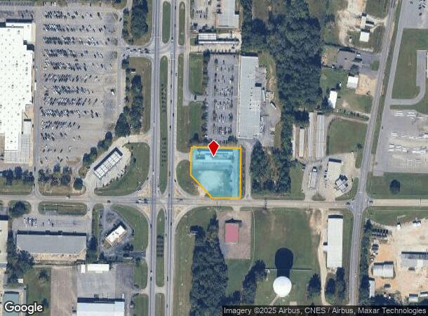
3371 S Oates St, Dothan, AL 36301
NEARBY LISTINGS FOR SALE OR LEASE
Property Detail
3371 S Oates St
17-01-01-2-000-012-007
LOC IN SW1/4 & NW1/4 OF SEC 1 & SE1/4 OF NE1/4 OF SEC 2 T2NR26E BEG @ NE INT OF E INEZ RD & S OATES ST TH N ALG R/W 4.71' NW
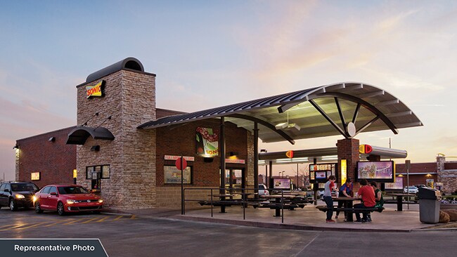
Restaurantdrivein
Houston
X
Alabama
01069C0217G
1.20 AC
2025
Dothan/Enterprise
2025
Other Market Areas
041100
Dothan, AL
3,065 SF
DEMOGRAPHICS near 3371 S Oates St
1 Mile
3 Mile
5 Mile
2024 Total Population
2,518
25,545
56,467
2029 Population
2,582
26,022
57,612
Pop Growth 2024-2029
+ 2.54%
+ 1.87%
+ 2.03%
Average Age
39
40
40
2024 Total Households
1,068
10,565
23,494
HH Growth 2024-2029
+ 2.53%
+ 1.86%
+ 2.01%
Median Household Inc
$43,477
$39,285
$42,341
Avg Household Size
2.30
2.30
2.30
2024 Avg HH Vehicles
2.00
2.00
2.00
Median Home Value
$152,823
$138,350
$149,251
Median Year Built
1985
1978
1978
Nearby Places
Map Layers
Map Styles
 Street
 Aerial
- Restaurants
- Banks
- Shops
- Fitness
- Groceries
PUBLIC TRANSPORTATION
AIRPORT
Dothan Regional
DRIVE
WALK
Distance
Dothan Regional
19 min
11.2 mi
Freight Ports
Port of Panama City
DRIVE
WALK
Distance
Port of Panama City
108 min
82.1 mi
SALE & LEASE HISTORY
LISTING DATE
SALE/LEASE

Aug 19, 2022
For Sale
Nearby Properties
Address
Land Use
TOTAL SIZE
Lot Size
Zoning
Address
Land Use
TOTAL SIZE
Lot Size
Zoning
192,165 SF
2 AC
Address
Land Use
TOTAL SIZE
Lot Size
Zoning
187,423 SF
22.30 AC
Address
Land Use
TOTAL SIZE
Lot Size
Zoning
10,086 SF
16.80 AC
Address
Land Use
TOTAL SIZE
Lot Size
Zoning
79,961 SF
12.40 AC
Address
Land Use
TOTAL SIZE
Lot Size
Zoning
11,422 SF
38 AC
Address
Land Use
TOTAL SIZE
Lot Size
Zoning
9,112 SF
10.50 AC
Address
Land Use
TOTAL SIZE
Lot Size
Zoning
145,107 SF
14.30 AC
Address
Land Use
TOTAL SIZE
Lot Size
Zoning
46,876 SF
12.66 AC
Address
Land Use
TOTAL SIZE
Lot Size
Zoning
2,680 SF
1.67 AC
Address
Land Use
TOTAL SIZE
Lot Size
Zoning
244,027 SF
Address
Land Use
TOTAL SIZE
Lot Size
Zoning
1,764 SF
8.10 AC
Address
Land Use
TOTAL SIZE
Lot Size
Zoning
10,054 SF
9.20 AC
Address
Land Use
TOTAL SIZE
Lot Size
Zoning
65,972 SF
3.84 AC
Address
Land Use
TOTAL SIZE
Lot Size
Zoning
46,974 SF
0.55 AC
Address
Land Use
TOTAL SIZE
Lot Size
Zoning
37,140 SF
0.43 AC
Address
Land Use
TOTAL SIZE
Lot Size
Zoning
1,776 SF
2.89 AC
Address
Land Use
TOTAL SIZE
Lot Size
Zoning
Address
Land Use
TOTAL SIZE
Lot Size
Zoning
93,253 SF
8.46 AC
Address
Land Use
TOTAL SIZE
Lot Size
Zoning
120,000 SF
32 AC
Address
Land Use
TOTAL SIZE
Lot Size
Zoning
4,800 SF
18 AC
Address
Land Use
TOTAL SIZE
Lot Size
Zoning
19,189 SF
5.26 AC
Address
Land Use
TOTAL SIZE
Lot Size
Zoning
48,628 SF
5.13 AC
Address
Land Use
TOTAL SIZE
Lot Size
Zoning
34,743 SF
6.54 AC
Address
Land Use
TOTAL SIZE
Lot Size
Zoning
1,603 SF
4.10 AC
Address
Land Use
TOTAL SIZE
Lot Size
Zoning
1,096 SF
5 AC
Address
Land Use
TOTAL SIZE
Lot Size
Zoning
4,338 SF
10.80 AC
Address
Land Use
TOTAL SIZE
Lot Size
Zoning
150,056 SF
9.43 AC
Address
Land Use
TOTAL SIZE
Lot Size
Zoning
39,320 SF
2.86 AC
Address
Land Use
TOTAL SIZE
Lot Size
Zoning
34,474 SF
6.28 AC
Address
Land Use
TOTAL SIZE
Lot Size
Zoning
7,450 SF
6.30 AC
The World's #1 Commercial Real Estate Marketplace
Connect with us
© 2025 CoStar Group
The information above has been obtained from sources believed reliable. While we do not doubt its accuracy we have not verified it and make no guarantee, warranty or representation about it. It is your responsibility to independently confirm its accuracy and completeness. Any projections, opinions, assumptions, or estimates used are for example only and do not represent the current or future performance of the property. The value of this transaction to you depends on tax and other factors which should be evaluated by your tax, financial, and legal advisors. You and your advisors should conduct a careful, independent investigation of the property to determine to your satisfaction the suitability of the property for your needs.