Property Record
3390 Denver Dr, Denver, NC 28037


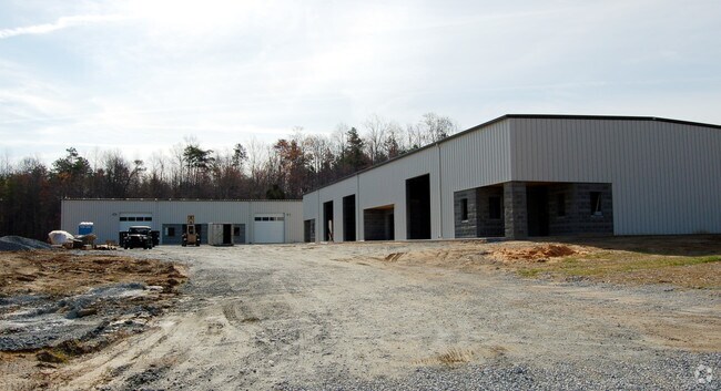
Property Detail
3390 Denver Dr
84046
#41&42 DENVER BUS PK SEC3
Multipleuses
Lincoln
I-G
North Carolina
2025
1.92 AC
2025
Lincoln County
071101
Charlotte
6,480 SF
Charlotte-Concord-Gastonia, NC-SC
NEARBY LISTINGS FOR SALE OR LEASE
DEMOGRAPHICS near 3390 Denver Dr
1 mile
3 mile
5 mile
2025 Total Population
1,045
19,307
39,762
2030 Population
1,164
21,309
43,782
Pop Growth 2025-2030
+ 11.39%
+ 10.37%
+ 10.11%
Average Age
41
43
44
2025 Total Households
412
7,453
15,705
HH Growth 2025-2030
+ 11.41%
+ 10.39%
+ 10.13%
Median Household Inc
$96,474
$109,492
$106,764
Avg Household Size
2.50
2.60
2.50
2025 Avg HH Vehicles
2.00
2.00
2.00
Median Home Value
$388,725
$478,592
$487,198
Median Year Built
1998
2001
2001
Nearby Places
Map Layers
Map Styles
 Street
 Aerial
Transit
 Traffic
 Biking
Places
Listings with unknown addresses are not visible on the map
- Restaurants
- Banks
- Shops
- Fitness
- Groceries
PUBLIC TRANSPORTATION
AIRPORT
Charlotte/Douglas International
Drive
Walk
Distance
Charlotte/Douglas International
48 min
27.1 mi
Concord-Padgett Regional
Drive
Walk
Distance
Concord-Padgett Regional
46 min
32.4 mi
Nearby Properties
Address
Land Use
TOTAL SIZE
Lot Size
Zoning
Address
Land Use
TOTAL SIZE
Lot Size
Zoning
56,780 SF
30.55 AC
B-G
Address
Land Use
TOTAL SIZE
Lot Size
Zoning
52,732 SF
17.01 AC
ELDD R-SF
Address
Land Use
TOTAL SIZE
Lot Size
Zoning
91,753 SF
19.94 AC
R-T
Address
Land Use
TOTAL SIZE
Lot Size
Zoning
6,264 SF
24.64 AC
ELDD B-G
Address
Land Use
TOTAL SIZE
Lot Size
Zoning
66,136 SF
18.10 AC
ELDD B-N &
Address
Land Use
TOTAL SIZE
Lot Size
Zoning
9,827 SF
13.35 AC
ELDD R-SF
Address
Land Use
TOTAL SIZE
Lot Size
Zoning
7,800 SF
4.49 AC
ELDD B-G C
Address
Land Use
TOTAL SIZE
Lot Size
Zoning
251,009 SF
20.46 AC
ELDD I-G
Address
Land Use
TOTAL SIZE
Lot Size
Zoning
42,185 SF
5.26 AC
B-G
Address
Land Use
TOTAL SIZE
Lot Size
Zoning
12,948 SF
28.37 AC
R-SF
Address
Land Use
TOTAL SIZE
Lot Size
Zoning
32,163 SF
48.72 AC
ELDD R-T
Address
Land Use
TOTAL SIZE
Lot Size
Zoning
17,443 SF
19.66 AC
B-G
Address
Land Use
TOTAL SIZE
Lot Size
Zoning
81,228 SF
26.89 AC
ELDD B-N C
Address
Land Use
TOTAL SIZE
Lot Size
Zoning
17,978 SF
39.55 AC
R-T
Address
Land Use
TOTAL SIZE
Lot Size
Zoning
601.08 AC
R-T
Address
Land Use
TOTAL SIZE
Lot Size
Zoning
8,100 SF
275.67 AC
PD-R CU
Address
Land Use
TOTAL SIZE
Lot Size
Zoning
20,923 SF
2.83 AC
R-S CU
Address
Land Use
TOTAL SIZE
Lot Size
Zoning
44,606 SF
4.49 AC
ELDD PD-I
Address
Land Use
TOTAL SIZE
Lot Size
Zoning
45,326 SF
4.45 AC
ELDD B-G
Address
Land Use
TOTAL SIZE
Lot Size
Zoning
12,000 SF
7.87 AC
ELDD B-G C
Address
Land Use
TOTAL SIZE
Lot Size
Zoning
12,500 SF
2.53 AC
ELDD B-G
Address
Land Use
TOTAL SIZE
Lot Size
Zoning
19,952 SF
2.24 AC
ELDD B-N
Address
Land Use
TOTAL SIZE
Lot Size
Zoning
9,657 SF
6.29 AC
R-T
Address
Land Use
TOTAL SIZE
Lot Size
Zoning
24,548 SF
11.40 AC
ELDD B-G
Address
Land Use
TOTAL SIZE
Lot Size
Zoning
20,000 SF
2.60 AC
ELDD I-G
Address
Land Use
TOTAL SIZE
Lot Size
Zoning
60,000 SF
28.03 AC
ELDD I-G
Address
Land Use
TOTAL SIZE
Lot Size
Zoning
24,325 SF
2.92 AC
ELDD B-N
Address
Land Use
TOTAL SIZE
Lot Size
Zoning
16,000 SF
3.12 AC
ELDD B-G
Address
Land Use
TOTAL SIZE
Lot Size
Zoning
23,940 SF
3.63 AC
I-G
Address
Land Use
TOTAL SIZE
Lot Size
Zoning
13,512 SF
2.23 AC
ELDD B-G C
The World's #1 Commercial Real Estate Marketplace
Connect with us
© 2026 CoStar Group
The information above has been obtained from sources believed reliable. While we do not doubt its accuracy we have not verified it and make no guarantee, warranty or representation about it. It is your responsibility to independently confirm its accuracy and completeness. Any projections, opinions, assumptions, or estimates used are for example only and do not represent the current or future performance of the property. The value of this transaction to you depends on tax and other factors which should be evaluated by your tax, financial, and legal advisors. You and your advisors should conduct a careful, independent investigation of the property to determine to your satisfaction the suitability of the property for your needs.