Property Record
3401 E Truman Rd, Kansas City, MO 64127


NEARBY LISTINGS FOR SALE OR LEASE
Property Detail
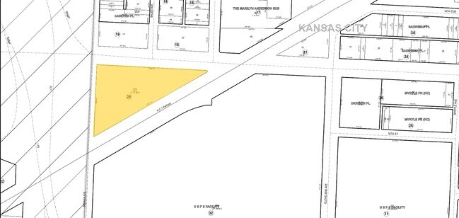
3401 E Truman Rd
28-340-20-03-00-0-00-000
SECTION 03 TOWNSHIP 49 RANGE 33 BEG AT SE COR 15TH & INDIANA STS TH E TO N LI K C TERMINAL RY TH SWLY ALG SD N LI TO E L I INDIANA AVE TH N ALG SD E LI TO BEG
Warehouse
Jackson
X
Missouri
29095C0256H
2.61 AC
2024
East Bottoms KC
2025
Kansas City
016000
Kansas City, MO-KS
54,757 SF
DEMOGRAPHICS near 3401 E Truman Rd
1 Mile
3 Mile
5 Mile
2024 Total Population
15,541
112,104
218,556
2029 Population
15,971
114,923
222,840
Pop Growth 2024-2029
+ 2.77%
+ 2.51%
+ 1.96%
Average Age
36
36
37
2024 Total Households
5,534
48,315
97,518
HH Growth 2024-2029
+ 2.67%
+ 2.57%
+ 2.04%
Median Household Inc
$36,019
$45,679
$48,786
Avg Household Size
2.60
2.10
2.10
2024 Avg HH Vehicles
1.00
1.00
1.00
Median Home Value
$100,812
$116,124
$140,788
Median Year Built
1955
1954
1954
Nearby Places
Map Layers
Map Styles
 Street
 Aerial
- Restaurants
- Banks
- Shops
- Fitness
- Groceries
PUBLIC TRANSPORTATION
COMMUTER RAIL
DRIVE
WALK
Distance
8 min
3.6 mi
DRIVE
WALK
Distance
14 min
7.4 mi
AIRPORT
Kansas City International
DRIVE
WALK
Distance
Kansas City International
31 min
22.3 mi
SALE & LEASE HISTORY
LISTING DATE
SALE/LEASE

Sep 12, 2017
For Sale
Apr 17, 2019
For Lease
Nearby Properties
Address
Land Use
TOTAL SIZE
Lot Size
Zoning
Address
Land Use
TOTAL SIZE
Lot Size
Zoning
172,810 SF
Address
Land Use
TOTAL SIZE
Lot Size
Zoning
568,235 SF
9.59 AC
Address
Land Use
TOTAL SIZE
Lot Size
Zoning
488,351 SF
8.34 AC
Address
Land Use
TOTAL SIZE
Lot Size
Zoning
1,825,083 SF
25.77 AC
Address
Land Use
TOTAL SIZE
Lot Size
Zoning
63,748 SF
3.92 AC
Address
Land Use
TOTAL SIZE
Lot Size
Zoning
404,524 SF
5.51 AC
Address
Land Use
TOTAL SIZE
Lot Size
Zoning
711,196 SF
15.58 AC
Address
Land Use
TOTAL SIZE
Lot Size
Zoning
277,042 SF
0.40 AC
Address
Land Use
TOTAL SIZE
Lot Size
Zoning
257,647 SF
3.63 AC
Address
Land Use
TOTAL SIZE
Lot Size
Zoning
44,491 SF
1.96 AC
C3A2
Address
Land Use
TOTAL SIZE
Lot Size
Zoning
81,578 SF
1.63 AC
Address
Land Use
TOTAL SIZE
Lot Size
Zoning
115,627 SF
1.56 AC
Address
Land Use
TOTAL SIZE
Lot Size
Zoning
261,570 SF
1.82 AC
Address
Land Use
TOTAL SIZE
Lot Size
Zoning
157,488 SF
1.60 AC
Address
Land Use
TOTAL SIZE
Lot Size
Zoning
87,294 SF
0.70 AC
Address
Land Use
TOTAL SIZE
Lot Size
Zoning
803,812 SF
5.85 AC
Address
Land Use
TOTAL SIZE
Lot Size
Zoning
384,543 SF
5.40 AC
Address
Land Use
TOTAL SIZE
Lot Size
Zoning
614,978 SF
31.56 AC
Address
Land Use
TOTAL SIZE
Lot Size
Zoning
274,622 SF
1.35 AC
Address
Land Use
TOTAL SIZE
Lot Size
Zoning
162,095 SF
Address
Land Use
TOTAL SIZE
Lot Size
Zoning
342,989 SF
1.84 AC
Address
Land Use
TOTAL SIZE
Lot Size
Zoning
238,003 SF
1.74 AC
Address
Land Use
TOTAL SIZE
Lot Size
Zoning
349,977 SF
2.21 AC
Address
Land Use
TOTAL SIZE
Lot Size
Zoning
191,753 SF
0.79 AC
M1
Address
Land Use
TOTAL SIZE
Lot Size
Zoning
250,410 SF
3.74 AC
Address
Land Use
TOTAL SIZE
Lot Size
Zoning
131,115 SF
2.80 AC
Address
Land Use
TOTAL SIZE
Lot Size
Zoning
32,777 SF
21.40 AC
Address
Land Use
TOTAL SIZE
Lot Size
Zoning
50,504 SF
0.39 AC
Address
Land Use
TOTAL SIZE
Lot Size
Zoning
90,023 SF
1.18 AC
Address
Land Use
TOTAL SIZE
Lot Size
Zoning
480,594 SF
44 SF
The World's #1 Commercial Real Estate Marketplace
Connect with us
© 2026 CoStar Group
The information above has been obtained from sources believed reliable. While we do not doubt its accuracy we have not verified it and make no guarantee, warranty or representation about it. It is your responsibility to independently confirm its accuracy and completeness. Any projections, opinions, assumptions, or estimates used are for example only and do not represent the current or future performance of the property. The value of this transaction to you depends on tax and other factors which should be evaluated by your tax, financial, and legal advisors. You and your advisors should conduct a careful, independent investigation of the property to determine to your satisfaction the suitability of the property for your needs.