Property Record
3420 E Harmony Rd, Fort Collins, CO 80528
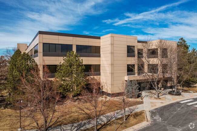

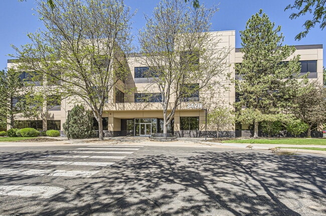

Property Detail
3420 E Harmony Rd
Fort Collins-Loveland, CO
LOT 1, PRESTON-KELLEY 3RD SUB, FTC (20180073580)
87333-28-001
LARIMER
Officebuilding
Colorado
B and X Area of moderate flood hazard, usually the area between the limits of the 100-year and 500-year floods.
1
2024
22.89 AC
2025
Fort Collins/Loveland
001605
Denver
189,255 SF
NEARBY LISTINGS FOR SALE OR LEASE
DEMOGRAPHICS near 3420 E Harmony Rd
1 mile
3 mile
5 mile
2025 Total Population
7,530
54,621
136,711
2030 Population
7,703
56,422
141,777
Pop Growth 2025-2030
+ 2.30%
+ 3.30%
+ 3.71%
Average Age
38
39
38
2025 Total Households
3,099
21,593
54,201
HH Growth 2025-2030
+ 2.52%
+ 3.49%
+ 3.80%
Median Household Inc
$96,387
$107,458
$97,490
Avg Household Size
2.30
2.40
2.40
2025 Avg HH Vehicles
2.00
2.00
2.00
Median Home Value
$627,524
$691,014
$658,320
Median Year Built
2003
2000
1996
Nearby Places
Map Layers
Map Styles
 Street
 Aerial
Layers
 Traffic
 Biking
Places
Listings with unknown addresses are not visible on the map
- Restaurants
- Banks
- Shops
- Fitness
- Groceries
SALE & LEASE HISTORY
LISTING DATE
SALE/LEASE

Sep 26, 2016
For Lease
Oct 17, 2022
For Lease
Jun 11, 2020
For Lease
Jun 02, 2025
For Sale
Jan 30, 2023
For Lease
Jan 17, 2019
For Lease
Aug 08, 2022
For Lease
Nearby Properties
Address
Land Use
TOTAL SIZE
Lot Size
Zoning
Address
Land Use
TOTAL SIZE
Lot Size
Zoning
986,039 SF
69.46 AC
HC
Address
Land Use
TOTAL SIZE
Lot Size
Zoning
235,094 SF
20.06 AC
HC
Address
Land Use
TOTAL SIZE
Lot Size
Zoning
360,725 SF
33.93 AC
MMN
Address
Land Use
TOTAL SIZE
Lot Size
Zoning
536,325 SF
71.48 AC
Address
Land Use
TOTAL SIZE
Lot Size
Zoning
211,711 SF
19.22 AC
HC
Address
Land Use
TOTAL SIZE
Lot Size
Zoning
215,240 SF
29.22 AC
RL
Address
Land Use
TOTAL SIZE
Lot Size
Zoning
95,880 SF
16.69 AC
Address
Land Use
TOTAL SIZE
Lot Size
Zoning
180,030 SF
18.80 AC
Address
Land Use
TOTAL SIZE
Lot Size
Zoning
137,014 SF
13.64 AC
HC
Address
Land Use
TOTAL SIZE
Lot Size
Zoning
146,813 SF
26.87 AC
Address
Land Use
TOTAL SIZE
Lot Size
Zoning
190,617 SF
10.30 AC
HC
Address
Land Use
TOTAL SIZE
Lot Size
Zoning
98,518 SF
7.54 AC
MMN
Address
Land Use
TOTAL SIZE
Lot Size
Zoning
199,464 SF
29.36 AC
HC
Address
Land Use
TOTAL SIZE
Lot Size
Zoning
371,388 SF
22.29 AC
Address
Land Use
TOTAL SIZE
Lot Size
Zoning
312,405 SF
16.01 AC
Address
Land Use
TOTAL SIZE
Lot Size
Zoning
215,222 SF
23.23 AC
Address
Land Use
TOTAL SIZE
Lot Size
Zoning
42,205 SF
11.50 AC
Address
Land Use
TOTAL SIZE
Lot Size
Zoning
375,679 SF
17.13 AC
Address
Land Use
TOTAL SIZE
Lot Size
Zoning
97,130 SF
8.48 AC
Address
Land Use
TOTAL SIZE
Lot Size
Zoning
191,538 SF
21.82 AC
Address
Land Use
TOTAL SIZE
Lot Size
Zoning
99,997 SF
10.47 AC
NC
Address
Land Use
TOTAL SIZE
Lot Size
Zoning
69,065 SF
11.67 AC
E
Address
Land Use
TOTAL SIZE
Lot Size
Zoning
177,171 SF
13.28 AC
HC
Address
Land Use
TOTAL SIZE
Lot Size
Zoning
106,534 SF
7.55 AC
E
Address
Land Use
TOTAL SIZE
Lot Size
Zoning
363,533 SF
13.39 AC
Address
Land Use
TOTAL SIZE
Lot Size
Zoning
144,438 SF
5.51 AC
LMN
Address
Land Use
TOTAL SIZE
Lot Size
Zoning
285,616 SF
10.16 AC
Address
Land Use
TOTAL SIZE
Lot Size
Zoning
112,500 SF
30 AC
RL
The World's #1 Commercial Real Estate Marketplace
Connect with us
© 2026 CoStar Group
The information above has been obtained from sources believed reliable. While we do not doubt its accuracy we have not verified it and make no guarantee, warranty or representation about it. It is your responsibility to independently confirm its accuracy and completeness. Any projections, opinions, assumptions, or estimates used are for example only and do not represent the current or future performance of the property. The value of this transaction to you depends on tax and other factors which should be evaluated by your tax, financial, and legal advisors. You and your advisors should conduct a careful, independent investigation of the property to determine to your satisfaction the suitability of the property for your needs.