Property Record
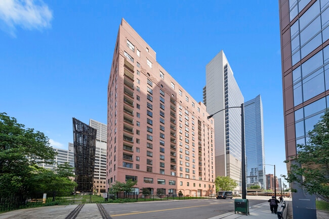
345 N Canal St, Chicago, IL 60606


Current Lease Availabilities
NEARBY LISTINGS FOR SALE OR LEASE
Property Detail
345 N Canal St
Chicago-Naperville-Elgin, IL-IN-WI
Fulton House Condominium
17-09-306-011-1094
Cook
Condominium
Illinois
A
0.50 AC
17031C0419J
West Loop
31,400 SF
Chicago
DEMOGRAPHICS near 345 N Canal St
1 Mile
3 Mile
5 Mile
2024 Total Population
102,597
442,095
877,716
2029 Population
102,571
434,876
848,189
Pop Growth 2024-2029
(0.03%)
(1.63%)
(3.36%)
Average Age
36
37
37
2024 Total Households
61,585
237,899
428,036
HH Growth 2024-2029
(0.20%)
(1.66%)
(3.17%)
Median Household Inc
$129,292
$112,731
$93,415
Avg Household Size
1.60
1.80
2.00
2024 Avg HH Vehicles
1.00
1.00
1.00
Median Home Value
$477,396
$498,875
$464,274
Median Year Built
2002
1986
1969
Nearby Places
Map Layers
Map Styles
 Street
 Aerial
- Restaurants
- Banks
- Shops
- Fitness
- Groceries
PUBLIC TRANSPORTATION
TRANSIT/SUBWAY
Clinton Station (Green, Pink Lines) (Green Line - Chicago Transit Authority "L" Trains (The "L"), Pink Line - Chicago Transit Authority "L" Trains (The "L"))
DRIVE
WALK
Distance
Clinton Station (Green, Pink Lines) (Green Line - Chicago Transit Authority "L" Trains (The "L"), Pink Line - Chicago Transit Authority "L" Trains (The "L"))
1 min
4 min
0.2 mi
Merchandise Mart Station (Brown Line - Chicago Transit Authority "L" Trains (The "L"), Purple Line - Chicago Transit Authority "L" Trains (The "L"))
DRIVE
WALK
Distance
Merchandise Mart Station (Brown Line - Chicago Transit Authority "L" Trains (The "L"), Purple Line - Chicago Transit Authority "L" Trains (The "L"))
3 min
8 min
0.4 mi
Grand Avenue Station (Blue Line) (Blue Line - Chicago Transit Authority "L" Trains (The "L"))
DRIVE
WALK
Distance
Grand Avenue Station (Blue Line) (Blue Line - Chicago Transit Authority "L" Trains (The "L"))
10 min
0.5 mi
Chicago Avenue Station (Brown, Purple Lines) (Brown Line - Chicago Transit Authority "L" Trains (The "L"), Purple Line - Chicago Transit Authority "L" Trains (The "L"))
DRIVE
WALK
Distance
Chicago Avenue Station (Brown, Purple Lines) (Brown Line - Chicago Transit Authority "L" Trains (The "L"), Purple Line - Chicago Transit Authority "L" Trains (The "L"))
2 min
12 min
0.6 mi
Washington/Wells Station (Downtown Loop) (Brown Line - Chicago Transit Authority "L" Trains (The "L"), Orange Line - Chicago Transit Authority "L" Trains (The "L"), Pink Line - Chicago Transit Authority "L" Trains (The "L"), Purple Line - Chicago Transit Authority "L" Trains (The "L"))
DRIVE
WALK
Distance
Washington/Wells Station (Downtown Loop) (Brown Line - Chicago Transit Authority "L" Trains (The "L"), Orange Line - Chicago Transit Authority "L" Trains (The "L"), Pink Line - Chicago Transit Authority "L" Trains (The "L"), Purple Line - Chicago Transit Authority "L" Trains (The "L"))
15 min
0.8 mi
COMMUTER RAIL
Chicago Ogilvie Transportation Center (Union Pacific North Line - Northeast Illinois Regional Commuter Railroad (Metra), Union Pacific Northwest Line - Northeast Illinois Regional Commuter Railroad (Metra), Union Pacific West Line - Northeast Illinois Regional Commuter Railroad (Metra))
DRIVE
WALK
Distance
Chicago Ogilvie Transportation Center (Union Pacific North Line - Northeast Illinois Regional Commuter Railroad (Metra), Union Pacific Northwest Line - Northeast Illinois Regional Commuter Railroad (Metra), Union Pacific West Line - Northeast Illinois Regional Commuter Railroad (Metra))
2 min
7 min
0.4 mi
Chicago Union Station (Burlington Northern-Santa Fe Railway Line - Northeast Illinois Regional Commuter Railroad (Metra), Heritage Corridor Line - Northeast Illinois Regional Commuter Railroad (Metra), Milwaukee District North Line - Northeast Illinois Regional Commuter Railroad (Metra), Milwaukee District West Line - Northeast Illinois Regional Commuter Railroad (Metra), North Central Service - Northeast Illinois Regional Commuter Railroad (Metra), SouthWest Service - Northeast Illinois Regional Commuter Railroad (Metra))
DRIVE
WALK
Distance
Chicago Union Station (Burlington Northern-Santa Fe Railway Line - Northeast Illinois Regional Commuter Railroad (Metra), Heritage Corridor Line - Northeast Illinois Regional Commuter Railroad (Metra), Milwaukee District North Line - Northeast Illinois Regional Commuter Railroad (Metra), Milwaukee District West Line - Northeast Illinois Regional Commuter Railroad (Metra), North Central Service - Northeast Illinois Regional Commuter Railroad (Metra), SouthWest Service - Northeast Illinois Regional Commuter Railroad (Metra))
3 min
12 min
0.6 mi
AIRPORT
Chicago Midway International
DRIVE
WALK
Distance
Chicago Midway International
18 min
10.8 mi
Chicago O'Hare International
DRIVE
WALK
Distance
Chicago O'Hare International
17 min
15.9 mi
Freight Ports
Port of Baltimore
DRIVE
WALK
Distance
Port of Baltimore
1 min
606.8 mi
Nearby Properties
Address
Land Use
TOTAL SIZE
Lot Size
Zoning
Address
Land Use
TOTAL SIZE
Lot Size
Zoning
4,667,723 SF
2.94 AC
DC-16
Address
Land Use
TOTAL SIZE
Lot Size
Zoning
1,546,909 SF
0.98 AC
PD 1369
Address
Land Use
TOTAL SIZE
Lot Size
Zoning
3,457,865 SF
3.74 AC
PD 70
Address
Land Use
TOTAL SIZE
Lot Size
Zoning
1,362,475 SF
1.97 AC
PD 1226
Address
Land Use
TOTAL SIZE
Lot Size
Zoning
2,343,906 SF
2.32 AC
PD 70
Address
Land Use
TOTAL SIZE
Lot Size
Zoning
1,396,750 SF
4.09 AC
PD 98
Address
Land Use
TOTAL SIZE
Lot Size
Zoning
1,810,145 SF
1.03 AC
PD 365
Address
Land Use
TOTAL SIZE
Lot Size
Zoning
3,090,691 SF
3.30 AC
PD 377,PD
Address
Land Use
TOTAL SIZE
Lot Size
Zoning
0.82 AC
PD 1115
Address
Land Use
TOTAL SIZE
Lot Size
Zoning
0.88 AC
DC-16,PD 9
Address
Land Use
TOTAL SIZE
Lot Size
Zoning
2,750,656 SF
6.29 AC
PD 1065
Address
Land Use
TOTAL SIZE
Lot Size
Zoning
1,888,207 SF
2.03 AC
PD 264
Address
Land Use
TOTAL SIZE
Lot Size
Zoning
1,496,448 SF
2 AC
PD 376
Address
Land Use
TOTAL SIZE
Lot Size
Zoning
2,429,909 SF
2.93 AC
PD 882
Address
Land Use
TOTAL SIZE
Lot Size
Zoning
2,456,900 SF
0.96 AC
PD 256
Address
Land Use
TOTAL SIZE
Lot Size
Zoning
2,612,517 SF
1.28 AC
PD 256
Address
Land Use
TOTAL SIZE
Lot Size
Zoning
4,296,046 SF
6.15 AC
DC-16
Address
Land Use
TOTAL SIZE
Lot Size
Zoning
1,215,367 SF
3.76 AC
PD 675
Address
Land Use
TOTAL SIZE
Lot Size
Zoning
3,914,400 SF
5.70 AC
DC-16
Address
Land Use
TOTAL SIZE
Lot Size
Zoning
1,559,966 SF
1.38 AC
DC-12
Address
Land Use
TOTAL SIZE
Lot Size
Zoning
831,084 SF
2.05 AC
PD 316
Address
Land Use
TOTAL SIZE
Lot Size
Zoning
1,316,385 SF
0.76 AC
PD 381
Address
Land Use
TOTAL SIZE
Lot Size
Zoning
1,231,710 SF
2.01 AC
PD 27
Address
Land Use
TOTAL SIZE
Lot Size
Zoning
1,051,000 SF
0.93 AC
PD 325
Address
Land Use
TOTAL SIZE
Lot Size
Zoning
0.61 AC
PD 824
Address
Land Use
TOTAL SIZE
Lot Size
Zoning
1,502,279 SF
3.79 AC
PD 98
Address
Land Use
TOTAL SIZE
Lot Size
Zoning
1,661,783 SF
0.56 AC
PD 500
Address
Land Use
TOTAL SIZE
Lot Size
Zoning
1,600,546 SF
1.04 AC
PD 191
Address
Land Use
TOTAL SIZE
Lot Size
Zoning
0.23 AC
PD 756
Address
Land Use
TOTAL SIZE
Lot Size
Zoning
1.54 AC
PD 743
The World's #1 Commercial Real Estate Marketplace
Connect with us
© 2025 CoStar Group
The information above has been obtained from sources believed reliable. While we do not doubt its accuracy we have not verified it and make no guarantee, warranty or representation about it. It is your responsibility to independently confirm its accuracy and completeness. Any projections, opinions, assumptions, or estimates used are for example only and do not represent the current or future performance of the property. The value of this transaction to you depends on tax and other factors which should be evaluated by your tax, financial, and legal advisors. You and your advisors should conduct a careful, independent investigation of the property to determine to your satisfaction the suitability of the property for your needs.