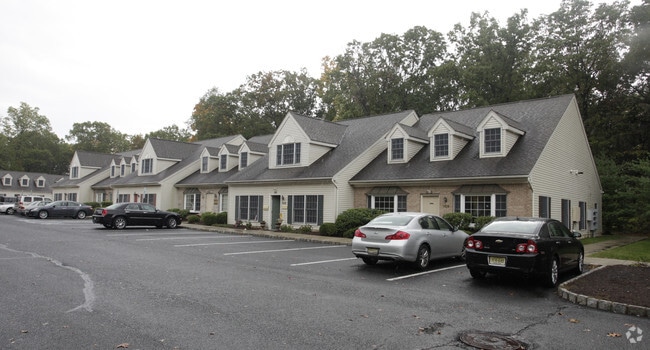
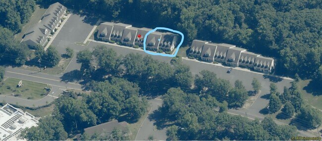
Property Record
35 Clyde Rd, Somerset, NJ 08873

NEARBY LISTINGS FOR SALE OR LEASE
Property Detail
35 Clyde Rd
Lakewood-New Brunswick, NJ
Towne Professional Pk/Somerset
08-00089-02-00001-12
Somerset
Medicalbuilding
New Jersey
X
1.12
34035C0260E
0.03 AC
2024
Somerset
2025
Northern New Jersey
053300
DEMOGRAPHICS near 35 Clyde Rd
1 Mile
3 Mile
5 Mile
2024 Total Population
4,304
92,243
225,823
2029 Population
4,295
91,631
224,942
Pop Growth 2024-2029
(0.21%)
(0.66%)
(0.39%)
Average Age
42
39
38
2024 Total Households
1,449
31,778
76,321
HH Growth 2024-2029
(0.28%)
(0.53%)
(0.26%)
Median Household Inc
$115,131
$93,462
$96,003
Avg Household Size
2.90
2.70
2.70
2024 Avg HH Vehicles
2.00
2.00
2.00
Median Home Value
$388,007
$371,698
$397,991
Median Year Built
1968
1978
1979
Nearby Places
Map Layers
Map Styles
 Street
 Aerial
- Restaurants
- Banks
- Shops
- Fitness
- Groceries
PUBLIC TRANSPORTATION
COMMUTER RAIL
Jersey Avenue (Northeast Corridor Line - NJ Transit Commuter Rail (NJ Transit))
DRIVE
WALK
Distance
Jersey Avenue (Northeast Corridor Line - NJ Transit Commuter Rail (NJ Transit))
6 min
2.9 mi
New Brunswick (Northeast Corridor Line - NJ Transit Commuter Rail (NJ Transit))
DRIVE
WALK
Distance
New Brunswick (Northeast Corridor Line - NJ Transit Commuter Rail (NJ Transit))
10 min
4.0 mi
AIRPORT
Newark Liberty International
DRIVE
WALK
Distance
Newark Liberty International
36 min
28.6 mi
SALE & LEASE HISTORY
LISTING DATE
SALE/LEASE

Sep 13, 2019
For Sale
Oct 02, 2020
For Sale
Jun 28, 2022
For Sale
Aug 05, 2017
For Sale
Apr 20, 2021
For Sale
Nearby Properties
Address
Land Use
TOTAL SIZE
Lot Size
Zoning
Address
Land Use
TOTAL SIZE
Lot Size
Zoning
25.77 AC
C-6
Address
Land Use
TOTAL SIZE
Lot Size
Zoning
11.50 AC
HI
Address
Land Use
TOTAL SIZE
Lot Size
Zoning
99.79 AC
B-I
Address
Land Use
TOTAL SIZE
Lot Size
Zoning
78.71 AC
ER
Address
Land Use
TOTAL SIZE
Lot Size
Zoning
48.30 AC
GB
Address
Land Use
TOTAL SIZE
Lot Size
Zoning
16,397 SF
41.98 AC
R20
Address
Land Use
TOTAL SIZE
Lot Size
Zoning
543,945 SF
48.46 AC
B-I
Address
Land Use
TOTAL SIZE
Lot Size
Zoning
18.21 AC
E
Address
Land Use
TOTAL SIZE
Lot Size
Zoning
11.35 AC
R20
Address
Land Use
TOTAL SIZE
Lot Size
Zoning
34.75 AC
CR
Address
Land Use
TOTAL SIZE
Lot Size
Zoning
27.23 AC
CR
Address
Land Use
TOTAL SIZE
Lot Size
Zoning
5.74 AC
C-2B
Address
Land Use
TOTAL SIZE
Lot Size
Zoning
4.89 AC
R-7
Address
Land Use
TOTAL SIZE
Lot Size
Zoning
8,430 SF
10.51 AC
I-2
Address
Land Use
TOTAL SIZE
Lot Size
Zoning
283,080 SF
34.62 AC
CR
Address
Land Use
TOTAL SIZE
Lot Size
Zoning
419,094 SF
49.17 AC
CR
Address
Land Use
TOTAL SIZE
Lot Size
Zoning
1.37 AC
HI
Address
Land Use
TOTAL SIZE
Lot Size
Zoning
18.50 AC
I-2
Address
Land Use
TOTAL SIZE
Lot Size
Zoning
12,316 SF
17.31 AC
GB
Address
Land Use
TOTAL SIZE
Lot Size
Zoning
298,292 SF
29.58 AC
B-I
Address
Land Use
TOTAL SIZE
Lot Size
Zoning
2.65 AC
R-6
Address
Land Use
TOTAL SIZE
Lot Size
Zoning
5.19 AC
I-2
Address
Land Use
TOTAL SIZE
Lot Size
Zoning
6.80 AC
R-6
Address
Land Use
TOTAL SIZE
Lot Size
Zoning
95,064 SF
14.41 AC
CR
Address
Land Use
TOTAL SIZE
Lot Size
Zoning
1,071 SF
5.17 AC
CI
Address
Land Use
TOTAL SIZE
Lot Size
Zoning
595 SF
0.93 AC
C-1
Address
Land Use
TOTAL SIZE
Lot Size
Zoning
29,992 SF
2 AC
RC
Address
Land Use
TOTAL SIZE
Lot Size
Zoning
11.10 AC
B-I
Address
Land Use
TOTAL SIZE
Lot Size
Zoning
30,000 SF
74.57 AC
R15
Address
Land Use
TOTAL SIZE
Lot Size
Zoning
7,104 SF
7.32 AC
R7
The World's #1 Commercial Real Estate Marketplace
Connect with us
© 2026 CoStar Group
The information above has been obtained from sources believed reliable. While we do not doubt its accuracy we have not verified it and make no guarantee, warranty or representation about it. It is your responsibility to independently confirm its accuracy and completeness. Any projections, opinions, assumptions, or estimates used are for example only and do not represent the current or future performance of the property. The value of this transaction to you depends on tax and other factors which should be evaluated by your tax, financial, and legal advisors. You and your advisors should conduct a careful, independent investigation of the property to determine to your satisfaction the suitability of the property for your needs.