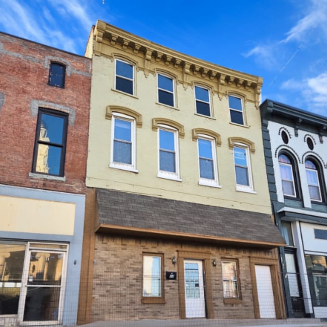
Property Record
37 S Main St, Winchester, KY 40391
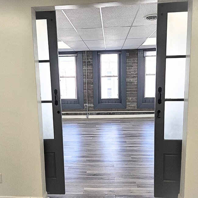
Current Lease Availabilities
NEARBY LISTINGS FOR SALE OR LEASE
Property Detail
37 S Main St
Lexington-Fayette, KY
Downtown
054-3217-01500
PART OF LOT 3
Commercialnec
Clark
X
Kentucky
21049C0106D
3
2024
0.11 AC
2024
Clark County
020106
Lexington/Fayette
7,722 SF
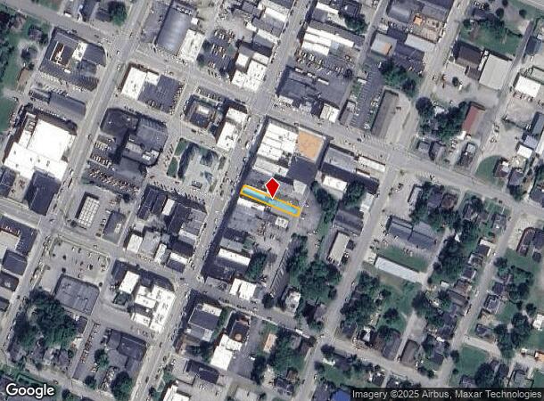
DEMOGRAPHICS near 37 S Main St
1 Mile
3 Mile
5 Mile
2024 Total Population
10,270
25,855
29,695
2029 Population
10,441
26,115
29,987
Pop Growth 2024-2029
+ 1.67%
+ 1.01%
+ 0.98%
Average Age
40
40
41
2024 Total Households
4,222
10,631
12,094
HH Growth 2024-2029
+ 1.66%
+ 1.01%
+ 0.99%
Median Household Inc
$46,828
$55,581
$57,411
Avg Household Size
2.30
2.40
2.40
2024 Avg HH Vehicles
2.00
2.00
2.00
Median Home Value
$155,910
$166,419
$173,364
Median Year Built
1965
1977
1979
Nearby Places
- Restaurants
- Banks
- Shops
- Fitness
- Groceries
PUBLIC TRANSPORTATION
AIRPORT
Blue Grass
DRIVE
WALK
Distance
Blue Grass
41 min
29.4 mi
Freight Ports
Port of Toledo
DRIVE
WALK
Distance
Port of Toledo
350 min
302.7 mi
Nearby Properties
Address
Land Use
TOTAL SIZE
Lot Size
Zoning
Address
Land Use
TOTAL SIZE
Lot Size
Zoning
45,000 SF
30.26 AC
AGRICULTUR
Address
Land Use
TOTAL SIZE
Lot Size
Zoning
423,158 SF
36.32 AC
LIGHT INDU
Address
Land Use
TOTAL SIZE
Lot Size
Zoning
127.39 AC
Address
Land Use
TOTAL SIZE
Lot Size
Zoning
792 SF
5.71 AC
SINGLE FAM
Address
Land Use
TOTAL SIZE
Lot Size
Zoning
Address
Land Use
TOTAL SIZE
Lot Size
Zoning
Address
Land Use
TOTAL SIZE
Lot Size
Zoning
Address
Land Use
TOTAL SIZE
Lot Size
Zoning
Address
Land Use
TOTAL SIZE
Lot Size
Zoning
Address
Land Use
TOTAL SIZE
Lot Size
Zoning
179,856 SF
20.42 AC
PLANNED DE
Address
Land Use
TOTAL SIZE
Lot Size
Zoning
60,726 SF
14.59 AC
Address
Land Use
TOTAL SIZE
Lot Size
Zoning
136,116 SF
12.58 AC
LIGHT INDU
Address
Land Use
TOTAL SIZE
Lot Size
Zoning
Address
Land Use
TOTAL SIZE
Lot Size
Zoning
6.65 AC
I1
Address
Land Use
TOTAL SIZE
Lot Size
Zoning
6.50 AC
PD
Address
Land Use
TOTAL SIZE
Lot Size
Zoning
0.98 AC
DOWNTOWN B
Address
Land Use
TOTAL SIZE
Lot Size
Zoning
17.86 AC
I1
Address
Land Use
TOTAL SIZE
Lot Size
Zoning
24.23 AC
I1
Address
Land Use
TOTAL SIZE
Lot Size
Zoning
121,809 SF
19.44 AC
LIGHT INDU
Address
Land Use
TOTAL SIZE
Lot Size
Zoning
Address
Land Use
TOTAL SIZE
Lot Size
Zoning
76,440 SF
15.67 AC
PLANNED DE
Address
Land Use
TOTAL SIZE
Lot Size
Zoning
4.53 AC
Address
Land Use
TOTAL SIZE
Lot Size
Zoning
64,000 SF
8.45 AC
HIGHWAY BU
Address
Land Use
TOTAL SIZE
Lot Size
Zoning
3.15 AC
Address
Land Use
TOTAL SIZE
Lot Size
Zoning
60,060 SF
6.04 AC
HIGHWAY BU
Address
Land Use
TOTAL SIZE
Lot Size
Zoning
15.06 AC
I1
Address
Land Use
TOTAL SIZE
Lot Size
Zoning
5.88 AC
PLANNED DE
Address
Land Use
TOTAL SIZE
Lot Size
Zoning
3.59 AC
I1
Address
Land Use
TOTAL SIZE
Lot Size
Zoning
69,834 SF
8.82 AC
PLANNED DE
Address
Land Use
TOTAL SIZE
Lot Size
Zoning
1.07 AC
PD
The World's #1 Commercial Real Estate Marketplace
Connect with us
© 2025 CoStar Group
The information above has been obtained from sources believed reliable. While we do not doubt its accuracy we have not verified it and make no guarantee, warranty or representation about it. It is your responsibility to independently confirm its accuracy and completeness. Any projections, opinions, assumptions, or estimates used are for example only and do not represent the current or future performance of the property. The value of this transaction to you depends on tax and other factors which should be evaluated by your tax, financial, and legal advisors. You and your advisors should conduct a careful, independent investigation of the property to determine to your satisfaction the suitability of the property for your needs.