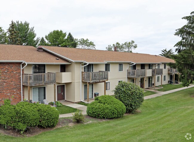
Property Record
3513 Roma Ln, Middleton, WI 53562

NEARBY LISTINGS FOR SALE OR LEASE
Property Detail
3513 Roma Ln
0709-061-9200-5
SEC 6-7-9 PRT SW1/4NE1/4 COM SEC N1/4 COR TH S 1336.92 FT TH N89DEGE 1321.06 FT TH S 485.25 FT TO POB TH CON S 400 FT TH S89DEGW 254.25 FT TH N1DEGW 170.36 FT TH N32DEGW 100 FT TH S 58DEGW 92.07 FT TH N27DEGW 89.02 FT TH N62DEGE 115FT TH N63D EGE 115
Commercialnec
Dane
X
Wisconsin
55025C0401G
22.59 AC
0
Shorecrest
2024
Milwaukee/Madison
011103
Madison, WI
DEMOGRAPHICS near 3513 Roma Ln
1 Mile
3 Mile
5 Mile
2024 Total Population
5,518
35,217
188,840
2029 Population
5,695
36,746
202,965
Pop Growth 2024-2029
+ 3.21%
+ 4.34%
+ 7.48%
Average Age
42
41
36
2024 Total Households
2,571
16,386
80,732
HH Growth 2024-2029
+ 3.31%
+ 4.67%
+ 7.87%
Median Household Inc
$84,203
$81,858
$70,072
Avg Household Size
2.10
2.10
2.10
2024 Avg HH Vehicles
2.00
2.00
1.00
Median Home Value
$627,888
$515,927
$464,862
Median Year Built
1989
1979
1989
Nearby Places
Map Layers
Map Styles
 Street
 Aerial
- Restaurants
- Banks
- Shops
- Fitness
- Groceries
PUBLIC TRANSPORTATION
AIRPORT
Dane County Regional/Truax Field
DRIVE
WALK
Distance
Dane County Regional/Truax Field
18 min
9.9 mi
Freight Ports
Port Milwaukee
DRIVE
WALK
Distance
Port Milwaukee
108 min
87.0 mi
Nearby Properties
Address
Land Use
TOTAL SIZE
Lot Size
Zoning
Address
Land Use
TOTAL SIZE
Lot Size
Zoning
226,593 SF
28.49 AC
PD
Address
Land Use
TOTAL SIZE
Lot Size
Zoning
291,526 SF
2.89 AC
PD
Address
Land Use
TOTAL SIZE
Lot Size
Zoning
349,680 SF
6.28 AC
TR-U2
Address
Land Use
TOTAL SIZE
Lot Size
Zoning
420,780 SF
10.14 AC
PD
Address
Land Use
TOTAL SIZE
Lot Size
Zoning
8.48 AC
Address
Land Use
TOTAL SIZE
Lot Size
Zoning
467,400 SF
6.17 AC
TR-U2
Address
Land Use
TOTAL SIZE
Lot Size
Zoning
10.12 AC
Address
Land Use
TOTAL SIZE
Lot Size
Zoning
Address
Land Use
TOTAL SIZE
Lot Size
Zoning
10.01 AC
Address
Land Use
TOTAL SIZE
Lot Size
Zoning
11,752 SF
0.58 AC
PD
Address
Land Use
TOTAL SIZE
Lot Size
Zoning
222,406 SF
0.01 AC
PD
Address
Land Use
TOTAL SIZE
Lot Size
Zoning
168,870 SF
2.89 AC
PD
Address
Land Use
TOTAL SIZE
Lot Size
Zoning
142,082 SF
228.01 AC
PD
Address
Land Use
TOTAL SIZE
Lot Size
Zoning
26.62 AC
Address
Land Use
TOTAL SIZE
Lot Size
Zoning
1.19 AC
Address
Land Use
TOTAL SIZE
Lot Size
Zoning
180,156 SF
3.48 AC
SE
Address
Land Use
TOTAL SIZE
Lot Size
Zoning
3.19 AC
Address
Land Use
TOTAL SIZE
Lot Size
Zoning
83,702 SF
3.74 AC
PD
Address
Land Use
TOTAL SIZE
Lot Size
Zoning
20,130 SF
2 AC
TR-U2
Address
Land Use
TOTAL SIZE
Lot Size
Zoning
147,593 SF
5.32 AC
PD
Address
Land Use
TOTAL SIZE
Lot Size
Zoning
44,955 SF
3.34 AC
SR-V2
Address
Land Use
TOTAL SIZE
Lot Size
Zoning
0.95 AC
Address
Land Use
TOTAL SIZE
Lot Size
Zoning
7.16 AC
Address
Land Use
TOTAL SIZE
Lot Size
Zoning
16,861 SF
2.22 AC
TR-U2
Address
Land Use
TOTAL SIZE
Lot Size
Zoning
152,384 SF
5.78 AC
PD
Address
Land Use
TOTAL SIZE
Lot Size
Zoning
Address
Land Use
TOTAL SIZE
Lot Size
Zoning
8.19 AC
Address
Land Use
TOTAL SIZE
Lot Size
Zoning
7.08 AC
Address
Land Use
TOTAL SIZE
Lot Size
Zoning
1.94 AC
Address
Land Use
TOTAL SIZE
Lot Size
Zoning
The World's #1 Commercial Real Estate Marketplace
Connect with us
© 2025 CoStar Group
The information above has been obtained from sources believed reliable. While we do not doubt its accuracy we have not verified it and make no guarantee, warranty or representation about it. It is your responsibility to independently confirm its accuracy and completeness. Any projections, opinions, assumptions, or estimates used are for example only and do not represent the current or future performance of the property. The value of this transaction to you depends on tax and other factors which should be evaluated by your tax, financial, and legal advisors. You and your advisors should conduct a careful, independent investigation of the property to determine to your satisfaction the suitability of the property for your needs.