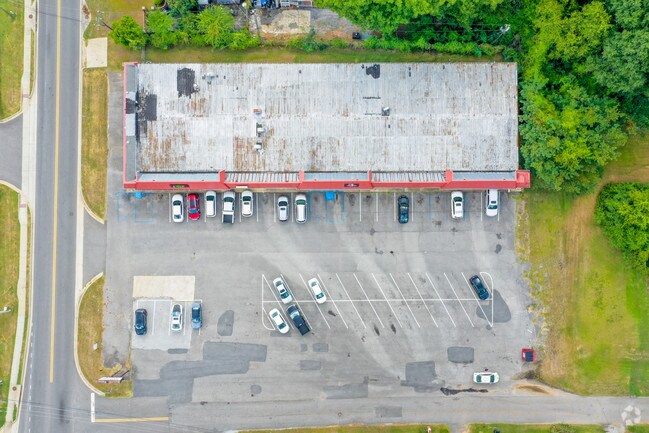
Property Record
3518 Loop Rd, Tuscaloosa, AL 35404

NEARBY LISTINGS FOR SALE OR LEASE
Property Detail
3518 Loop Rd
Tuscaloosa, AL
Village East 3
30-09-29-1-004-001.005
BEG. NE CORN LT. 4, HOLLOMAN SUB. 1 S 17', NE 505' (S), S 61', SE 55' (S) NE 105' TO P.O.B., SE 400' (S), NE 124' ALG. N LINE
Communitycenter
Tuscaloosa
X
Alabama
01125C0528G
4
2025
1.05 AC
2024
Tuscaloosa
012101
Birmingham
12,904 SF
DEMOGRAPHICS near 3518 Loop Rd
1 mile
3 mile
5 mile
2024 Total Population
5,134
57,869
124,246
2029 Population
5,856
65,778
140,368
Pop Growth 2024-2029
+ 14.06%
+ 13.67%
+ 12.98%
Average Age
40
34
34
2024 Total Households
2,237
23,231
47,984
HH Growth 2024-2029
+ 13.23%
+ 14.61%
+ 14.64%
Median Household Inc
$70,162
$43,495
$43,208
Avg Household Size
2.20
2.20
2.10
2024 Avg HH Vehicles
2.00
2.00
2.00
Median Home Value
$201,717
$174,574
$198,899
Median Year Built
1976
1991
1991
Nearby Places
Map Layers
Map Styles
 Street
 Aerial
Transit
 Traffic
 Biking
Places
Listings with unknown addresses are not visible on the map
- Restaurants
- Banks
- Shops
- Fitness
- Groceries
PUBLIC TRANSPORTATION
COMMUTER RAIL
Drive
Walk
Distance
9 min
4.3 mi
SALE & LEASE HISTORY
LISTING DATE
SALE/LEASE

Sep 24, 2016
For Sale
Jul 23, 2018
For Sale
Nearby Properties
Address
Land Use
TOTAL SIZE
Lot Size
Zoning
Address
Land Use
TOTAL SIZE
Lot Size
Zoning
318,383 SF
44 SF
BN
Address
Land Use
TOTAL SIZE
Lot Size
Zoning
22,925 SF
13.45 AC
R4
Address
Land Use
TOTAL SIZE
Lot Size
Zoning
279,917 SF
4.01 AC
MX3
Address
Land Use
TOTAL SIZE
Lot Size
Zoning
24,165 SF
28 AC
BN
Address
Land Use
TOTAL SIZE
Lot Size
Zoning
8,760 SF
23 AC
R4
Address
Land Use
TOTAL SIZE
Lot Size
Zoning
40,160 SF
10.79 AC
RMF1
Address
Land Use
TOTAL SIZE
Lot Size
Zoning
231,339 SF
4.20 AC
MX5
Address
Land Use
TOTAL SIZE
Lot Size
Zoning
55.11 AC
I
Address
Land Use
TOTAL SIZE
Lot Size
Zoning
9,616 SF
30.17 AC
R4
Address
Land Use
TOTAL SIZE
Lot Size
Zoning
15,888 SF
112 AC
I
Address
Land Use
TOTAL SIZE
Lot Size
Zoning
21,811 SF
16 AC
R4
Address
Land Use
TOTAL SIZE
Lot Size
Zoning
1,490 SF
9.40 AC
R-4
Address
Land Use
TOTAL SIZE
Lot Size
Zoning
196,378 SF
1.46 AC
MX5
Address
Land Use
TOTAL SIZE
Lot Size
Zoning
28,796 SF
15 AC
R4
Address
Land Use
TOTAL SIZE
Lot Size
Zoning
9,328 SF
19 AC
RMF1
Address
Land Use
TOTAL SIZE
Lot Size
Zoning
115,911 SF
4.48 AC
I
Address
Land Use
TOTAL SIZE
Lot Size
Zoning
1,088 SF
17 AC
R4
Address
Land Use
TOTAL SIZE
Lot Size
Zoning
1,832 SF
19 AC
RMF-1
Address
Land Use
TOTAL SIZE
Lot Size
Zoning
12 AC
R1
Address
Land Use
TOTAL SIZE
Lot Size
Zoning
45,716 SF
8.80 AC
R4
Address
Land Use
TOTAL SIZE
Lot Size
Zoning
25,155 SF
6 AC
R4
Address
Land Use
TOTAL SIZE
Lot Size
Zoning
25,422 SF
8.90 AC
RMF1
Address
Land Use
TOTAL SIZE
Lot Size
Zoning
82,284 SF
1.87 AC
MX5
Address
Land Use
TOTAL SIZE
Lot Size
Zoning
15,912 SF
22 AC
Address
Land Use
TOTAL SIZE
Lot Size
Zoning
32,616 SF
11 AC
Address
Land Use
TOTAL SIZE
Lot Size
Zoning
193,154 SF
20 AC
BN
Address
Land Use
TOTAL SIZE
Lot Size
Zoning
20,185 SF
25.54 AC
Address
Land Use
TOTAL SIZE
Lot Size
Zoning
9,796 SF
14 AC
RMF1
Address
Land Use
TOTAL SIZE
Lot Size
Zoning
16,536 SF
15.96 AC
R4
Address
Land Use
TOTAL SIZE
Lot Size
Zoning
2,442 SF
10.85 AC
R4
The World's #1 Commercial Real Estate Marketplace
Connect with us
© 2026 CoStar Group
The information above has been obtained from sources believed reliable. While we do not doubt its accuracy we have not verified it and make no guarantee, warranty or representation about it. It is your responsibility to independently confirm its accuracy and completeness. Any projections, opinions, assumptions, or estimates used are for example only and do not represent the current or future performance of the property. The value of this transaction to you depends on tax and other factors which should be evaluated by your tax, financial, and legal advisors. You and your advisors should conduct a careful, independent investigation of the property to determine to your satisfaction the suitability of the property for your needs.