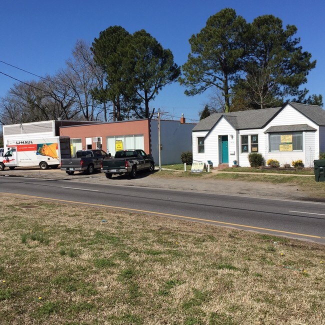
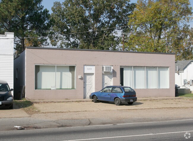
Property Record
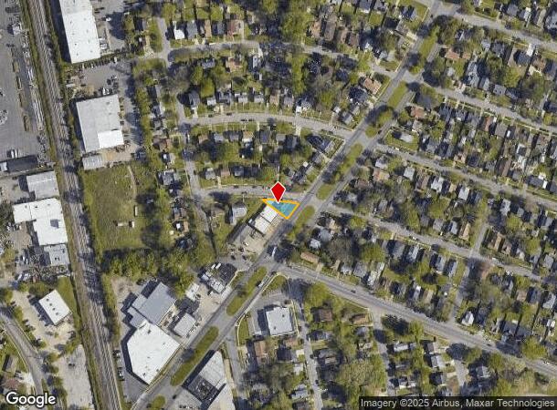
3415 Chesapeake Blvd, Norfolk, VA 23513
NEARBY LISTINGS FOR SALE OR LEASE
Property Detail
3415 Chesapeake Blvd
25258100
West Estabrook
Storebuilding
6 BLK 1 W ESTABROOK
X
Norfolk City
5101040038H
Virginia
2025
0.08 AC
2025
Military
006100
Hampton Roads
1,128 SF
Virginia Beach-Norfolk-Newport News, VA-NC
DEMOGRAPHICS near 3415 Chesapeake Blvd
1 Mile
3 Mile
5 Mile
2024 Total Population
18,485
121,552
283,082
2029 Population
17,974
118,765
278,915
Pop Growth 2024-2029
(2.76%)
(2.29%)
(1.47%)
Average Age
39
37
37
2024 Total Households
7,360
49,749
115,814
HH Growth 2024-2029
(3.17%)
(2.77%)
(1.81%)
Median Household Inc
$63,131
$55,705
$59,889
Avg Household Size
2.40
2.30
2.30
2024 Avg HH Vehicles
2.00
2.00
2.00
Median Home Value
$191,706
$233,457
$248,644
Median Year Built
1955
1962
1968
Nearby Places
Map Layers
Map Styles
 Street
 Aerial
- Restaurants
- Banks
- Shops
- Fitness
- Groceries
PUBLIC TRANSPORTATION
AIRPORT
Norfolk International
DRIVE
WALK
Distance
Norfolk International
11 min
3.2 mi
Newport News/Williamsburg International
DRIVE
WALK
Distance
Newport News/Williamsburg International
37 min
27.1 mi
SALE & LEASE HISTORY
LISTING DATE
SALE/LEASE

Jan 12, 2023
For Lease
Nearby Properties
Address
Land Use
TOTAL SIZE
Lot Size
Zoning
Address
Land Use
TOTAL SIZE
Lot Size
Zoning
2,301.65 AC
Address
Land Use
TOTAL SIZE
Lot Size
Zoning
223 AC
I5
Address
Land Use
TOTAL SIZE
Lot Size
Zoning
Address
Land Use
TOTAL SIZE
Lot Size
Zoning
Address
Land Use
TOTAL SIZE
Lot Size
Zoning
116,476 SF
947.43 AC
Address
Land Use
TOTAL SIZE
Lot Size
Zoning
52.36 AC
Address
Land Use
TOTAL SIZE
Lot Size
Zoning
192,422 SF
10.70 AC
D4
Address
Land Use
TOTAL SIZE
Lot Size
Zoning
30,036 SF
50.39 AC
Address
Land Use
TOTAL SIZE
Lot Size
Zoning
55.11 AC
IN2
Address
Land Use
TOTAL SIZE
Lot Size
Zoning
92.17 AC
OSP
Address
Land Use
TOTAL SIZE
Lot Size
Zoning
23.51 AC
R13
Address
Land Use
TOTAL SIZE
Lot Size
Zoning
40.37 AC
R6
Address
Land Use
TOTAL SIZE
Lot Size
Zoning
95.32 AC
Address
Land Use
TOTAL SIZE
Lot Size
Zoning
321,691 SF
30.58 AC
Address
Land Use
TOTAL SIZE
Lot Size
Zoning
126,088 SF
4.91 AC
C2
Address
Land Use
TOTAL SIZE
Lot Size
Zoning
4.92 AC
IN1
Address
Land Use
TOTAL SIZE
Lot Size
Zoning
340,291 SF
18.77 AC
O1
Address
Land Use
TOTAL SIZE
Lot Size
Zoning
291,748 SF
3.40 AC
G1
Address
Land Use
TOTAL SIZE
Lot Size
Zoning
79,577 SF
3.04 AC
C2
Address
Land Use
TOTAL SIZE
Lot Size
Zoning
319,444 SF
19.02 AC
O1
Address
Land Use
TOTAL SIZE
Lot Size
Zoning
640,920 SF
3.67 AC
HCEF
Address
Land Use
TOTAL SIZE
Lot Size
Zoning
167,279 SF
9.97 AC
IN1
Address
Land Use
TOTAL SIZE
Lot Size
Zoning
4,197 SF
56.14 AC
C2
Address
Land Use
TOTAL SIZE
Lot Size
Zoning
24,710 SF
0.44 AC
Address
Land Use
TOTAL SIZE
Lot Size
Zoning
137,320 SF
7.45 AC
Address
Land Use
TOTAL SIZE
Lot Size
Zoning
293,094 SF
1.92 AC
Address
Land Use
TOTAL SIZE
Lot Size
Zoning
235,750 SF
4.16 AC
UV
Address
Land Use
TOTAL SIZE
Lot Size
Zoning
83,307 SF
9.78 AC
CSECPD
Address
Land Use
TOTAL SIZE
Lot Size
Zoning
1,020 SF
13.45 AC
R11
Address
Land Use
TOTAL SIZE
Lot Size
Zoning
47,832 SF
7.51 AC
C2
The World's #1 Commercial Real Estate Marketplace
Connect with us
© 2025 CoStar Group
The information above has been obtained from sources believed reliable. While we do not doubt its accuracy we have not verified it and make no guarantee, warranty or representation about it. It is your responsibility to independently confirm its accuracy and completeness. Any projections, opinions, assumptions, or estimates used are for example only and do not represent the current or future performance of the property. The value of this transaction to you depends on tax and other factors which should be evaluated by your tax, financial, and legal advisors. You and your advisors should conduct a careful, independent investigation of the property to determine to your satisfaction the suitability of the property for your needs.