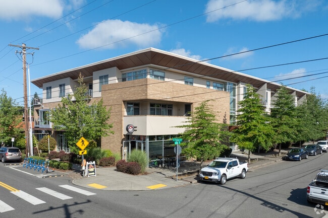
Property Record
3525 Ne 50Th Ave, Portland, OR 97213
Property Detail
3525 Ne 50Th Ave
R600512
BEAUMONT VILLAGE LOFTS CONDOMINIUM, GENERAL COMMON ELEMENTS
Commercialcondominium
MULTNOMAH
CM2
Oregon
B and X Area of moderate flood hazard, usually the area between the limits of the 100-year and 500-year floods.
6,7
0
0.01 AC
2025
Cully
002802
Portland
4,018 SF
Portland-Vancouver-Hillsboro, OR-WA
NEARBY LISTINGS FOR SALE OR LEASE
DEMOGRAPHICS near 3525 Ne 50Th Ave
1 mile
3 mile
5 mile
2025 Total Population
22,791
176,600
418,538
2030 Population
22,312
174,160
415,020
Pop Growth 2025-2030
(2.10%)
(1.38%)
(0.84%)
Average Age
42
41
41
2025 Total Households
9,297
78,272
191,262
HH Growth 2025-2030
(2.34%)
(1.52%)
(0.91%)
Median Household Inc
$111,397
$94,158
$87,704
Avg Household Size
2.40
2.10
2.10
2025 Avg HH Vehicles
2.00
1.00
1.00
Median Home Value
$722,623
$685,411
$636,542
Median Year Built
1946
1949
1960
Nearby Places
Map Layers
Map Styles
 Street
 Aerial
Layers
 Traffic
 Biking
Places
Listings with unknown addresses are not visible on the map
- Restaurants
- Banks
- Shops
- Fitness
- Groceries
PUBLIC TRANSPORTATION
TRANSIT/SUBWAY
NE 60th (MAX Blue Line - Tri-County Metropolitan Transportation District of Oregon Rail (TriMet Rail), MAX Green Line - Tri-County Metropolitan Transportation District of Oregon Rail (TriMet Rail), MAX Red Line - Tri-County Metropolitan Transportation District of Oregon Rail (TriMet Rail))
Drive
Walk
Distance
NE 60th (MAX Blue Line - Tri-County Metropolitan Transportation District of Oregon Rail (TriMet Rail), MAX Green Line - Tri-County Metropolitan Transportation District of Oregon Rail (TriMet Rail), MAX Red Line - Tri-County Metropolitan Transportation District of Oregon Rail (TriMet Rail))
11 min
9 min
0.5 mi
AIRPORT
Portland International
Drive
Walk
Distance
Portland International
13 min
4.6 mi
Freight Ports
Port of Portland
Drive
Walk
Distance
Port of Portland
1 min
4.5 mi
SALE & LEASE HISTORY
LISTING DATE
SALE/LEASE

Sep 25, 2025
For Lease
Sep 13, 2019
For Sale
Oct 10, 2024
For Lease
Nov 11, 2019
For Sale
Nearby Properties
Address
Land Use
TOTAL SIZE
Lot Size
Zoning
Address
Land Use
TOTAL SIZE
Lot Size
Zoning
1,405,000 SF
16.51 AC
IG2
Address
Land Use
TOTAL SIZE
Lot Size
Zoning
395,815 SF
2.66 AC
IRD
Address
Land Use
TOTAL SIZE
Lot Size
Zoning
627,500 SF
16.60 AC
CX
Address
Land Use
TOTAL SIZE
Lot Size
Zoning
417,324 SF
0.68 AC
CX
Address
Land Use
TOTAL SIZE
Lot Size
Zoning
178,785 SF
10.20 AC
R5
Address
Land Use
TOTAL SIZE
Lot Size
Zoning
197,027 SF
28.54 AC
R7H
Address
Land Use
TOTAL SIZE
Lot Size
Zoning
817,845 SF
22.54 AC
IG2
Address
Land Use
TOTAL SIZE
Lot Size
Zoning
296,039 SF
11.70 AC
R5
Address
Land Use
TOTAL SIZE
Lot Size
Zoning
7.78 AC
EX
Address
Land Use
TOTAL SIZE
Lot Size
Zoning
183,664 SF
8.96 AC
R5
Address
Land Use
TOTAL SIZE
Lot Size
Zoning
243,371 SF
0.67 AC
CI2
Address
Land Use
TOTAL SIZE
Lot Size
Zoning
247,520 SF
7.74 AC
CX
Address
Land Use
TOTAL SIZE
Lot Size
Zoning
193,898 SF
2.50 AC
IRD
Address
Land Use
TOTAL SIZE
Lot Size
Zoning
134,398 SF
3.17 AC
CG
Address
Land Use
TOTAL SIZE
Lot Size
Zoning
23.95 AC
IG2
Address
Land Use
TOTAL SIZE
Lot Size
Zoning
2,218,439 SF
21.88 AC
CX
Address
Land Use
TOTAL SIZE
Lot Size
Zoning
105.72 AC
IG2
Address
Land Use
TOTAL SIZE
Lot Size
Zoning
54,676 SF
190.32 AC
OS
Address
Land Use
TOTAL SIZE
Lot Size
Zoning
42,839,055 SF
19.25 AC
CI1
Address
Land Use
TOTAL SIZE
Lot Size
Zoning
40,595 SF
1.99 AC
IRD
Address
Land Use
TOTAL SIZE
Lot Size
Zoning
96,554 SF
2.02 AC
CM3
Address
Land Use
TOTAL SIZE
Lot Size
Zoning
320,732 SF
1.14 AC
CX
Address
Land Use
TOTAL SIZE
Lot Size
Zoning
152,575 SF
5.32 AC
EG1
Address
Land Use
TOTAL SIZE
Lot Size
Zoning
440,000 SF
1.80 AC
CX
Address
Land Use
TOTAL SIZE
Lot Size
Zoning
11,375 SF
1.46 AC
CI2
Address
Land Use
TOTAL SIZE
Lot Size
Zoning
785,000 SF
4 AC
NULL
Address
Land Use
TOTAL SIZE
Lot Size
Zoning
133.11 AC
IG2
Address
Land Use
TOTAL SIZE
Lot Size
Zoning
64,673 SF
NULL
Address
Land Use
TOTAL SIZE
Lot Size
Zoning
1,256 SF
103.58 AC
IG2
Address
Land Use
TOTAL SIZE
Lot Size
Zoning
88,789 SF
1.48 AC
EX
The World's #1 Commercial Real Estate Marketplace
Connect with us
© 2026 CoStar Group
The information above has been obtained from sources believed reliable. While we do not doubt its accuracy we have not verified it and make no guarantee, warranty or representation about it. It is your responsibility to independently confirm its accuracy and completeness. Any projections, opinions, assumptions, or estimates used are for example only and do not represent the current or future performance of the property. The value of this transaction to you depends on tax and other factors which should be evaluated by your tax, financial, and legal advisors. You and your advisors should conduct a careful, independent investigation of the property to determine to your satisfaction the suitability of the property for your needs.