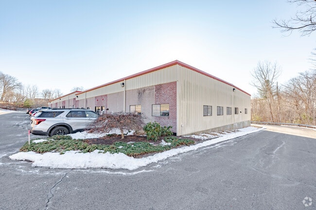
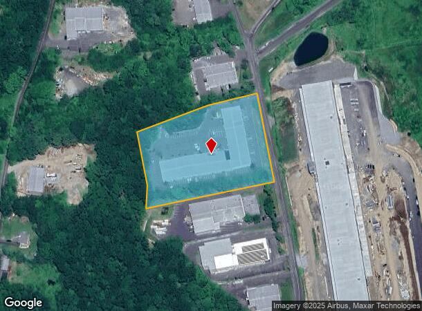
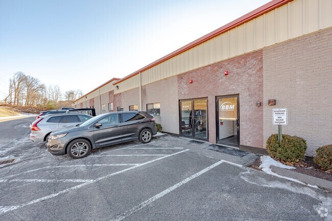
Property Record
353 Christian St, Oxford, CT 06478
Current Lease Availabilities
NEARBY LISTINGS FOR SALE OR LEASE
Property Detail
353 Christian St
OXFO-000017-000034-000003-K000002
New Haven
Manufacturinglight
Connecticut
X
3-k2
09009C0232H
4.21 AC
2025
Naugatuck
2025
Westchester/So Connecticut
346102
New Haven-Milford, CT
44,000 SF
DEMOGRAPHICS near 353 Christian St
1 Mile
3 Mile
5 Mile
2024 Total Population
217
11,144
50,994
2029 Population
220
11,173
50,859
Pop Growth 2024-2029
+ 1.38%
+ 0.26%
(0.26%)
Average Age
41
43
44
2024 Total Households
72
4,134
20,625
HH Growth 2024-2029
+ 1.39%
+ 0.17%
(0.46%)
Median Household Inc
$124,038
$124,615
$100,972
Avg Household Size
2.70
2.60
2.40
2024 Avg HH Vehicles
3.00
2.00
2.00
Median Home Value
$417,500
$405,976
$320,981
Median Year Built
1993
1982
1974
Nearby Places
Map Layers
Map Styles
 Street
 Aerial
- Restaurants
- Banks
- Shops
- Fitness
- Groceries
PUBLIC TRANSPORTATION
COMMUTER RAIL
Naugatuck Station (New Haven Line - Metro-North Commuter Railroad Company (Metro-North))
DRIVE
WALK
Distance
Naugatuck Station (New Haven Line - Metro-North Commuter Railroad Company (Metro-North))
17 min
8.9 mi
Beacon Falls Station (New Haven Line - Metro-North Commuter Railroad Company (Metro-North))
DRIVE
WALK
Distance
Beacon Falls Station (New Haven Line - Metro-North Commuter Railroad Company (Metro-North))
18 min
9.1 mi
AIRPORT
Tweed/New Haven
DRIVE
WALK
Distance
Tweed/New Haven
46 min
24.5 mi
Freight Ports
Port of New Haven
DRIVE
WALK
Distance
Port of New Haven
41 min
21.6 mi
Nearby Properties
Address
Land Use
TOTAL SIZE
Lot Size
Zoning
Address
Land Use
TOTAL SIZE
Lot Size
Zoning
404.50 AC
IND
Address
Land Use
TOTAL SIZE
Lot Size
Zoning
18.85 AC
T5
Address
Land Use
TOTAL SIZE
Lot Size
Zoning
207,001 SF
60.66 AC
M-2
Address
Land Use
TOTAL SIZE
Lot Size
Zoning
17.80 AC
IND
Address
Land Use
TOTAL SIZE
Lot Size
Zoning
20.30 AC
IND
Address
Land Use
TOTAL SIZE
Lot Size
Zoning
13,440 SF
15.60 AC
RA1
Address
Land Use
TOTAL SIZE
Lot Size
Zoning
40.53 AC
L200
Address
Land Use
TOTAL SIZE
Lot Size
Zoning
36.62 AC
L200
Address
Land Use
TOTAL SIZE
Lot Size
Zoning
137,519 SF
10.11 AC
IND
Address
Land Use
TOTAL SIZE
Lot Size
Zoning
1,832 SF
77.04 AC
L200
Address
Land Use
TOTAL SIZE
Lot Size
Zoning
20 AC
IND
Address
Land Use
TOTAL SIZE
Lot Size
Zoning
62.31 AC
IND
Address
Land Use
TOTAL SIZE
Lot Size
Zoning
110,160 SF
24.13 AC
IND
Address
Land Use
TOTAL SIZE
Lot Size
Zoning
142,146 SF
6.63 AC
B-2
Address
Land Use
TOTAL SIZE
Lot Size
Zoning
60,528 SF
10 AC
IND
Address
Land Use
TOTAL SIZE
Lot Size
Zoning
9.66 AC
IND
Address
Land Use
TOTAL SIZE
Lot Size
Zoning
60,000 SF
12 AC
IND
Address
Land Use
TOTAL SIZE
Lot Size
Zoning
43,250 SF
6.20 AC
IND
Address
Land Use
TOTAL SIZE
Lot Size
Zoning
45,000 SF
5.36 AC
IND
Address
Land Use
TOTAL SIZE
Lot Size
Zoning
51,345 SF
6.75 AC
IND
Address
Land Use
TOTAL SIZE
Lot Size
Zoning
67,910 SF
5.60 AC
IND
Address
Land Use
TOTAL SIZE
Lot Size
Zoning
18,685 SF
9.05 AC
CA40
Address
Land Use
TOTAL SIZE
Lot Size
Zoning
19.53 AC
Address
Land Use
TOTAL SIZE
Lot Size
Zoning
50,937 SF
7.25 AC
GI40
Address
Land Use
TOTAL SIZE
Lot Size
Zoning
35,820 SF
12 AC
IND
Address
Land Use
TOTAL SIZE
Lot Size
Zoning
41,200 SF
5.65 AC
IND
Address
Land Use
TOTAL SIZE
Lot Size
Zoning
183.58 AC
RGCD
Address
Land Use
TOTAL SIZE
Lot Size
Zoning
18,040 SF
3.96 AC
IND
Address
Land Use
TOTAL SIZE
Lot Size
Zoning
29,592 SF
5.35 AC
IND
The World's #1 Commercial Real Estate Marketplace
Connect with us
© 2025 CoStar Group
The information above has been obtained from sources believed reliable. While we do not doubt its accuracy we have not verified it and make no guarantee, warranty or representation about it. It is your responsibility to independently confirm its accuracy and completeness. Any projections, opinions, assumptions, or estimates used are for example only and do not represent the current or future performance of the property. The value of this transaction to you depends on tax and other factors which should be evaluated by your tax, financial, and legal advisors. You and your advisors should conduct a careful, independent investigation of the property to determine to your satisfaction the suitability of the property for your needs.