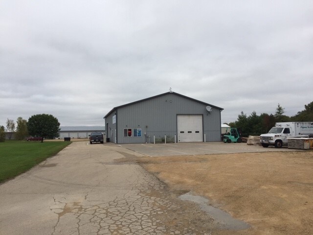
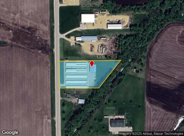
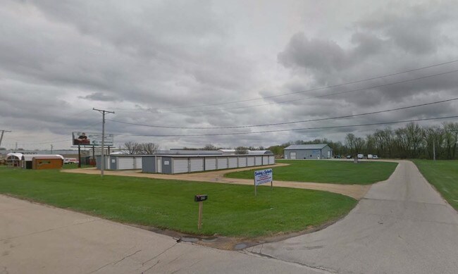
Property Record
3553 Il Route 26 S, Freeport, IL 61032
NEARBY LISTINGS FOR SALE OR LEASE
-
-
View all Freeport listings for sale on LoopNet.com
Property Detail
3553 Il Route 26 S
18-19-18-300-018
PT NW SW SEC 18-26-8 FREEPORT E-ZONE ABATEMENT 1997-2000
Publicstorage
Stephenson
X
Illinois
17177C0450C
2.76 AC
2024
Illinois North Area
2024
Other Market Areas
001200
Freeport, IL
4,050 SF
DEMOGRAPHICS near 3553 Il Route 26 S
1 Mile
3 Mile
5 Mile
2024 Total Population
47
10,851
27,191
2029 Population
46
10,658
26,770
Pop Growth 2024-2029
(2.13%)
(1.78%)
(1.55%)
Average Age
51
44
43
2024 Total Households
19
4,648
11,888
HH Growth 2024-2029
(5.26%)
(1.87%)
(1.64%)
Median Household Inc
$74,999
$51,581
$44,502
Avg Household Size
2.20
2.20
2.20
2024 Avg HH Vehicles
2.00
2.00
1.00
Median Home Value
$183,333
$74,924
$81,096
Median Year Built
1974
1955
1959
Nearby Places
Map Layers
Map Styles
 Street
 Aerial
- Restaurants
- Banks
- Shops
- Fitness
- Groceries
PUBLIC TRANSPORTATION
AIRPORT
Chicago/Rockford International
DRIVE
WALK
Distance
Chicago/Rockford International
52 min
35.8 mi
Freight Ports
Port Milwaukee
DRIVE
WALK
Distance
Port Milwaukee
152 min
117.5 mi
SALE & LEASE HISTORY
LISTING DATE
SALE/LEASE

May 17, 2019
For Sale
Nearby Properties
Address
Land Use
TOTAL SIZE
Lot Size
Zoning
Address
Land Use
TOTAL SIZE
Lot Size
Zoning
499,200 SF
36.03 AC
Address
Land Use
TOTAL SIZE
Lot Size
Zoning
16.04 AC
Address
Land Use
TOTAL SIZE
Lot Size
Zoning
21.95 AC
Address
Land Use
TOTAL SIZE
Lot Size
Zoning
3.51 AC
Address
Land Use
TOTAL SIZE
Lot Size
Zoning
10.52 AC
Address
Land Use
TOTAL SIZE
Lot Size
Zoning
26.60 AC
Address
Land Use
TOTAL SIZE
Lot Size
Zoning
77,686 SF
4.39 AC
Address
Land Use
TOTAL SIZE
Lot Size
Zoning
46.61 AC
Address
Land Use
TOTAL SIZE
Lot Size
Zoning
11.48 AC
Address
Land Use
TOTAL SIZE
Lot Size
Zoning
7.62 AC
Address
Land Use
TOTAL SIZE
Lot Size
Zoning
1.44 AC
Address
Land Use
TOTAL SIZE
Lot Size
Zoning
10.37 AC
Address
Land Use
TOTAL SIZE
Lot Size
Zoning
13.20 AC
Address
Land Use
TOTAL SIZE
Lot Size
Zoning
2.02 AC
Address
Land Use
TOTAL SIZE
Lot Size
Zoning
4.21 AC
Address
Land Use
TOTAL SIZE
Lot Size
Zoning
Address
Land Use
TOTAL SIZE
Lot Size
Zoning
5.14 AC
Address
Land Use
TOTAL SIZE
Lot Size
Zoning
4.13 AC
Address
Land Use
TOTAL SIZE
Lot Size
Zoning
38.59 AC
Address
Land Use
TOTAL SIZE
Lot Size
Zoning
9.32 AC
Address
Land Use
TOTAL SIZE
Lot Size
Zoning
9,917 SF
5.50 AC
Address
Land Use
TOTAL SIZE
Lot Size
Zoning
18,145 SF
1.43 AC
Address
Land Use
TOTAL SIZE
Lot Size
Zoning
3.36 AC
Address
Land Use
TOTAL SIZE
Lot Size
Zoning
8,525 SF
3.02 AC
Address
Land Use
TOTAL SIZE
Lot Size
Zoning
0.78 AC
Address
Land Use
TOTAL SIZE
Lot Size
Zoning
23,153 SF
6.41 AC
Address
Land Use
TOTAL SIZE
Lot Size
Zoning
11,345 SF
1.40 AC
Address
Land Use
TOTAL SIZE
Lot Size
Zoning
19.66 AC
Address
Land Use
TOTAL SIZE
Lot Size
Zoning
10,605 SF
1.65 AC
Address
Land Use
TOTAL SIZE
Lot Size
Zoning
9.08 AC
The World's #1 Commercial Real Estate Marketplace
Connect with us
© 2026 CoStar Group
The information above has been obtained from sources believed reliable. While we do not doubt its accuracy we have not verified it and make no guarantee, warranty or representation about it. It is your responsibility to independently confirm its accuracy and completeness. Any projections, opinions, assumptions, or estimates used are for example only and do not represent the current or future performance of the property. The value of this transaction to you depends on tax and other factors which should be evaluated by your tax, financial, and legal advisors. You and your advisors should conduct a careful, independent investigation of the property to determine to your satisfaction the suitability of the property for your needs.