Property Record
Vac/36Th Stw Vic Ave, Lancaster, CA 93536

This Property Is For Sale
Property Detail
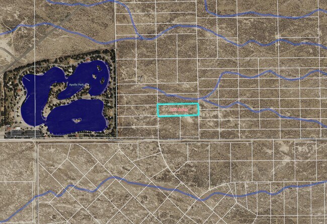
Vac/36Th Stw Vic Ave
Los Angeles-Long Beach-Glendale, CA
RECORD OF SURVEY AS PER BK 66 PG 27-28 OF R S LOT 30
3107-003-012
LOS ANGELES
Industrialacreage
California
LRMPD*
30
B and X Area of moderate flood hazard, usually the area between the limits of the 100-year and 500-year floods.
2.67 AC
2024
Antelope Valley
2025
Los Angeles
901214
NEARBY LISTINGS FOR SALE OR LEASE
DEMOGRAPHICS near Vac/36Th Stw Vic Ave
1 mile
3 mile
5 mile
2025 Total Population
28
6,927
66,393
2030 Population
28
6,885
66,361
Pop Growth 2025-2030
0.00%
(0.61%)
(0.05%)
Average Age
36
38
38
2025 Total Households
10
2,175
21,442
HH Growth 2025-2030
0.00%
(0.51%)
(0.20%)
Median Household Inc
$42,500
$68,441
$76,244
Avg Household Size
2.60
3.00
3.00
2025 Avg HH Vehicles
2.00
2.00
2.00
Median Home Value
$499,999
$454,214
$458,041
Median Year Built
2009
1999
1986
Nearby Places
Map Layers
Map Styles
 Street
 Aerial
Transit
 Traffic
 Biking
Places
Listings with unknown addresses are not visible on the map
- Restaurants
- Banks
- Shops
- Fitness
- Groceries
PUBLIC TRANSPORTATION
COMMUTER RAIL
Lancaster (Antelope Valley Line - Southern California Regional Rail Authority (Metrolink))
Drive
Walk
Distance
Lancaster (Antelope Valley Line - Southern California Regional Rail Authority (Metrolink))
11 min
5.9 mi
Freight Ports
Port of Long Beach
Drive
Walk
Distance
Port of Long Beach
115 min
97.7 mi
Nearby Properties
Address
Land Use
TOTAL SIZE
Lot Size
Zoning
Address
Land Use
TOTAL SIZE
Lot Size
Zoning
2,922,905 SF
85.01 AC
LRLI
Address
Land Use
TOTAL SIZE
Lot Size
Zoning
465,697 SF
27.82 AC
LRSP*
Address
Land Use
TOTAL SIZE
Lot Size
Zoning
249,045 SF
19.74 AC
LRMPD*
Address
Land Use
TOTAL SIZE
Lot Size
Zoning
89,351 SF
17.97 AC
LRMDR
Address
Land Use
TOTAL SIZE
Lot Size
Zoning
81,668 SF
5.47 AC
LRSP80-01*
Address
Land Use
TOTAL SIZE
Lot Size
Zoning
198,494 SF
9.78 AC
LRSP*
Address
Land Use
TOTAL SIZE
Lot Size
Zoning
Address
Land Use
TOTAL SIZE
Lot Size
Zoning
Address
Land Use
TOTAL SIZE
Lot Size
Zoning
99,247 SF
10.11 AC
LRA12*
Address
Land Use
TOTAL SIZE
Lot Size
Zoning
57,050 SF
4.28 AC
LRLI
Address
Land Use
TOTAL SIZE
Lot Size
Zoning
37.45 AC
LRSP
Address
Land Use
TOTAL SIZE
Lot Size
Zoning
Address
Land Use
TOTAL SIZE
Lot Size
Zoning
58.68 AC
LCD22*
Address
Land Use
TOTAL SIZE
Lot Size
Zoning
Address
Land Use
TOTAL SIZE
Lot Size
Zoning
57.24 AC
LCD22*
Address
Land Use
TOTAL SIZE
Lot Size
Zoning
81.54 AC
LCD22*
Address
Land Use
TOTAL SIZE
Lot Size
Zoning
77.36 AC
LCD22*
Address
Land Use
TOTAL SIZE
Lot Size
Zoning
11,148 SF
1.62 AC
LRM120000*
Address
Land Use
TOTAL SIZE
Lot Size
Zoning
259,447 SF
4.51 AC
LRD22*
Address
Land Use
TOTAL SIZE
Lot Size
Zoning
31,200 SF
2.28 AC
LRLI
Address
Land Use
TOTAL SIZE
Lot Size
Zoning
19,580 SF
2.02 AC
LRM120000*
Address
Land Use
TOTAL SIZE
Lot Size
Zoning
32.84 AC
LCD22*
Address
Land Use
TOTAL SIZE
Lot Size
Zoning
14,581 SF
0.95 AC
LRSP*
Address
Land Use
TOTAL SIZE
Lot Size
Zoning
26.32 AC
LCM1
Address
Land Use
TOTAL SIZE
Lot Size
Zoning
17.50 AC
LCD21*
Address
Land Use
TOTAL SIZE
Lot Size
Zoning
76.91 AC
LRA12*
Address
Land Use
TOTAL SIZE
Lot Size
Zoning
80 AC
LRA12*
Address
Land Use
TOTAL SIZE
Lot Size
Zoning
9.18 AC
LRC
Address
Land Use
TOTAL SIZE
Lot Size
Zoning
14,581 SF
1.06 AC
LRSP*
The World's #1 Commercial Real Estate Marketplace
Connect with us
© 2026 CoStar Group
The information above has been obtained from sources believed reliable. While we do not doubt its accuracy we have not verified it and make no guarantee, warranty or representation about it. It is your responsibility to independently confirm its accuracy and completeness. Any projections, opinions, assumptions, or estimates used are for example only and do not represent the current or future performance of the property. The value of this transaction to you depends on tax and other factors which should be evaluated by your tax, financial, and legal advisors. You and your advisors should conduct a careful, independent investigation of the property to determine to your satisfaction the suitability of the property for your needs.