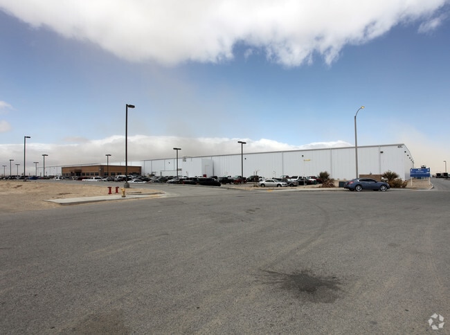
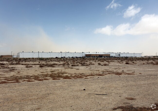
Property Record
46905 47Th St W, Lancaster, CA 93536

Property Detail
46905 47Th St W
3105-001-043
PM 325-44-45 LOT 5
Warehouse
LOS ANGELES
LRMPD*
California
C and X Area of minimal flood hazard, usually depicted on FIRMs as above the 500-year flood level.
5
2025
19.74 AC
2025
Antelope Valley
900901
Los Angeles
249,045 SF
Los Angeles-Long Beach-Glendale, CA
NEARBY LISTINGS FOR SALE OR LEASE
DEMOGRAPHICS near 46905 47Th St W
1 mile
3 mile
5 mile
2025 Total Population
26
1,869
61,857
2030 Population
25
1,877
61,868
Pop Growth 2025-2030
(3.85%)
+ 0.43%
+ 0.02%
Average Age
33
38
38
2025 Total Households
9
605
19,630
HH Growth 2025-2030
0.00%
0.00%
(0.12%)
Median Household Inc
$42,500
$64,285
$87,916
Avg Household Size
2.60
3.00
3.00
2025 Avg HH Vehicles
2.00
2.00
2.00
Median Home Value
$450,000
$599,759
$480,012
Median Year Built
2007
2005
1988
Nearby Places
Map Layers
Map Styles
 Street
 Aerial
Layers
 Traffic
 Biking
Places
Listings with unknown addresses are not visible on the map
- Restaurants
- Banks
- Shops
- Fitness
- Groceries
PUBLIC TRANSPORTATION
COMMUTER RAIL
Lancaster (Antelope Valley Line - Southern California Regional Rail Authority (Metrolink))
Drive
Walk
Distance
Lancaster (Antelope Valley Line - Southern California Regional Rail Authority (Metrolink))
11 min
6.9 mi
Freight Ports
Port of Long Beach
Drive
Walk
Distance
Port of Long Beach
115 min
98.6 mi
Nearby Properties
Address
Land Use
TOTAL SIZE
Lot Size
Zoning
Address
Land Use
TOTAL SIZE
Lot Size
Zoning
2,922,905 SF
85.01 AC
LRLI
Address
Land Use
TOTAL SIZE
Lot Size
Zoning
465,697 SF
27.82 AC
LRSP*
Address
Land Use
TOTAL SIZE
Lot Size
Zoning
89,351 SF
17.97 AC
LRMDR
Address
Land Use
TOTAL SIZE
Lot Size
Zoning
198,494 SF
9.78 AC
LRSP*
Address
Land Use
TOTAL SIZE
Lot Size
Zoning
Address
Land Use
TOTAL SIZE
Lot Size
Zoning
99,247 SF
10.11 AC
LRA12*
Address
Land Use
TOTAL SIZE
Lot Size
Zoning
57,050 SF
4.28 AC
LRLI
Address
Land Use
TOTAL SIZE
Lot Size
Zoning
37.45 AC
LRSP
Address
Land Use
TOTAL SIZE
Lot Size
Zoning
31,200 SF
2.28 AC
LRLI
Address
Land Use
TOTAL SIZE
Lot Size
Zoning
14,581 SF
0.95 AC
LRSP*
Address
Land Use
TOTAL SIZE
Lot Size
Zoning
26.32 AC
LCM1
Address
Land Use
TOTAL SIZE
Lot Size
Zoning
76.91 AC
LRA12*
Address
Land Use
TOTAL SIZE
Lot Size
Zoning
80 AC
LRA12*
Address
Land Use
TOTAL SIZE
Lot Size
Zoning
14,581 SF
1.06 AC
LRSP*
Address
Land Use
TOTAL SIZE
Lot Size
Zoning
37.01 AC
LRA12*
Address
Land Use
TOTAL SIZE
Lot Size
Zoning
30.68 AC
LRHI
Address
Land Use
TOTAL SIZE
Lot Size
Zoning
6,457 SF
2.26 AC
LRLI*
Address
Land Use
TOTAL SIZE
Lot Size
Zoning
7,858 SF
0.60 AC
LRSP*
Address
Land Use
TOTAL SIZE
Lot Size
Zoning
9.47 AC
LRA12*
Address
Land Use
TOTAL SIZE
Lot Size
Zoning
18.89 AC
LRMUE
Address
Land Use
TOTAL SIZE
Lot Size
Zoning
16,614 SF
1.09 AC
LRSP*
Address
Land Use
TOTAL SIZE
Lot Size
Zoning
9.62 AC
LRA12*
Address
Land Use
TOTAL SIZE
Lot Size
Zoning
12,200 SF
2.22 AC
LRLI*
Address
Land Use
TOTAL SIZE
Lot Size
Zoning
69.81 AC
LRRR-2.5
Address
Land Use
TOTAL SIZE
Lot Size
Zoning
6,370 SF
0.54 AC
LRSP*
Address
Land Use
TOTAL SIZE
Lot Size
Zoning
7,858 SF
0.54 AC
LRSP*
Address
Land Use
TOTAL SIZE
Lot Size
Zoning
7,858 SF
0.61 AC
LRSP*
Address
Land Use
TOTAL SIZE
Lot Size
Zoning
4,540 SF
4.76 AC
LRA12*
The World's #1 Commercial Real Estate Marketplace
Connect with us
© 2026 CoStar Group
The information above has been obtained from sources believed reliable. While we do not doubt its accuracy we have not verified it and make no guarantee, warranty or representation about it. It is your responsibility to independently confirm its accuracy and completeness. Any projections, opinions, assumptions, or estimates used are for example only and do not represent the current or future performance of the property. The value of this transaction to you depends on tax and other factors which should be evaluated by your tax, financial, and legal advisors. You and your advisors should conduct a careful, independent investigation of the property to determine to your satisfaction the suitability of the property for your needs.