Property Record
3602 Larkin Ln, Rowlett, TX 75089
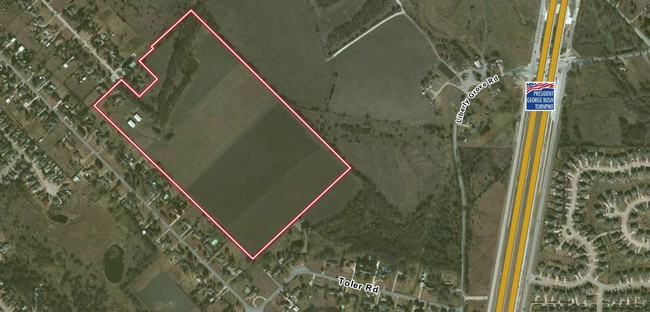
Property Detail
3602 Larkin Ln
65022558510540000
REASON CRIST ABST 225 PG 585 TR 54.1 ACS 45.9009 FOR REM ACS 65022558510540000 VOL2003157/03202 DD07312003 CO-DC 0225585105401 3CW02255851
Privatepreserveopenspacevacantlandforestlandconservation
DALLAS
Z405
Texas
B and X Area of moderate flood hazard, usually the area between the limits of the 100-year and 500-year floods.
5.98 AC
2025
Garland
2025
Dallas/Ft Worth
018140
Dallas-Fort Worth-Arlington, TX
NEARBY LISTINGS FOR SALE OR LEASE
DEMOGRAPHICS near 3602 Larkin Ln
1 mile
3 mile
5 mile
2025 Total Population
8,101
74,795
207,331
2030 Population
8,382
78,063
217,446
Pop Growth 2025-2030
+ 3.47%
+ 4.37%
+ 4.88%
Average Age
40
39
39
2025 Total Households
2,707
24,773
68,559
HH Growth 2025-2030
+ 3.40%
+ 4.43%
+ 4.96%
Median Household Inc
$101,569
$110,320
$95,807
Avg Household Size
3.00
3.00
3.00
2025 Avg HH Vehicles
3.00
2.00
2.00
Median Home Value
$354,666
$365,542
$345,697
Median Year Built
1994
1995
1991
Nearby Places
Map Layers
Map Styles
 Street
 Aerial
Layers
 Traffic
 Biking
Places
Listings with unknown addresses are not visible on the map
- Restaurants
- Banks
- Shops
- Fitness
- Groceries
PUBLIC TRANSPORTATION
AIRPORT
Dallas Love Field
Drive
Walk
Distance
Dallas Love Field
42 min
27.3 mi
Dallas-Fort Worth International
Drive
Walk
Distance
Dallas-Fort Worth International
48 min
39.2 mi
Freight Ports
Port of Shreveport
Drive
Walk
Distance
Port of Shreveport
217 min
196.9 mi
Nearby Properties
Address
Land Use
TOTAL SIZE
Lot Size
Zoning
Address
Land Use
TOTAL SIZE
Lot Size
Zoning
328,843 SF
11.70 AC
Z239
Address
Land Use
TOTAL SIZE
Lot Size
Zoning
361,965 SF
11.12 AC
Z06
Address
Land Use
TOTAL SIZE
Lot Size
Zoning
320,801 SF
10.14 AC
Z236
Address
Land Use
TOTAL SIZE
Lot Size
Zoning
250,602 SF
4.99 AC
Z01
Address
Land Use
TOTAL SIZE
Lot Size
Zoning
423,253 SF
30.26 AC
Z239
Address
Land Use
TOTAL SIZE
Lot Size
Zoning
261,164 SF
32.58 AC
Address
Land Use
TOTAL SIZE
Lot Size
Zoning
366,600 SF
8.09 AC
Z06
Address
Land Use
TOTAL SIZE
Lot Size
Zoning
427,231 SF
9.96 AC
Z38
Address
Land Use
TOTAL SIZE
Lot Size
Zoning
313,217 SF
3.61 AC
Z205
Address
Land Use
TOTAL SIZE
Lot Size
Zoning
228,458 SF
5.56 AC
Z236
Address
Land Use
TOTAL SIZE
Lot Size
Zoning
65,595 SF
19.22 AC
Z239
Address
Land Use
TOTAL SIZE
Lot Size
Zoning
286,659 SF
9.94 AC
Z236
Address
Land Use
TOTAL SIZE
Lot Size
Zoning
259,280 SF
5.15 AC
Z01
Address
Land Use
TOTAL SIZE
Lot Size
Zoning
231,434 SF
11.27 AC
Z06
Address
Land Use
TOTAL SIZE
Lot Size
Zoning
60,593 SF
35.93 AC
Z06
Address
Land Use
TOTAL SIZE
Lot Size
Zoning
473,201 SF
13.32 AC
Address
Land Use
TOTAL SIZE
Lot Size
Zoning
223,052 SF
5.81 AC
Z236
Address
Land Use
TOTAL SIZE
Lot Size
Zoning
0.12 AC
Z63
Address
Land Use
TOTAL SIZE
Lot Size
Zoning
43,600 SF
62.86 AC
Z306
Address
Land Use
TOTAL SIZE
Lot Size
Zoning
420,500 SF
33.25 AC
Address
Land Use
TOTAL SIZE
Lot Size
Zoning
85,793 SF
6.90 AC
Address
Land Use
TOTAL SIZE
Lot Size
Zoning
261,000 SF
1 AC
Z318
Address
Land Use
TOTAL SIZE
Lot Size
Zoning
271,051 SF
10.28 AC
Z01
Address
Land Use
TOTAL SIZE
Lot Size
Zoning
145,203 SF
12.86 AC
Z239
Address
Land Use
TOTAL SIZE
Lot Size
Zoning
76,812 SF
9.22 AC
Z144
Address
Land Use
TOTAL SIZE
Lot Size
Zoning
226,800 SF
4.98 AC
Z340
Address
Land Use
TOTAL SIZE
Lot Size
Zoning
83,296 SF
14.88 AC
Z01
Address
Land Use
TOTAL SIZE
Lot Size
Zoning
82,847 SF
4.87 AC
Z236
Address
Land Use
TOTAL SIZE
Lot Size
Zoning
133,111 SF
2.73 AC
Z06
Address
Land Use
TOTAL SIZE
Lot Size
Zoning
78,017 SF
1.75 AC
Z236
The World's #1 Commercial Real Estate Marketplace
Connect with us
© 2026 CoStar Group
The information above has been obtained from sources believed reliable. While we do not doubt its accuracy we have not verified it and make no guarantee, warranty or representation about it. It is your responsibility to independently confirm its accuracy and completeness. Any projections, opinions, assumptions, or estimates used are for example only and do not represent the current or future performance of the property. The value of this transaction to you depends on tax and other factors which should be evaluated by your tax, financial, and legal advisors. You and your advisors should conduct a careful, independent investigation of the property to determine to your satisfaction the suitability of the property for your needs.