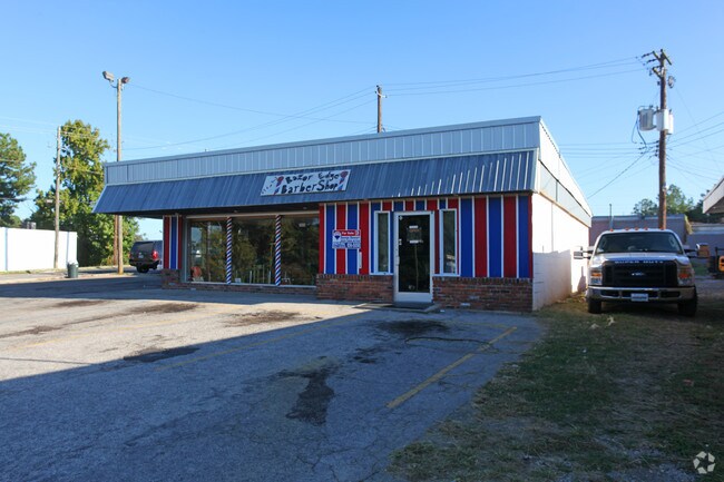
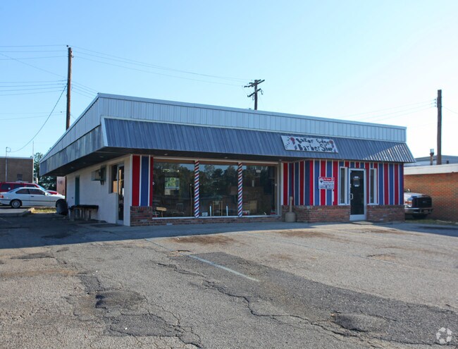
Property Record
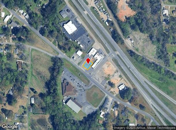
3604 Main St, Adamsville, AL 35005
NEARBY LISTINGS FOR SALE OR LEASE
Property Detail
3604 Main St
21-00-03-4-002-006.001
COM AT INTER NE R/W BANKHEAD HWY WITH N 1/4 LINE OF 1/4 SEC TH SE ALONG R/W 750 FT TO POB CONT SE 70.5 FT TH NE 98.9 FT TH NW 43.5 FT TH SW 16.5 FT TH NW 30.3 FT TH SW 79.4 FT TO POB SEC 3 TP 17S R 4W
Recreationalentertainmentgeneral
Jefferson
X
Alabama
01073C0358H
0.15 AC
2022
Bessemer
2024
Birmingham
012104
Birmingham-Hoover, AL
1,512 SF
DEMOGRAPHICS near 3604 Main St
1 Mile
3 Mile
5 Mile
2024 Total Population
2,480
12,234
29,572
2029 Population
2,423
11,971
29,132
Pop Growth 2024-2029
(2.30%)
(2.15%)
(1.49%)
Average Age
42
42
42
2024 Total Households
981
4,830
11,824
HH Growth 2024-2029
(2.34%)
(2.24%)
(1.54%)
Median Household Inc
$50,248
$52,668
$52,129
Avg Household Size
2.50
2.50
2.40
2024 Avg HH Vehicles
2.00
2.00
2.00
Median Home Value
$145,939
$141,662
$128,992
Median Year Built
1969
1968
1971
Nearby Places
Map Layers
Map Styles
 Street
 Aerial
- Restaurants
- Banks
- Shops
- Fitness
- Groceries
PUBLIC TRANSPORTATION
AIRPORT
Birmingham-Shuttlesworth International
DRIVE
WALK
Distance
Birmingham-Shuttlesworth International
24 min
15.3 mi
SALE & LEASE HISTORY
LISTING DATE
SALE/LEASE

Sep 24, 2016
For Sale
Nearby Properties
Address
Land Use
TOTAL SIZE
Lot Size
Zoning
Address
Land Use
TOTAL SIZE
Lot Size
Zoning
181,399 SF
20.91 AC
A1
Address
Land Use
TOTAL SIZE
Lot Size
Zoning
137,177 SF
10 AC
INST
Address
Land Use
TOTAL SIZE
Lot Size
Zoning
31,817 SF
2.17 AC
CP-C
Address
Land Use
TOTAL SIZE
Lot Size
Zoning
87,260 SF
8.20 AC
A1-C
Address
Land Use
TOTAL SIZE
Lot Size
Zoning
46,492 SF
4.62 AC
A1-C
Address
Land Use
TOTAL SIZE
Lot Size
Zoning
31,438 SF
8 AC
B2
Address
Land Use
TOTAL SIZE
Lot Size
Zoning
26,458 SF
3.88 AC
INST
Address
Land Use
TOTAL SIZE
Lot Size
Zoning
111,145 SF
14 AC
R1
Address
Land Use
TOTAL SIZE
Lot Size
Zoning
48,001 SF
3.90 AC
B2
Address
Land Use
TOTAL SIZE
Lot Size
Zoning
57,685 SF
6.70 AC
I3
Address
Land Use
TOTAL SIZE
Lot Size
Zoning
37,100 SF
22.70 AC
INST
Address
Land Use
TOTAL SIZE
Lot Size
Zoning
29,928 SF
4.38 AC
INST
Address
Land Use
TOTAL SIZE
Lot Size
Zoning
16,219 SF
5.77 AC
INST
Address
Land Use
TOTAL SIZE
Lot Size
Zoning
25,417 SF
6.26 AC
B3
Address
Land Use
TOTAL SIZE
Lot Size
Zoning
1,200 SF
8.30 AC
A1
Address
Land Use
TOTAL SIZE
Lot Size
Zoning
30,693 SF
12 AC
INST
Address
Land Use
TOTAL SIZE
Lot Size
Zoning
47,248 SF
17.51 AC
C1-A
Address
Land Use
TOTAL SIZE
Lot Size
Zoning
26,114 SF
1.72 AC
C1
Address
Land Use
TOTAL SIZE
Lot Size
Zoning
42,642 SF
6 AC
A1-C
Address
Land Use
TOTAL SIZE
Lot Size
Zoning
24,566 SF
2 AC
R1
Address
Land Use
TOTAL SIZE
Lot Size
Zoning
9,625 SF
5.31 AC
C1
Address
Land Use
TOTAL SIZE
Lot Size
Zoning
4,387 SF
0.90 AC
A1-C
Address
Land Use
TOTAL SIZE
Lot Size
Zoning
13,784 SF
1.77 AC
C1
Address
Land Use
TOTAL SIZE
Lot Size
Zoning
21,728 SF
3.27 AC
R-1
Address
Land Use
TOTAL SIZE
Lot Size
Zoning
51,656 SF
4.76 AC
C1
Address
Land Use
TOTAL SIZE
Lot Size
Zoning
16,300 SF
0.50 AC
R2
Address
Land Use
TOTAL SIZE
Lot Size
Zoning
22,850 SF
6.10 AC
BR
Address
Land Use
TOTAL SIZE
Lot Size
Zoning
8,554 SF
1.39 AC
CP
Address
Land Use
TOTAL SIZE
Lot Size
Zoning
8,407 SF
1.03 AC
C1
Address
Land Use
TOTAL SIZE
Lot Size
Zoning
34,592 SF
4.40 AC
B2
The World's #1 Commercial Real Estate Marketplace
Connect with us
© 2025 CoStar Group
The information above has been obtained from sources believed reliable. While we do not doubt its accuracy we have not verified it and make no guarantee, warranty or representation about it. It is your responsibility to independently confirm its accuracy and completeness. Any projections, opinions, assumptions, or estimates used are for example only and do not represent the current or future performance of the property. The value of this transaction to you depends on tax and other factors which should be evaluated by your tax, financial, and legal advisors. You and your advisors should conduct a careful, independent investigation of the property to determine to your satisfaction the suitability of the property for your needs.