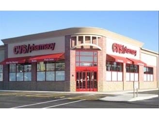
Property Record
3674 Highway 5, Douglasville, GA 30135


NEARBY LISTINGS FOR SALE OR LEASE
Property Detail
3674 Highway 5
Atlanta-Sandy Springs-Roswell, GA
Lettie Y Phillips
9025-00-9-0-192
BLDG/2.193 AC, GA HWY 5 @ CENTRAL CHURCH RD
Storebuilding
Douglas
X
Georgia
13097C0134C
3
2024
2.19 AC
2024
Villa Rica/W Outlying
080506
Atlanta
13,416 SF
DEMOGRAPHICS near 3674 Highway 5
1 Mile
3 Mile
5 Mile
2024 Total Population
5,026
32,301
75,148
2029 Population
5,257
33,873
79,275
Pop Growth 2024-2029
+ 4.60%
+ 4.87%
+ 5.49%
Average Age
40
39
38
2024 Total Households
1,861
11,559
26,063
HH Growth 2024-2029
+ 4.78%
+ 4.97%
+ 5.57%
Median Household Inc
$53,279
$64,399
$66,718
Avg Household Size
2.70
2.70
2.80
2024 Avg HH Vehicles
2.00
2.00
2.00
Median Home Value
$162,725
$197,896
$207,882
Median Year Built
1977
1986
1992
Nearby Places
Map Layers
Map Styles
 Street
 Aerial
- Restaurants
- Banks
- Shops
- Fitness
- Groceries
PUBLIC TRANSPORTATION
AIRPORT
Hartsfield - Jackson Atlanta International
DRIVE
WALK
Distance
Hartsfield - Jackson Atlanta International
46 min
33.3 mi
Freight Ports
Georgia Ports - Savannah
DRIVE
WALK
Distance
Georgia Ports - Savannah
308 min
272.6 mi
Nearby Properties
Address
Land Use
TOTAL SIZE
Lot Size
Zoning
Address
Land Use
TOTAL SIZE
Lot Size
Zoning
320,483 SF
24.27 AC
DCD
Address
Land Use
TOTAL SIZE
Lot Size
Zoning
299,120 SF
21.37 AC
DCD
Address
Land Use
TOTAL SIZE
Lot Size
Zoning
522,936 SF
39.33 AC
IL
Address
Land Use
TOTAL SIZE
Lot Size
Zoning
500,688 SF
41.29 AC
C-G
Address
Land Use
TOTAL SIZE
Lot Size
Zoning
247,203 SF
18.74 AC
DCD
Address
Land Use
TOTAL SIZE
Lot Size
Zoning
331,774 SF
37.68 AC
DCD
Address
Land Use
TOTAL SIZE
Lot Size
Zoning
263,326 SF
24.07 AC
CG
Address
Land Use
TOTAL SIZE
Lot Size
Zoning
136,748 SF
19 AC
R-6
Address
Land Use
TOTAL SIZE
Lot Size
Zoning
166,816 SF
26.23 AC
R-MF
Address
Land Use
TOTAL SIZE
Lot Size
Zoning
132,754 SF
20.35 AC
R-6
Address
Land Use
TOTAL SIZE
Lot Size
Zoning
338,918 SF
24.51 AC
CG
Address
Land Use
TOTAL SIZE
Lot Size
Zoning
200,233 SF
17.49 AC
R-6
Address
Land Use
TOTAL SIZE
Lot Size
Zoning
224,137 SF
22.83 AC
CG
Address
Land Use
TOTAL SIZE
Lot Size
Zoning
151,822 SF
21.57 AC
CG
Address
Land Use
TOTAL SIZE
Lot Size
Zoning
87,669 SF
9.44 AC
CG
Address
Land Use
TOTAL SIZE
Lot Size
Zoning
72,268 SF
7.26 AC
Address
Land Use
TOTAL SIZE
Lot Size
Zoning
26,274 SF
2.42 AC
OI-L
Address
Land Use
TOTAL SIZE
Lot Size
Zoning
114,267 SF
11.43 AC
CG
Address
Land Use
TOTAL SIZE
Lot Size
Zoning
78,688 SF
12.17 AC
CG
Address
Land Use
TOTAL SIZE
Lot Size
Zoning
135,300 SF
16.13 AC
CG
Address
Land Use
TOTAL SIZE
Lot Size
Zoning
87,472 SF
9.10 AC
DCD
Address
Land Use
TOTAL SIZE
Lot Size
Zoning
49,148 SF
3.38 AC
CG
Address
Land Use
TOTAL SIZE
Lot Size
Zoning
89,748 SF
2.56 AC
CG
Address
Land Use
TOTAL SIZE
Lot Size
Zoning
41,925 SF
3.77 AC
DCD
Address
Land Use
TOTAL SIZE
Lot Size
Zoning
86,140 SF
10.88 AC
CG
Address
Land Use
TOTAL SIZE
Lot Size
Zoning
3,500 SF
51.89 AC
DCD
Address
Land Use
TOTAL SIZE
Lot Size
Zoning
103,676 SF
7.36 AC
CG
Address
Land Use
TOTAL SIZE
Lot Size
Zoning
129,646 SF
9.80 AC
CG
Address
Land Use
TOTAL SIZE
Lot Size
Zoning
110,828 SF
8.74 AC
CG
Address
Land Use
TOTAL SIZE
Lot Size
Zoning
109,917 SF
2.26 AC
CG
The World's #1 Commercial Real Estate Marketplace
Connect with us
© 2026 CoStar Group
The information above has been obtained from sources believed reliable. While we do not doubt its accuracy we have not verified it and make no guarantee, warranty or representation about it. It is your responsibility to independently confirm its accuracy and completeness. Any projections, opinions, assumptions, or estimates used are for example only and do not represent the current or future performance of the property. The value of this transaction to you depends on tax and other factors which should be evaluated by your tax, financial, and legal advisors. You and your advisors should conduct a careful, independent investigation of the property to determine to your satisfaction the suitability of the property for your needs.