Property Record
3795 Paris St, Denver, CO 80239
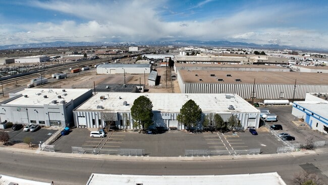

Property Detail
3795 Paris St
1261-02-002
UPLAND WEST FLG NO 2 01261 B2 L2
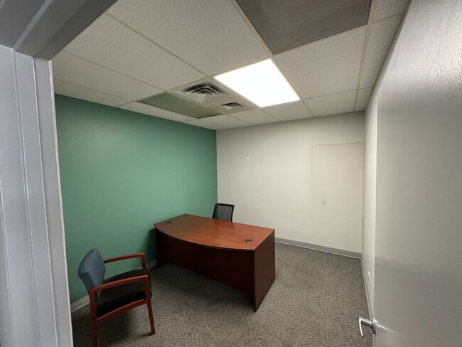
Warehouse
DENVER
I-B
Colorado
B and X Area of moderate flood hazard, usually the area between the limits of the 100-year and 500-year floods.
2
2024
1.04 AC
2025
Cent E I-70/Montbello
004110
Denver
23,359 SF
Denver-Aurora-Centennial, CO
NEARBY LISTINGS FOR SALE OR LEASE
DEMOGRAPHICS near 3795 Paris St
1 mile
3 mile
5 mile
2025 Total Population
8,257
133,914
306,263
2030 Population
8,481
137,175
313,995
Pop Growth 2025-2030
+ 2.71%
+ 2.44%
+ 2.52%
Average Age
35
35
36
2025 Total Households
2,483
44,063
108,705
HH Growth 2025-2030
+ 2.78%
+ 2.67%
+ 2.65%
Median Household Inc
$73,017
$84,404
$83,600
Avg Household Size
3.00
2.90
2.70
2025 Avg HH Vehicles
2.00
2.00
2.00
Median Home Value
$424,835
$474,366
$483,465
Median Year Built
1981
1986
1982
Nearby Places
Map Layers
Map Styles
 Street
 Aerial
Transit
 Traffic
 Biking
Places
Listings with unknown addresses are not visible on the map
- Restaurants
- Banks
- Shops
- Fitness
- Groceries
PUBLIC TRANSPORTATION
AIRPORT
Denver International
Drive
Walk
Distance
Denver International
20 min
14.9 mi
SALE & LEASE HISTORY
LISTING DATE
SALE/LEASE

Sep 04, 2025
For Lease
Oct 19, 2020
For Lease
Jan 30, 2024
For Lease
Feb 20, 2018
For Lease
Feb 09, 2022
For Lease
Aug 24, 2022
For Lease
Nearby Properties
Address
Land Use
TOTAL SIZE
Lot Size
Zoning
Address
Land Use
TOTAL SIZE
Lot Size
Zoning
677,018 SF
5.05 AC
C-MX
Address
Land Use
TOTAL SIZE
Lot Size
Zoning
368,450 SF
48.59 AC
Address
Land Use
TOTAL SIZE
Lot Size
Zoning
719,357 SF
21.47 AC
M-MX-5
Address
Land Use
TOTAL SIZE
Lot Size
Zoning
353,829 SF
4.51 AC
Address
Land Use
TOTAL SIZE
Lot Size
Zoning
343,997 SF
6.36 AC
S-MX-5
Address
Land Use
TOTAL SIZE
Lot Size
Zoning
880,442 SF
67.95 AC
I-B
Address
Land Use
TOTAL SIZE
Lot Size
Zoning
244,271 SF
15.30 AC
Address
Land Use
TOTAL SIZE
Lot Size
Zoning
525,050 SF
105.06 AC
Address
Land Use
TOTAL SIZE
Lot Size
Zoning
169,941 SF
4.08 AC
I-B
Address
Land Use
TOTAL SIZE
Lot Size
Zoning
723,053 SF
32.44 AC
M-IMX-12
Address
Land Use
TOTAL SIZE
Lot Size
Zoning
269,025 SF
18.86 AC
M-RX-5
Address
Land Use
TOTAL SIZE
Lot Size
Zoning
87,346 SF
1.76 AC
RFBAD
Address
Land Use
TOTAL SIZE
Lot Size
Zoning
45,803 SF
1.96 AC
M-IMX-5
Address
Land Use
TOTAL SIZE
Lot Size
Zoning
335,757 SF
36.88 AC
CMP-EI2
Address
Land Use
TOTAL SIZE
Lot Size
Zoning
97,306 SF
4.25 AC
C-MX
Address
Land Use
TOTAL SIZE
Lot Size
Zoning
102,444 SF
3.76 AC
GTWY
Address
Land Use
TOTAL SIZE
Lot Size
Zoning
691,200 SF
38.09 AC
Address
Land Use
TOTAL SIZE
Lot Size
Zoning
109,982 SF
2.92 AC
M-IMX-12
Address
Land Use
TOTAL SIZE
Lot Size
Zoning
88,214 SF
3.40 AC
C-MX
Address
Land Use
TOTAL SIZE
Lot Size
Zoning
390,822 SF
13.47 AC
O-1
Address
Land Use
TOTAL SIZE
Lot Size
Zoning
57,392 SF
0.72 AC
Address
Land Use
TOTAL SIZE
Lot Size
Zoning
135,803 SF
3.36 AC
Address
Land Use
TOTAL SIZE
Lot Size
Zoning
273,184 SF
1.89 AC
Address
Land Use
TOTAL SIZE
Lot Size
Zoning
6.97 AC
C-MU-20
Address
Land Use
TOTAL SIZE
Lot Size
Zoning
651,423 SF
82.50 AC
I-2
Address
Land Use
TOTAL SIZE
Lot Size
Zoning
131,544 SF
3.92 AC
Address
Land Use
TOTAL SIZE
Lot Size
Zoning
646,975 SF
32.60 AC
M-IMX-8
Address
Land Use
TOTAL SIZE
Lot Size
Zoning
185,207 SF
9.94 AC
C-MU-20
Address
Land Use
TOTAL SIZE
Lot Size
Zoning
269,622 SF
12.90 AC
Address
Land Use
TOTAL SIZE
Lot Size
Zoning
124,526 SF
10 AC
M-RH-3
The World's #1 Commercial Real Estate Marketplace
Connect with us
© 2026 CoStar Group
The information above has been obtained from sources believed reliable. While we do not doubt its accuracy we have not verified it and make no guarantee, warranty or representation about it. It is your responsibility to independently confirm its accuracy and completeness. Any projections, opinions, assumptions, or estimates used are for example only and do not represent the current or future performance of the property. The value of this transaction to you depends on tax and other factors which should be evaluated by your tax, financial, and legal advisors. You and your advisors should conduct a careful, independent investigation of the property to determine to your satisfaction the suitability of the property for your needs.