Property Record
38 Ident Rd, South Windsor, CT 06074


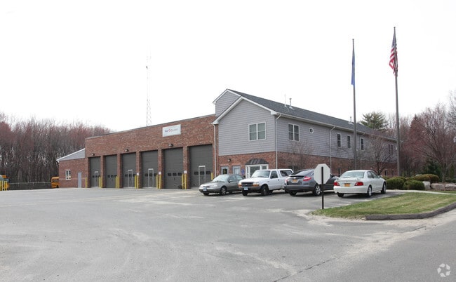
Property Detail
38 Ident Rd
Industrialgeneral
Capitol
I
Connecticut
B and X Area of moderate flood hazard, usually the area between the limits of the 100-year and 500-year floods.
3.01 AC
2024
South Windsor
2025
Hartford
487300
Hartford-West Hartford-East Hartford, CT
13,400 SF
SWIN-000084-000000-000043
NEARBY LISTINGS FOR SALE OR LEASE
DEMOGRAPHICS near 38 Ident Rd
1 mile
3 mile
5 mile
2025 Total Population
697
23,186
91,632
2030 Population
715
23,631
93,399
Pop Growth 2025-2030
+ 2.58%
+ 1.92%
+ 1.93%
Average Age
45
42
41
2025 Total Households
285
9,307
36,312
HH Growth 2025-2030
+ 2.46%
+ 1.85%
+ 1.94%
Median Household Inc
$128,125
$119,501
$95,791
Avg Household Size
2.40
2.40
2.50
2025 Avg HH Vehicles
2.00
2.00
2.00
Median Home Value
$371,211
$322,761
$290,924
Median Year Built
1956
1968
1970
Nearby Places
Map Layers
Map Styles
 Street
 Aerial
Layers
 Traffic
 Biking
Places
Listings with unknown addresses are not visible on the map
- Restaurants
- Banks
- Shops
- Fitness
- Groceries
PUBLIC TRANSPORTATION
COMMUTER RAIL
Drive
Walk
Distance
15 min
7.8 mi
Windsor Locks (Hartford Line - CT Rail (CTRail))
Drive
Walk
Distance
Windsor Locks (Hartford Line - CT Rail (CTRail))
14 min
7.9 mi
AIRPORT
Bradley International
Drive
Walk
Distance
Bradley International
25 min
10.5 mi
Freight Ports
Port of New Haven
Drive
Walk
Distance
Port of New Haven
64 min
45.7 mi
SALE & LEASE HISTORY
LISTING DATE
SALE/LEASE

Mar 23, 2021
For Lease
Feb 01, 2021
For Lease
Nearby Properties
Address
Land Use
TOTAL SIZE
Lot Size
Zoning
Address
Land Use
TOTAL SIZE
Lot Size
Zoning
13,680 SF
240.83 AC
Address
Land Use
TOTAL SIZE
Lot Size
Zoning
248,364 SF
47.28 AC
A20
Address
Land Use
TOTAL SIZE
Lot Size
Zoning
659,693 SF
102.30 AC
I
Address
Land Use
TOTAL SIZE
Lot Size
Zoning
301,011 SF
60.83 AC
I
Address
Land Use
TOTAL SIZE
Lot Size
Zoning
6.50 AC
Address
Land Use
TOTAL SIZE
Lot Size
Zoning
421,152 SF
45.95 AC
CD
Address
Land Use
TOTAL SIZE
Lot Size
Zoning
35.05 AC
FP
Address
Land Use
TOTAL SIZE
Lot Size
Zoning
177,630 SF
32.64 AC
Address
Land Use
TOTAL SIZE
Lot Size
Zoning
247,428 SF
35.46 AC
Address
Land Use
TOTAL SIZE
Lot Size
Zoning
101,317 SF
24.91 AC
RR
Address
Land Use
TOTAL SIZE
Lot Size
Zoning
209,744 SF
25.67 AC
CD
Address
Land Use
TOTAL SIZE
Lot Size
Zoning
259,600 SF
25.58 AC
CD
Address
Land Use
TOTAL SIZE
Lot Size
Zoning
302,370 SF
16.43 AC
I
Address
Land Use
TOTAL SIZE
Lot Size
Zoning
182,628 SF
15.94 AC
CD
Address
Land Use
TOTAL SIZE
Lot Size
Zoning
156,929 SF
43 AC
GD
Address
Land Use
TOTAL SIZE
Lot Size
Zoning
416,640 SF
30 AC
I
Address
Land Use
TOTAL SIZE
Lot Size
Zoning
768 SF
15.72 AC
Address
Land Use
TOTAL SIZE
Lot Size
Zoning
62,487 SF
14.35 AC
CD
Address
Land Use
TOTAL SIZE
Lot Size
Zoning
153,247 SF
19.85 AC
I
Address
Land Use
TOTAL SIZE
Lot Size
Zoning
11,212 SF
15.54 AC
Address
Land Use
TOTAL SIZE
Lot Size
Zoning
168,000 SF
13.86 AC
I
Address
Land Use
TOTAL SIZE
Lot Size
Zoning
59,882 SF
6 AC
RC
Address
Land Use
TOTAL SIZE
Lot Size
Zoning
229,636 SF
15.05 AC
I
Address
Land Use
TOTAL SIZE
Lot Size
Zoning
76,907 SF
6.97 AC
RC
Address
Land Use
TOTAL SIZE
Lot Size
Zoning
13.39 AC
RR
Address
Land Use
TOTAL SIZE
Lot Size
Zoning
44,363 SF
23 AC
A20
Address
Land Use
TOTAL SIZE
Lot Size
Zoning
43.62 AC
Address
Land Use
TOTAL SIZE
Lot Size
Zoning
242,072 SF
12.07 AC
I
Address
Land Use
TOTAL SIZE
Lot Size
Zoning
49,088 SF
1.47 AC
Address
Land Use
TOTAL SIZE
Lot Size
Zoning
167,595 SF
17.53 AC
The World's #1 Commercial Real Estate Marketplace
Connect with us
© 2026 CoStar Group
The information above has been obtained from sources believed reliable. While we do not doubt its accuracy we have not verified it and make no guarantee, warranty or representation about it. It is your responsibility to independently confirm its accuracy and completeness. Any projections, opinions, assumptions, or estimates used are for example only and do not represent the current or future performance of the property. The value of this transaction to you depends on tax and other factors which should be evaluated by your tax, financial, and legal advisors. You and your advisors should conduct a careful, independent investigation of the property to determine to your satisfaction the suitability of the property for your needs.