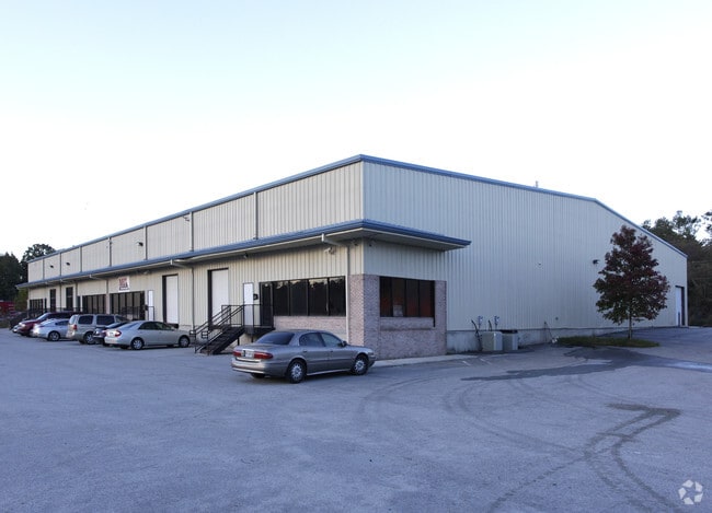
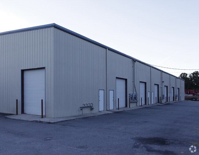
Property Record
381 Veterans Memorial Hwy Sw, Mableton, GA 30126

NEARBY LISTINGS FOR SALE OR LEASE
Property Detail
381 Veterans Memorial Hwy Sw
Publicstorage
Cobb
X
Georgia
13067C0204G
7.41 AC
2025
I-20 W/Douglasville
2025
Atlanta
031317
Atlanta-Sandy Springs-Roswell, GA
52,250 SF
18-0041-0-049-0
DEMOGRAPHICS near 381 Veterans Memorial Hwy Sw
1 Mile
3 Mile
5 Mile
2024 Total Population
5,853
63,491
159,485
2029 Population
5,986
64,654
162,647
Pop Growth 2024-2029
+ 2.27%
+ 1.83%
+ 1.98%
Average Age
38
38
38
2024 Total Households
2,135
23,319
62,160
HH Growth 2024-2029
+ 2.25%
+ 1.81%
+ 1.96%
Median Household Inc
$68,549
$76,350
$74,204
Avg Household Size
2.60
2.60
2.50
2024 Avg HH Vehicles
2.00
2.00
2.00
Median Home Value
$260,132
$284,850
$295,297
Median Year Built
1968
1985
1988
Nearby Places
Map Layers
Map Styles
 Street
 Aerial
- Restaurants
- Banks
- Shops
- Fitness
- Groceries
PUBLIC TRANSPORTATION
AIRPORT
Hartsfield - Jackson Atlanta International
DRIVE
WALK
Distance
Hartsfield - Jackson Atlanta International
34 min
21.5 mi
Nearby Properties
Address
Land Use
TOTAL SIZE
Lot Size
Zoning
Address
Land Use
TOTAL SIZE
Lot Size
Zoning
290,784 SF
21.09 AC
RM-12
Address
Land Use
TOTAL SIZE
Lot Size
Zoning
694,436 SF
36.80 AC
HI
Address
Land Use
TOTAL SIZE
Lot Size
Zoning
283,396 SF
29.88 AC
RM-12
Address
Land Use
TOTAL SIZE
Lot Size
Zoning
241,200 SF
18.40 AC
RM-12
Address
Land Use
TOTAL SIZE
Lot Size
Zoning
152,348 SF
12.76 AC
RM-12
Address
Land Use
TOTAL SIZE
Lot Size
Zoning
150,440 SF
25 AC
LI
Address
Land Use
TOTAL SIZE
Lot Size
Zoning
350,840 SF
22.90 AC
LI
Address
Land Use
TOTAL SIZE
Lot Size
Zoning
151,436 SF
11.42 AC
RM-12
Address
Land Use
TOTAL SIZE
Lot Size
Zoning
377,059 SF
32.20 AC
LI
Address
Land Use
TOTAL SIZE
Lot Size
Zoning
217,412 SF
18.29 AC
RM-12
Address
Land Use
TOTAL SIZE
Lot Size
Zoning
16.56 AC
LI
Address
Land Use
TOTAL SIZE
Lot Size
Zoning
3.46 AC
RM-12
Address
Land Use
TOTAL SIZE
Lot Size
Zoning
192,776 SF
16.35 AC
RM-12
Address
Land Use
TOTAL SIZE
Lot Size
Zoning
259,325 SF
23.30 AC
LI
Address
Land Use
TOTAL SIZE
Lot Size
Zoning
111,047 SF
14.40 AC
GC
Address
Land Use
TOTAL SIZE
Lot Size
Zoning
111,246 SF
11.28 AC
RM-12
Address
Land Use
TOTAL SIZE
Lot Size
Zoning
121,625 SF
10.40 AC
RM-12
Address
Land Use
TOTAL SIZE
Lot Size
Zoning
109,072 SF
15.23 AC
NRC
Address
Land Use
TOTAL SIZE
Lot Size
Zoning
114,622 SF
11.31 AC
RM-12
Address
Land Use
TOTAL SIZE
Lot Size
Zoning
119,424 SF
11.32 AC
RM-12
Address
Land Use
TOTAL SIZE
Lot Size
Zoning
113,244 SF
7.95 AC
RM-12
Address
Land Use
TOTAL SIZE
Lot Size
Zoning
115,380 SF
10.12 AC
RM-12
Address
Land Use
TOTAL SIZE
Lot Size
Zoning
89,686 SF
10.60 AC
NRC
Address
Land Use
TOTAL SIZE
Lot Size
Zoning
117,715 SF
7.88 AC
RM-12
Address
Land Use
TOTAL SIZE
Lot Size
Zoning
81,828 SF
13.99 AC
GC
Address
Land Use
TOTAL SIZE
Lot Size
Zoning
63,424 SF
10.67 AC
RM-12
Address
Land Use
TOTAL SIZE
Lot Size
Zoning
2.76 AC
NRC
Address
Land Use
TOTAL SIZE
Lot Size
Zoning
2,636 SF
2.97 AC
NRC
Address
Land Use
TOTAL SIZE
Lot Size
Zoning
160,380 SF
11.71 AC
RM-12
The World's #1 Commercial Real Estate Marketplace
Connect with us
© 2025 CoStar Group
The information above has been obtained from sources believed reliable. While we do not doubt its accuracy we have not verified it and make no guarantee, warranty or representation about it. It is your responsibility to independently confirm its accuracy and completeness. Any projections, opinions, assumptions, or estimates used are for example only and do not represent the current or future performance of the property. The value of this transaction to you depends on tax and other factors which should be evaluated by your tax, financial, and legal advisors. You and your advisors should conduct a careful, independent investigation of the property to determine to your satisfaction the suitability of the property for your needs.