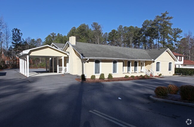
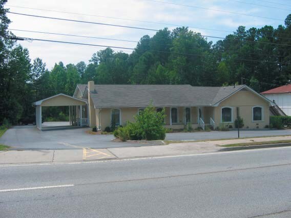
Property Record
385 Scenic Hwy, Lawrenceville, GA 30046

NEARBY LISTINGS FOR SALE OR LEASE
Property Detail
385 Scenic Hwy
Atlanta-Sandy Springs-Roswell, GA
Scenic Forest
5-116-088
L3 BB SCENIC FOREST #1
Religious
Gwinnett
AE
Georgia
13135C0088F
3
0
0.54 AC
2025
Lawrenceville/Lilburn
050521
Atlanta
3,468 SF
DEMOGRAPHICS near 385 Scenic Hwy
1 Mile
3 Mile
5 Mile
2024 Total Population
8,939
82,464
205,504
2029 Population
9,280
85,958
214,193
Pop Growth 2024-2029
+ 3.81%
+ 4.24%
+ 4.23%
Average Age
38
37
37
2024 Total Households
3,085
27,016
65,298
HH Growth 2024-2029
+ 3.82%
+ 4.35%
+ 4.33%
Median Household Inc
$63,723
$71,741
$80,926
Avg Household Size
2.80
3.00
3.00
2024 Avg HH Vehicles
2.00
2.00
2.00
Median Home Value
$269,756
$299,130
$295,600
Median Year Built
1985
1996
1995
Nearby Places
Map Layers
Map Styles
 Street
 Aerial
- Restaurants
- Banks
- Shops
- Fitness
- Groceries
PUBLIC TRANSPORTATION
AIRPORT
Hartsfield - Jackson Atlanta International
DRIVE
WALK
Distance
Hartsfield - Jackson Atlanta International
59 min
42.2 mi
SALE & LEASE HISTORY
LISTING DATE
SALE/LEASE

Feb 03, 2017
For Sale
Apr 20, 2017
For Sale
Nearby Properties
Address
Land Use
TOTAL SIZE
Lot Size
Zoning
Address
Land Use
TOTAL SIZE
Lot Size
Zoning
1,218,930 SF
66.65 AC
OI
Address
Land Use
TOTAL SIZE
Lot Size
Zoning
1,276,197 SF
91.78 AC
OI
Address
Land Use
TOTAL SIZE
Lot Size
Zoning
850,292 SF
70.76 AC
HM
Address
Land Use
TOTAL SIZE
Lot Size
Zoning
275,917 SF
13.34 AC
BG
Address
Land Use
TOTAL SIZE
Lot Size
Zoning
522,601 SF
42.40 AC
RM
Address
Land Use
TOTAL SIZE
Lot Size
Zoning
484,262 SF
34.27 AC
RM
Address
Land Use
TOTAL SIZE
Lot Size
Zoning
493,520 SF
12.67 AC
BG2
Address
Land Use
TOTAL SIZE
Lot Size
Zoning
321,476 SF
38.63 AC
RMM
Address
Land Use
TOTAL SIZE
Lot Size
Zoning
16,062 SF
89.78 AC
BG
Address
Land Use
TOTAL SIZE
Lot Size
Zoning
812,946 SF
82.22 AC
BG2
Address
Land Use
TOTAL SIZE
Lot Size
Zoning
641,171 SF
43.12 AC
RM13
Address
Land Use
TOTAL SIZE
Lot Size
Zoning
352,924 SF
86.43 AC
R100
Address
Land Use
TOTAL SIZE
Lot Size
Zoning
360,279 SF
13.16 AC
RM24
Address
Land Use
TOTAL SIZE
Lot Size
Zoning
298,990 SF
24.16 AC
RM12
Address
Land Use
TOTAL SIZE
Lot Size
Zoning
333,734 SF
24 AC
BG
Address
Land Use
TOTAL SIZE
Lot Size
Zoning
271,668 SF
20.13 AC
RM13
Address
Land Use
TOTAL SIZE
Lot Size
Zoning
279,207 SF
19.14 AC
RM13
Address
Land Use
TOTAL SIZE
Lot Size
Zoning
325,459 SF
21.18 AC
HM
Address
Land Use
TOTAL SIZE
Lot Size
Zoning
221,082 SF
12.90 AC
RM24
Address
Land Use
TOTAL SIZE
Lot Size
Zoning
216,861 SF
21.43 AC
RM13
Address
Land Use
TOTAL SIZE
Lot Size
Zoning
201,000 SF
29.98 AC
R75
Address
Land Use
TOTAL SIZE
Lot Size
Zoning
213,116 SF
15.09 AC
RM12
Address
Land Use
TOTAL SIZE
Lot Size
Zoning
220,161 SF
9.71 AC
OI
Address
Land Use
TOTAL SIZE
Lot Size
Zoning
286,368 SF
34.55 AC
R75
Address
Land Use
TOTAL SIZE
Lot Size
Zoning
278,350 SF
35.62 AC
C2
Address
Land Use
TOTAL SIZE
Lot Size
Zoning
357,652 SF
22.03 AC
HM
Address
Land Use
TOTAL SIZE
Lot Size
Zoning
214,399 SF
29.91 AC
C2
Address
Land Use
TOTAL SIZE
Lot Size
Zoning
240,509 SF
19.18 AC
RM
Address
Land Use
TOTAL SIZE
Lot Size
Zoning
175,190 SF
11.17 AC
RM
Address
Land Use
TOTAL SIZE
Lot Size
Zoning
153,597 SF
13.66 AC
RM13
The World's #1 Commercial Real Estate Marketplace
Connect with us
© 2025 CoStar Group
The information above has been obtained from sources believed reliable. While we do not doubt its accuracy we have not verified it and make no guarantee, warranty or representation about it. It is your responsibility to independently confirm its accuracy and completeness. Any projections, opinions, assumptions, or estimates used are for example only and do not represent the current or future performance of the property. The value of this transaction to you depends on tax and other factors which should be evaluated by your tax, financial, and legal advisors. You and your advisors should conduct a careful, independent investigation of the property to determine to your satisfaction the suitability of the property for your needs.