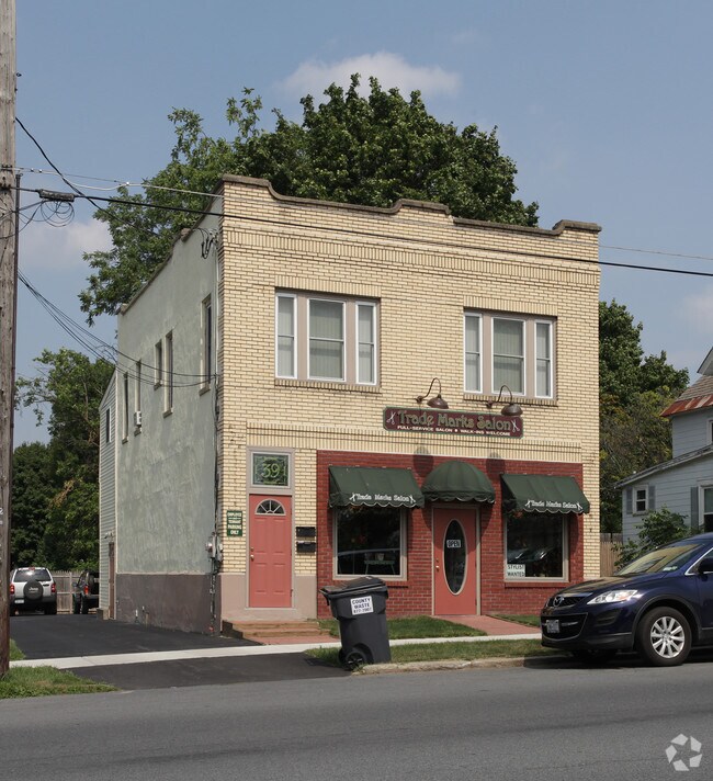
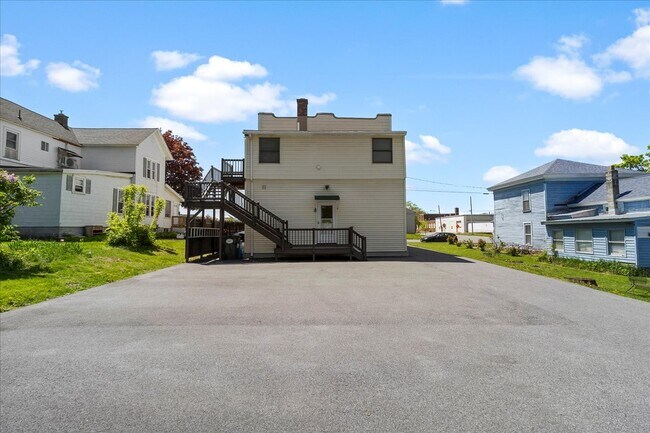
Property Record
39 Hudson St, South Glens Falls, NY 12803
This Property Is For Sale
NEARBY LISTINGS FOR SALE OR LEASE
Property Detail
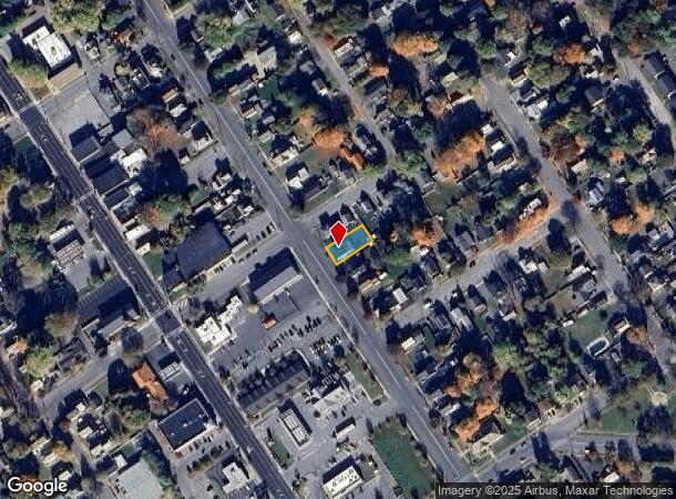
39 Hudson St
Albany-Schenectady-Troy, NY
Saratoga
414401-037-054-0002-007-000-0000
New York
Commercialofficeresidentialmixeduse
7.000
2025
0.13 AC
2024
Saratoga County
060200
Albany/Schenectady/Troy
2,548 SF
DEMOGRAPHICS near 39 Hudson St
1 Mile
3 Mile
5 Mile
2024 Total Population
8,321
40,403
68,097
2029 Population
8,357
40,121
67,792
Pop Growth 2024-2029
+ 0.43%
(0.70%)
(0.45%)
Average Age
42
42
43
2024 Total Households
3,913
17,722
29,360
HH Growth 2024-2029
+ 0.41%
(0.77%)
(0.52%)
Median Household Inc
$56,477
$63,183
$71,276
Avg Household Size
2.10
2.20
2.20
2024 Avg HH Vehicles
2.00
2.00
2.00
Median Home Value
$165,431
$177,838
$200,748
Median Year Built
1952
1957
1972
Nearby Places
Map Layers
Map Styles
 Street
 Aerial
- Restaurants
- Banks
- Shops
- Fitness
- Groceries
PUBLIC TRANSPORTATION
COMMUTER RAIL
DRIVE
WALK
Distance
12 min
7.2 mi
Nearby Properties
Address
Land Use
TOTAL SIZE
Lot Size
Zoning
Address
Land Use
TOTAL SIZE
Lot Size
Zoning
273,242 SF
11.07 AC
GC2
Address
Land Use
TOTAL SIZE
Lot Size
Zoning
16.34 AC
M1
Address
Land Use
TOTAL SIZE
Lot Size
Zoning
116,696 SF
23.70 AC
04 - FARM
Address
Land Use
TOTAL SIZE
Lot Size
Zoning
35.53 AC
HI
Address
Land Use
TOTAL SIZE
Lot Size
Zoning
161,338 SF
1.74 AC
GC2
Address
Land Use
TOTAL SIZE
Lot Size
Zoning
19.74 AC
HI
Address
Land Use
TOTAL SIZE
Lot Size
Zoning
Address
Land Use
TOTAL SIZE
Lot Size
Zoning
9,216 SF
32.20 AC
UR
Address
Land Use
TOTAL SIZE
Lot Size
Zoning
191,130 SF
20.09 AC
R-1A
Address
Land Use
TOTAL SIZE
Lot Size
Zoning
82,922 SF
8.03 AC
I
Address
Land Use
TOTAL SIZE
Lot Size
Zoning
Address
Land Use
TOTAL SIZE
Lot Size
Zoning
5,680 SF
39.79 AC
UR
Address
Land Use
TOTAL SIZE
Lot Size
Zoning
29,108 SF
22.48 AC
MDR
Address
Land Use
TOTAL SIZE
Lot Size
Zoning
1.91 AC
HI
Address
Land Use
TOTAL SIZE
Lot Size
Zoning
183,950 SF
11.41 AC
C1
Address
Land Use
TOTAL SIZE
Lot Size
Zoning
144,029 SF
28.34 AC
R1
Address
Land Use
TOTAL SIZE
Lot Size
Zoning
91,000 SF
0.52 AC
GC2
Address
Land Use
TOTAL SIZE
Lot Size
Zoning
Address
Land Use
TOTAL SIZE
Lot Size
Zoning
9.72 AC
CI
Address
Land Use
TOTAL SIZE
Lot Size
Zoning
12,337 SF
26.95 AC
HI
Address
Land Use
TOTAL SIZE
Lot Size
Zoning
130,142 SF
20.71 AC
CI
Address
Land Use
TOTAL SIZE
Lot Size
Zoning
70,176 SF
3.50 AC
GC1
Address
Land Use
TOTAL SIZE
Lot Size
Zoning
7,823 SF
27.33 AC
LDR25
Address
Land Use
TOTAL SIZE
Lot Size
Zoning
8,042 SF
39.64 AC
O
Address
Land Use
TOTAL SIZE
Lot Size
Zoning
1,600 SF
42.56 AC
SPLIT
Address
Land Use
TOTAL SIZE
Lot Size
Zoning
6,549 SF
17.26 AC
M1
Address
Land Use
TOTAL SIZE
Lot Size
Zoning
Address
Land Use
TOTAL SIZE
Lot Size
Zoning
156,550 SF
33.27 AC
CI
Address
Land Use
TOTAL SIZE
Lot Size
Zoning
16.20 AC
R1
Address
Land Use
TOTAL SIZE
Lot Size
Zoning
8,683 SF
8.27 AC
HI
The World's #1 Commercial Real Estate Marketplace
Connect with us
© 2025 CoStar Group
The information above has been obtained from sources believed reliable. While we do not doubt its accuracy we have not verified it and make no guarantee, warranty or representation about it. It is your responsibility to independently confirm its accuracy and completeness. Any projections, opinions, assumptions, or estimates used are for example only and do not represent the current or future performance of the property. The value of this transaction to you depends on tax and other factors which should be evaluated by your tax, financial, and legal advisors. You and your advisors should conduct a careful, independent investigation of the property to determine to your satisfaction the suitability of the property for your needs.