Property Record
390 Fairmount Ave, Jamestown, NY 14701

NEARBY LISTINGS FOR SALE OR LEASE
Property Detail
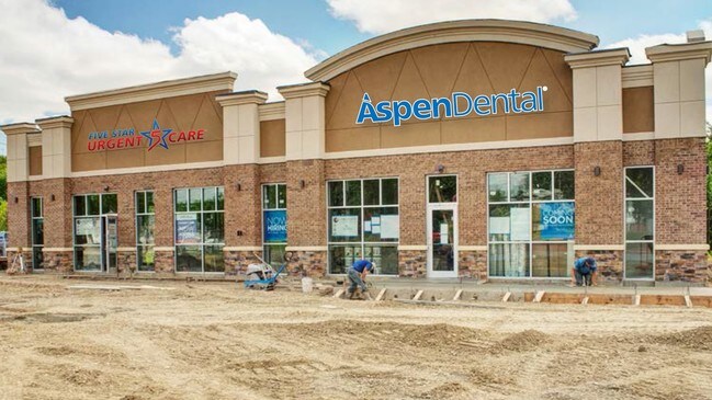
390 Fairmount Ave
Jamestown-Dunkirk-Fredonia, NY
OLD APN: 062201 111-12-24.1
062201 386.09-1-18.1
Chautauqua
Professionalbldglegalinsurancerealestateetc
New York
2024
18.001
2024
New York West Area
030500
Other Market Areas
3,440 SF
DEMOGRAPHICS near 390 Fairmount Ave
1 Mile
3 Mile
5 Mile
2024 Total Population
2,906
20,378
42,713
2029 Population
2,869
20,103
42,039
Pop Growth 2024-2029
(1.27%)
(1.35%)
(1.58%)
Average Age
48
44
43
2024 Total Households
1,303
9,167
18,702
HH Growth 2024-2029
(1.23%)
(1.42%)
(1.65%)
Median Household Inc
$39,885
$44,444
$41,941
Avg Household Size
2.00
2.10
2.20
2024 Avg HH Vehicles
2.00
2.00
1.00
Median Home Value
$88,888
$90,775
$83,475
Median Year Built
1953
1950
1949
Nearby Places
Map Layers
Map Styles
 Street
 Aerial
- Restaurants
- Banks
- Shops
- Fitness
- Groceries
SALE & LEASE HISTORY
LISTING DATE
SALE/LEASE

Jul 25, 2018
For Sale
Nearby Properties
Address
Land Use
TOTAL SIZE
Lot Size
Zoning
Address
Land Use
TOTAL SIZE
Lot Size
Zoning
Address
Land Use
TOTAL SIZE
Lot Size
Zoning
130,937 SF
8.60 AC
07 - MIXED
Address
Land Use
TOTAL SIZE
Lot Size
Zoning
Address
Land Use
TOTAL SIZE
Lot Size
Zoning
97,461 SF
1.41 AC
Address
Land Use
TOTAL SIZE
Lot Size
Zoning
68,532 SF
2 AC
Address
Land Use
TOTAL SIZE
Lot Size
Zoning
Address
Land Use
TOTAL SIZE
Lot Size
Zoning
259,898 SF
50.60 AC
Address
Land Use
TOTAL SIZE
Lot Size
Zoning
Address
Land Use
TOTAL SIZE
Lot Size
Zoning
197,094 SF
25.10 AC
05 - COMME
Address
Land Use
TOTAL SIZE
Lot Size
Zoning
114,938 SF
10.40 AC
02 - SINGL
Address
Land Use
TOTAL SIZE
Lot Size
Zoning
68,967 SF
3.80 AC
05 - COMME
Address
Land Use
TOTAL SIZE
Lot Size
Zoning
106,027 SF
20.60 AC
Address
Land Use
TOTAL SIZE
Lot Size
Zoning
Address
Land Use
TOTAL SIZE
Lot Size
Zoning
116,338 SF
15.40 AC
05 - COMME
Address
Land Use
TOTAL SIZE
Lot Size
Zoning
82,116 SF
6.55 AC
05 - COMME
Address
Land Use
TOTAL SIZE
Lot Size
Zoning
92,006 SF
12.30 AC
05 - COMME
Address
Land Use
TOTAL SIZE
Lot Size
Zoning
85,514 SF
10.80 AC
Address
Land Use
TOTAL SIZE
Lot Size
Zoning
35,850 SF
1.17 AC
Address
Land Use
TOTAL SIZE
Lot Size
Zoning
0.69 AC
Address
Land Use
TOTAL SIZE
Lot Size
Zoning
672,147 SF
48.40 AC
05 - COMME
Address
Land Use
TOTAL SIZE
Lot Size
Zoning
169,236 SF
11.80 AC
06 - INDUS
Address
Land Use
TOTAL SIZE
Lot Size
Zoning
2,484 SF
62.50 AC
04 - FARM
Address
Land Use
TOTAL SIZE
Lot Size
Zoning
Address
Land Use
TOTAL SIZE
Lot Size
Zoning
22,456 SF
0.87 AC
Address
Land Use
TOTAL SIZE
Lot Size
Zoning
113,146 SF
13.40 AC
05 - COMME
Address
Land Use
TOTAL SIZE
Lot Size
Zoning
9,720 SF
0.69 AC
Address
Land Use
TOTAL SIZE
Lot Size
Zoning
72,197 SF
0.85 AC
Address
Land Use
TOTAL SIZE
Lot Size
Zoning
48.42 AC
Address
Land Use
TOTAL SIZE
Lot Size
Zoning
109,416 SF
0.44 AC
Address
Land Use
TOTAL SIZE
Lot Size
Zoning
97,383 SF
0.48 AC
The World's #1 Commercial Real Estate Marketplace
Connect with us
© 2025 CoStar Group
The information above has been obtained from sources believed reliable. While we do not doubt its accuracy we have not verified it and make no guarantee, warranty or representation about it. It is your responsibility to independently confirm its accuracy and completeness. Any projections, opinions, assumptions, or estimates used are for example only and do not represent the current or future performance of the property. The value of this transaction to you depends on tax and other factors which should be evaluated by your tax, financial, and legal advisors. You and your advisors should conduct a careful, independent investigation of the property to determine to your satisfaction the suitability of the property for your needs.