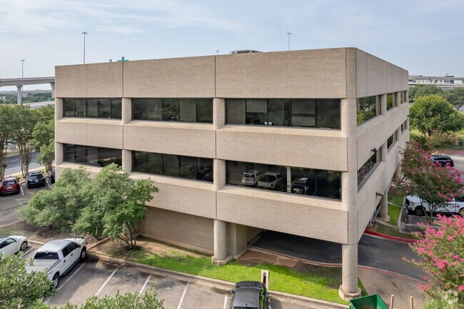
Property Record
3910 S Interstate 35, Austin, TX 78704

NEARBY LISTINGS FOR SALE OR LEASE
Property Detail
3910 S Interstate 35
Austin-Round Rock-San Marcos, TX
Perry Addn
316269
LOT 1 PERRY ADDN
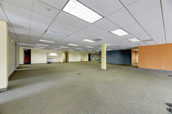
Officebuilding
Travis
X
Texas
48453C0585H
1
2024
1.11 AC
2025
South
002322
Austin
27,821 SF
DEMOGRAPHICS near 3910 S Interstate 35
1 Mile
3 Mile
5 Mile
2024 Total Population
10,404
163,994
350,107
2029 Population
11,314
178,835
381,930
Pop Growth 2024-2029
+ 8.75%
+ 9.05%
+ 9.09%
Average Age
34
36
36
2024 Total Households
4,665
76,283
155,282
HH Growth 2024-2029
+ 9.37%
+ 9.89%
+ 10.06%
Median Household Inc
$54,845
$67,403
$74,358
Avg Household Size
1.90
2.00
2.10
2024 Avg HH Vehicles
1.00
2.00
2.00
Median Home Value
$439,011
$483,995
$462,270
Median Year Built
1984
1990
1997
Nearby Places
Map Layers
Map Styles
 Street
 Aerial
- Restaurants
- Banks
- Shops
- Fitness
- Groceries
PUBLIC TRANSPORTATION
COMMUTER RAIL
DRIVE
WALK
Distance
11 min
5.5 mi
AIRPORT
Austin-Bergstrom International
DRIVE
WALK
Distance
Austin-Bergstrom International
19 min
8.2 mi
SALE & LEASE HISTORY
LISTING DATE
SALE/LEASE

Sep 04, 2018
For Lease
Oct 11, 2016
For Lease
Oct 09, 2018
For Lease
Oct 05, 2016
For Lease
Nov 29, 2021
For Sale
Nov 29, 2016
For Lease
Mar 10, 2017
For Lease
Nearby Properties
Address
Land Use
TOTAL SIZE
Lot Size
Zoning
Address
Land Use
TOTAL SIZE
Lot Size
Zoning
9,768 SF
386.80 AC
Address
Land Use
TOTAL SIZE
Lot Size
Zoning
9,034 SF
28.69 AC
Address
Land Use
TOTAL SIZE
Lot Size
Zoning
498,684 SF
61.86 AC
Address
Land Use
TOTAL SIZE
Lot Size
Zoning
47.20 AC
Address
Land Use
TOTAL SIZE
Lot Size
Zoning
1,400,000 SF
3.07 AC
Address
Land Use
TOTAL SIZE
Lot Size
Zoning
999,200 SF
25 AC
Address
Land Use
TOTAL SIZE
Lot Size
Zoning
341,096 SF
0.31 AC
Address
Land Use
TOTAL SIZE
Lot Size
Zoning
400,000 SF
0.27 AC
Address
Land Use
TOTAL SIZE
Lot Size
Zoning
6.12 AC
Address
Land Use
TOTAL SIZE
Lot Size
Zoning
27.45 AC
Address
Land Use
TOTAL SIZE
Lot Size
Zoning
8,213 SF
36.95 AC
Address
Land Use
TOTAL SIZE
Lot Size
Zoning
442,023 SF
8.97 AC
Address
Land Use
TOTAL SIZE
Lot Size
Zoning
372,000 SF
1.35 AC
Address
Land Use
TOTAL SIZE
Lot Size
Zoning
8.17 AC
Address
Land Use
TOTAL SIZE
Lot Size
Zoning
368,349 SF
17.13 AC
Address
Land Use
TOTAL SIZE
Lot Size
Zoning
356,147 SF
10.48 AC
Address
Land Use
TOTAL SIZE
Lot Size
Zoning
492,715 SF
9.22 AC
Address
Land Use
TOTAL SIZE
Lot Size
Zoning
13.46 AC
Address
Land Use
TOTAL SIZE
Lot Size
Zoning
456,650 SF
15 AC
Address
Land Use
TOTAL SIZE
Lot Size
Zoning
224,624 SF
4.61 AC
Address
Land Use
TOTAL SIZE
Lot Size
Zoning
307,610 SF
8.95 AC
Address
Land Use
TOTAL SIZE
Lot Size
Zoning
269,203 SF
1.46 AC
Address
Land Use
TOTAL SIZE
Lot Size
Zoning
263,052 SF
0.99 AC
Address
Land Use
TOTAL SIZE
Lot Size
Zoning
268,140 SF
1.53 AC
Address
Land Use
TOTAL SIZE
Lot Size
Zoning
454,740 SF
27.77 AC
Address
Land Use
TOTAL SIZE
Lot Size
Zoning
387,267 SF
3.25 AC
Address
Land Use
TOTAL SIZE
Lot Size
Zoning
300,530 SF
3.62 AC
Address
Land Use
TOTAL SIZE
Lot Size
Zoning
413,880 SF
30.21 AC
Address
Land Use
TOTAL SIZE
Lot Size
Zoning
316,847 SF
10.35 AC
Address
Land Use
TOTAL SIZE
Lot Size
Zoning
342,956 SF
6.15 AC
The World's #1 Commercial Real Estate Marketplace
Connect with us
© 2026 CoStar Group
The information above has been obtained from sources believed reliable. While we do not doubt its accuracy we have not verified it and make no guarantee, warranty or representation about it. It is your responsibility to independently confirm its accuracy and completeness. Any projections, opinions, assumptions, or estimates used are for example only and do not represent the current or future performance of the property. The value of this transaction to you depends on tax and other factors which should be evaluated by your tax, financial, and legal advisors. You and your advisors should conduct a careful, independent investigation of the property to determine to your satisfaction the suitability of the property for your needs.