Property Record
3915 E Patrick Ln, Las Vegas, NV 89120


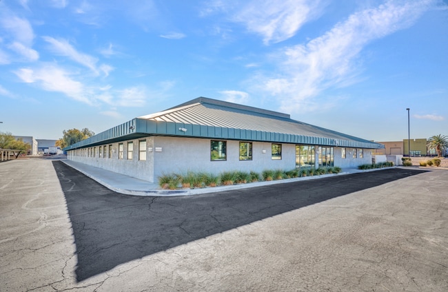

Property Detail
3915 E Patrick Ln
161-31-710-005
PATRICK BUSINESS PARK PLAT BOOK 55 PAGE 3 LOT 10 BLOCK 1
Commercialnec
Clark
MD
Nevada
B and X Area of moderate flood hazard, usually the area between the limits of the 100-year and 500-year floods.
10
2026
1.58 AC
2026
South Las Vegas
002821
Las Vegas
20,000 SF
Las Vegas-Henderson-North Las Vegas, NV
NEARBY LISTINGS FOR SALE OR LEASE
DEMOGRAPHICS near 3915 E Patrick Ln
1 mile
3 mile
5 mile
2025 Total Population
13,433
156,649
418,632
2030 Population
14,072
163,272
437,097
Pop Growth 2025-2030
+ 4.76%
+ 4.23%
+ 4.41%
Average Age
41
41
41
2025 Total Households
5,685
62,372
168,656
HH Growth 2025-2030
+ 4.82%
+ 4.25%
+ 4.37%
Median Household Inc
$62,067
$69,940
$67,466
Avg Household Size
2.30
2.40
2.40
2025 Avg HH Vehicles
2.00
2.00
2.00
Median Home Value
$455,586
$411,624
$406,012
Median Year Built
1990
1988
1991
Nearby Places
Map Layers
Map Styles
 Street
 Aerial
Transit
 Traffic
 Biking
Places
Listings with unknown addresses are not visible on the map
- Restaurants
- Banks
- Shops
- Fitness
- Groceries
PUBLIC TRANSPORTATION
AIRPORT
Harry Reid International
Drive
Walk
Distance
Harry Reid International
10 min
4.4 mi
Boulder City Municipal
Drive
Walk
Distance
Boulder City Municipal
28 min
18.5 mi
SALE & LEASE HISTORY
LISTING DATE
SALE/LEASE

Jan 31, 2025
For Sale
Nearby Properties
Address
Land Use
TOTAL SIZE
Lot Size
Zoning
Address
Land Use
TOTAL SIZE
Lot Size
Zoning
678,168 SF
69.69 AC
Address
Land Use
TOTAL SIZE
Lot Size
Zoning
726,941 SF
74.75 AC
CT
Address
Land Use
TOTAL SIZE
Lot Size
Zoning
265,609 SF
47.36 AC
H1
Address
Land Use
TOTAL SIZE
Lot Size
Zoning
14,840 SF
38.54 AC
CC
Address
Land Use
TOTAL SIZE
Lot Size
Zoning
21,257 SF
12.72 AC
Address
Land Use
TOTAL SIZE
Lot Size
Zoning
44.69 AC
PF
Address
Land Use
TOTAL SIZE
Lot Size
Zoning
399,206 SF
22.06 AC
MD
Address
Land Use
TOTAL SIZE
Lot Size
Zoning
358,212 SF
9.06 AC
CC
Address
Land Use
TOTAL SIZE
Lot Size
Zoning
410,084 SF
16.74 AC
RH24
Address
Land Use
TOTAL SIZE
Lot Size
Zoning
9,164 SF
22.81 AC
R3
Address
Land Use
TOTAL SIZE
Lot Size
Zoning
100.25 AC
RS1
Address
Land Use
TOTAL SIZE
Lot Size
Zoning
148.64 AC
PF
Address
Land Use
TOTAL SIZE
Lot Size
Zoning
8,891 SF
11.59 AC
Address
Land Use
TOTAL SIZE
Lot Size
Zoning
198.15 AC
PF
Address
Land Use
TOTAL SIZE
Lot Size
Zoning
383,889 SF
31.11 AC
Address
Land Use
TOTAL SIZE
Lot Size
Zoning
38,764 SF
12.66 AC
H1
Address
Land Use
TOTAL SIZE
Lot Size
Zoning
38.36 AC
Address
Land Use
TOTAL SIZE
Lot Size
Zoning
4,460 SF
27.52 AC
Address
Land Use
TOTAL SIZE
Lot Size
Zoning
314,454 SF
22.94 AC
CC
Address
Land Use
TOTAL SIZE
Lot Size
Zoning
152.76 AC
PF
Address
Land Use
TOTAL SIZE
Lot Size
Zoning
279,107 SF
22.64 AC
CC
Address
Land Use
TOTAL SIZE
Lot Size
Zoning
43.37 AC
RS1
Address
Land Use
TOTAL SIZE
Lot Size
Zoning
100.43 AC
PF
Address
Land Use
TOTAL SIZE
Lot Size
Zoning
266,782 SF
8.83 AC
Address
Land Use
TOTAL SIZE
Lot Size
Zoning
13,589 SF
56.80 AC
PF
Address
Land Use
TOTAL SIZE
Lot Size
Zoning
4.18 AC
PF
Address
Land Use
TOTAL SIZE
Lot Size
Zoning
303,540 SF
4.99 AC
Address
Land Use
TOTAL SIZE
Lot Size
Zoning
213,048 SF
13.60 AC
Address
Land Use
TOTAL SIZE
Lot Size
Zoning
8,235 SF
5.77 AC
Address
Land Use
TOTAL SIZE
Lot Size
Zoning
82,405 SF
5.49 AC
PS
The World's #1 Commercial Real Estate Marketplace
Connect with us
© 2026 CoStar Group
The information above has been obtained from sources believed reliable. While we do not doubt its accuracy we have not verified it and make no guarantee, warranty or representation about it. It is your responsibility to independently confirm its accuracy and completeness. Any projections, opinions, assumptions, or estimates used are for example only and do not represent the current or future performance of the property. The value of this transaction to you depends on tax and other factors which should be evaluated by your tax, financial, and legal advisors. You and your advisors should conduct a careful, independent investigation of the property to determine to your satisfaction the suitability of the property for your needs.