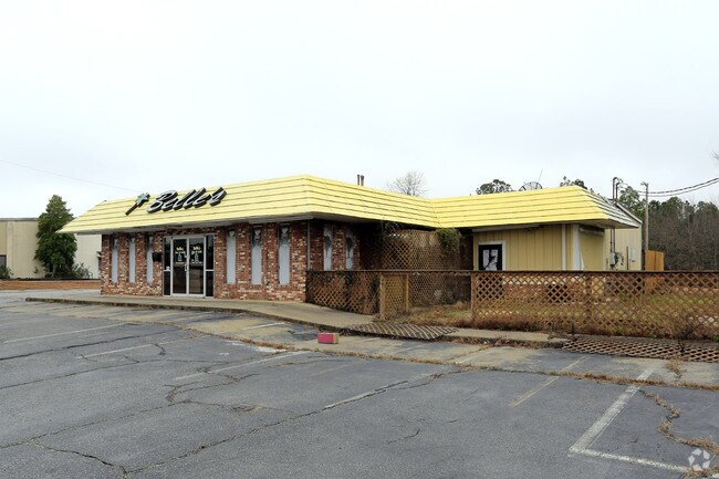
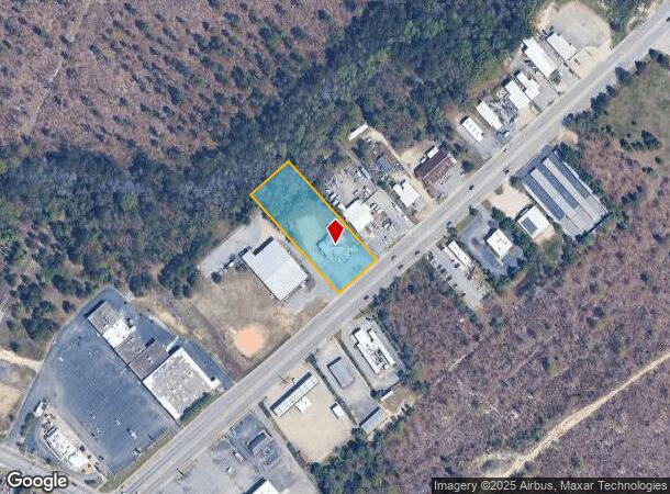
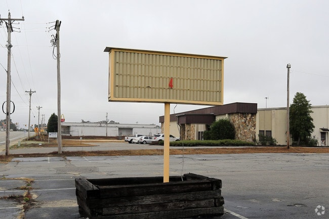
Property Record
3920 Platt Springs Rd, West Columbia, SC 29170

NEARBY LISTINGS FOR SALE OR LEASE
Property Detail
3920 Platt Springs Rd
006796-01-003
Prepared For Robert E Sargent
Nightclub
TRACT A
X
Lexington
45063C0259J
South Carolina
2025
1.38 AC
2024
Cayce/West Columbia
021034
Columbia
3,900 SF
Columbia, SC
DEMOGRAPHICS near 3920 Platt Springs Rd
1 Mile
3 Mile
5 Mile
2024 Total Population
2,570
25,489
76,158
2029 Population
2,789
27,715
82,924
Pop Growth 2024-2029
+ 8.52%
+ 8.73%
+ 8.88%
Average Age
41
40
40
2024 Total Households
1,013
10,310
31,155
HH Growth 2024-2029
+ 8.69%
+ 8.90%
+ 9.05%
Median Household Inc
$67,853
$64,819
$62,216
Avg Household Size
2.50
2.40
2.40
2024 Avg HH Vehicles
2.00
2.00
2.00
Median Home Value
$162,242
$157,081
$158,924
Median Year Built
1978
1987
1988
Nearby Places
Map Layers
Map Styles
 Street
 Aerial
- Restaurants
- Banks
- Shops
- Fitness
- Groceries
PUBLIC TRANSPORTATION
AIRPORT
Columbia Metro
DRIVE
WALK
Distance
Columbia Metro
4 min
2.7 mi
Freight Ports
Georgia Ports - Savannah
DRIVE
WALK
Distance
Georgia Ports - Savannah
1 min
125.4 mi
Nearby Properties
Address
Land Use
TOTAL SIZE
Lot Size
Zoning
Address
Land Use
TOTAL SIZE
Lot Size
Zoning
461,888 SF
61.50 AC
ID
Address
Land Use
TOTAL SIZE
Lot Size
Zoning
3,614 SF
1,444.32 AC
ID
Address
Land Use
TOTAL SIZE
Lot Size
Zoning
10,304 SF
11.89 AC
R1
Address
Land Use
TOTAL SIZE
Lot Size
Zoning
257,688 SF
23.03 AC
ID
Address
Land Use
TOTAL SIZE
Lot Size
Zoning
41,860 SF
6.54 AC
ID
Address
Land Use
TOTAL SIZE
Lot Size
Zoning
318,309 SF
33.51 AC
ID
Address
Land Use
TOTAL SIZE
Lot Size
Zoning
70,740 SF
13 AC
ID
Address
Land Use
TOTAL SIZE
Lot Size
Zoning
430.11 AC
ID
Address
Land Use
TOTAL SIZE
Lot Size
Zoning
254,399 SF
49.79 AC
ID
Address
Land Use
TOTAL SIZE
Lot Size
Zoning
54,000 SF
8.60 AC
ID
Address
Land Use
TOTAL SIZE
Lot Size
Zoning
8,269 SF
12.99 AC
RD
Address
Land Use
TOTAL SIZE
Lot Size
Zoning
10.52 AC
ID
Address
Land Use
TOTAL SIZE
Lot Size
Zoning
115,000 SF
11.99 AC
ID
Address
Land Use
TOTAL SIZE
Lot Size
Zoning
73,778 SF
4.95 AC
A
Address
Land Use
TOTAL SIZE
Lot Size
Zoning
17,442 SF
2.78 AC
Address
Land Use
TOTAL SIZE
Lot Size
Zoning
54,092 SF
5.90 AC
ID
Address
Land Use
TOTAL SIZE
Lot Size
Zoning
95,730 SF
8.15 AC
ID
Address
Land Use
TOTAL SIZE
Lot Size
Zoning
52,096 SF
10.35 AC
ID
Address
Land Use
TOTAL SIZE
Lot Size
Zoning
29,167 SF
3.15 AC
ID
Address
Land Use
TOTAL SIZE
Lot Size
Zoning
8,030 SF
1.66 AC
C1
Address
Land Use
TOTAL SIZE
Lot Size
Zoning
47,126 SF
4.53 AC
Address
Land Use
TOTAL SIZE
Lot Size
Zoning
10,286 SF
1.75 AC
ID
Address
Land Use
TOTAL SIZE
Lot Size
Zoning
35,183 SF
1.24 AC
C1
Address
Land Use
TOTAL SIZE
Lot Size
Zoning
42,842 SF
6.47 AC
ID
Address
Land Use
TOTAL SIZE
Lot Size
Zoning
4,200 SF
1.37 AC
ID
Address
Land Use
TOTAL SIZE
Lot Size
Zoning
87.19 AC
ID
Address
Land Use
TOTAL SIZE
Lot Size
Zoning
111,130 SF
15.68 AC
ID
Address
Land Use
TOTAL SIZE
Lot Size
Zoning
96,736 SF
8.30 AC
Address
Land Use
TOTAL SIZE
Lot Size
Zoning
78.48 AC
ID
Address
Land Use
TOTAL SIZE
Lot Size
Zoning
31,000 SF
7.49 AC
C2
The World's #1 Commercial Real Estate Marketplace
Connect with us
© 2025 CoStar Group
The information above has been obtained from sources believed reliable. While we do not doubt its accuracy we have not verified it and make no guarantee, warranty or representation about it. It is your responsibility to independently confirm its accuracy and completeness. Any projections, opinions, assumptions, or estimates used are for example only and do not represent the current or future performance of the property. The value of this transaction to you depends on tax and other factors which should be evaluated by your tax, financial, and legal advisors. You and your advisors should conduct a careful, independent investigation of the property to determine to your satisfaction the suitability of the property for your needs.