Property Record
3930 S Oates St, Dothan, AL 36301
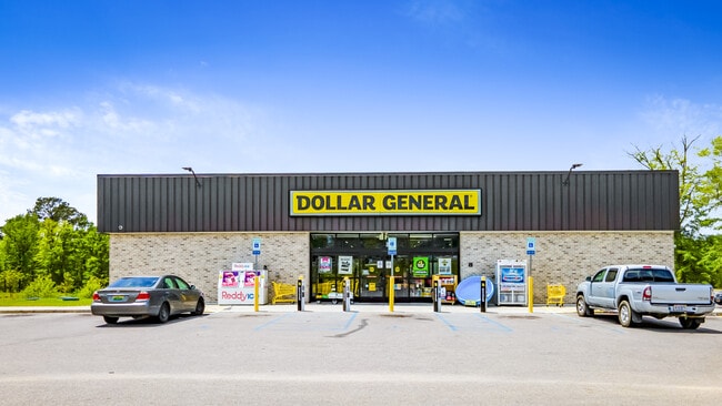


Property Detail
3930 S Oates St
Dothan, AL
LOT 1 BROADWAY-ALABASTER DR SUB
17-01-11-0-000-002-000
Houston
Storebuilding
Alabama
B and X Area of moderate flood hazard, usually the area between the limits of the 100-year and 500-year floods.
1
2025
1.87 AC
2025
Dothan/Enterprise
040802
Other Market Areas
10,800 SF
NEARBY LISTINGS FOR SALE OR LEASE
DEMOGRAPHICS near 3930 S Oates St
1 mile
3 mile
5 mile
2025 Total Population
2,357
19,200
53,391
2030 Population
2,453
19,567
54,398
Pop Growth 2025-2030
+ 4.07%
+ 1.91%
+ 1.89%
Average Age
39
40
40
2025 Total Households
905
7,911
22,068
HH Growth 2025-2030
+ 4.09%
+ 1.91%
+ 1.89%
Median Household Inc
$55,972
$53,386
$50,454
Avg Household Size
2.50
2.40
2.30
2025 Avg HH Vehicles
2.00
2.00
2.00
Median Home Value
$214,620
$171,440
$176,599
Median Year Built
1995
1983
1979
Nearby Places
Map Layers
Map Styles
 Street
 Aerial
Transit
 Traffic
 Biking
Places
Listings with unknown addresses are not visible on the map
- Restaurants
- Banks
- Shops
- Fitness
- Groceries
PUBLIC TRANSPORTATION
AIRPORT
Dothan Regional
Drive
Walk
Distance
Dothan Regional
21 min
11.7 mi
SALE & LEASE HISTORY
LISTING DATE
SALE/LEASE

Jul 08, 2020
For Sale
Apr 27, 2022
For Sale
Nearby Properties
Address
Land Use
TOTAL SIZE
Lot Size
Zoning
Address
Land Use
TOTAL SIZE
Lot Size
Zoning
187,423 SF
22.30 AC
Address
Land Use
TOTAL SIZE
Lot Size
Zoning
11,422 SF
38 AC
Address
Land Use
TOTAL SIZE
Lot Size
Zoning
9,112 SF
10.50 AC
Address
Land Use
TOTAL SIZE
Lot Size
Zoning
145,107 SF
14.30 AC
Address
Land Use
TOTAL SIZE
Lot Size
Zoning
46,876 SF
12.66 AC
Address
Land Use
TOTAL SIZE
Lot Size
Zoning
2,680 SF
1.67 AC
Address
Land Use
TOTAL SIZE
Lot Size
Zoning
244,027 SF
Address
Land Use
TOTAL SIZE
Lot Size
Zoning
1,764 SF
8.10 AC
Address
Land Use
TOTAL SIZE
Lot Size
Zoning
10,054 SF
9.20 AC
Address
Land Use
TOTAL SIZE
Lot Size
Zoning
1,776 SF
2.89 AC
Address
Land Use
TOTAL SIZE
Lot Size
Zoning
Address
Land Use
TOTAL SIZE
Lot Size
Zoning
93,253 SF
8.46 AC
Address
Land Use
TOTAL SIZE
Lot Size
Zoning
120,000 SF
32 AC
Address
Land Use
TOTAL SIZE
Lot Size
Zoning
4,800 SF
18 AC
Address
Land Use
TOTAL SIZE
Lot Size
Zoning
19,189 SF
5.26 AC
Address
Land Use
TOTAL SIZE
Lot Size
Zoning
48,628 SF
5.13 AC
Address
Land Use
TOTAL SIZE
Lot Size
Zoning
34,743 SF
6.54 AC
Address
Land Use
TOTAL SIZE
Lot Size
Zoning
1,096 SF
5 AC
Address
Land Use
TOTAL SIZE
Lot Size
Zoning
150,056 SF
9.43 AC
Address
Land Use
TOTAL SIZE
Lot Size
Zoning
39,320 SF
2.86 AC
Address
Land Use
TOTAL SIZE
Lot Size
Zoning
34,474 SF
6.28 AC
Address
Land Use
TOTAL SIZE
Lot Size
Zoning
22,297 SF
1.59 AC
Address
Land Use
TOTAL SIZE
Lot Size
Zoning
23,215 SF
4.64 AC
Address
Land Use
TOTAL SIZE
Lot Size
Zoning
2,400 SF
21 AC
Address
Land Use
TOTAL SIZE
Lot Size
Zoning
47,063 SF
9 AC
Address
Land Use
TOTAL SIZE
Lot Size
Zoning
5,008 SF
3.24 AC
Address
Land Use
TOTAL SIZE
Lot Size
Zoning
2,535 SF
32 AC
Address
Land Use
TOTAL SIZE
Lot Size
Zoning
15,352 SF
7.69 AC
Address
Land Use
TOTAL SIZE
Lot Size
Zoning
15,068 SF
1.80 AC
Address
Land Use
TOTAL SIZE
Lot Size
Zoning
15,050 SF
1.90 AC
The World's #1 Commercial Real Estate Marketplace
Connect with us
© 2026 CoStar Group
The information above has been obtained from sources believed reliable. While we do not doubt its accuracy we have not verified it and make no guarantee, warranty or representation about it. It is your responsibility to independently confirm its accuracy and completeness. Any projections, opinions, assumptions, or estimates used are for example only and do not represent the current or future performance of the property. The value of this transaction to you depends on tax and other factors which should be evaluated by your tax, financial, and legal advisors. You and your advisors should conduct a careful, independent investigation of the property to determine to your satisfaction the suitability of the property for your needs.