Property Record
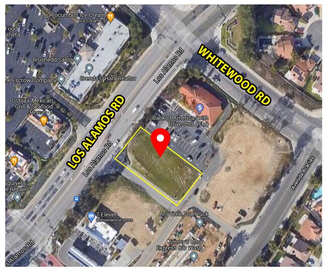
39442 Los Alamos Rd, Murrieta, CA 92563


NEARBY LISTINGS FOR SALE OR LEASE
Property Detail
39442 Los Alamos Rd
Riverside-San Bernardino-Ontario, CA
Parcel Map No. 25451
948-530-006
.50 ACRES M/L IN PAR 4 PM 170/081 PM 25451
Commercialacreage
Riverside
X
California
06065C2710H
4
2024
0.50 AC
2025
South Riverside
043211
Inland Empire (California)
DEMOGRAPHICS near 39442 Los Alamos Rd
1 Mile
3 Mile
5 Mile
2024 Total Population
3,819
88,601
193,997
2029 Population
3,978
92,927
204,308
Pop Growth 2024-2029
+ 4.16%
+ 4.88%
+ 5.32%
Average Age
33
37
37
2024 Total Households
1,065
26,576
58,393
HH Growth 2024-2029
+ 3.57%
+ 4.32%
+ 4.81%
Median Household Inc
$112,603
$104,658
$106,160
Avg Household Size
3.50
3.20
3.20
2024 Avg HH Vehicles
3.00
2.00
2.00
Median Home Value
$575,000
$527,381
$565,664
Median Year Built
2005
2000
2002
Nearby Places
Map Layers
Map Styles
 Street
 Aerial
- Restaurants
- Banks
- Shops
- Fitness
- Groceries
PUBLIC TRANSPORTATION
AIRPORT
Ontario International
DRIVE
WALK
Distance
Ontario International
59 min
48.0 mi
SALE & LEASE HISTORY
LISTING DATE
SALE/LEASE

Feb 19, 2020
For Sale
Apr 29, 2022
For Lease
Nearby Properties
Address
Land Use
TOTAL SIZE
Lot Size
Zoning
Address
Land Use
TOTAL SIZE
Lot Size
Zoning
276,770 SF
17.18 AC
Address
Land Use
TOTAL SIZE
Lot Size
Zoning
86,149 SF
20.51 AC
MF2
Address
Land Use
TOTAL SIZE
Lot Size
Zoning
390,411 SF
14.69 AC
Address
Land Use
TOTAL SIZE
Lot Size
Zoning
103,511 SF
12.03 AC
Address
Land Use
TOTAL SIZE
Lot Size
Zoning
42,104 SF
11.76 AC
RR
Address
Land Use
TOTAL SIZE
Lot Size
Zoning
15.26 AC
SP
Address
Land Use
TOTAL SIZE
Lot Size
Zoning
80,910 SF
12.77 AC
MDP
Address
Land Use
TOTAL SIZE
Lot Size
Zoning
119,885 SF
7.99 AC
Address
Land Use
TOTAL SIZE
Lot Size
Zoning
57,703 SF
36.14 AC
Address
Land Use
TOTAL SIZE
Lot Size
Zoning
240,791 SF
11.16 AC
Address
Land Use
TOTAL SIZE
Lot Size
Zoning
44,948 SF
9.71 AC
Address
Land Use
TOTAL SIZE
Lot Size
Zoning
32,812 SF
26.35 AC
RR
Address
Land Use
TOTAL SIZE
Lot Size
Zoning
81,888 SF
8.79 AC
Address
Land Use
TOTAL SIZE
Lot Size
Zoning
328,221 SF
14.25 AC
MU-3
Address
Land Use
TOTAL SIZE
Lot Size
Zoning
159,153 SF
13.24 AC
Address
Land Use
TOTAL SIZE
Lot Size
Zoning
38.61 AC
Address
Land Use
TOTAL SIZE
Lot Size
Zoning
120,000 SF
5.81 AC
RR
Address
Land Use
TOTAL SIZE
Lot Size
Zoning
152,379 SF
16.96 AC
Address
Land Use
TOTAL SIZE
Lot Size
Zoning
228,679 SF
41.30 AC
Address
Land Use
TOTAL SIZE
Lot Size
Zoning
185,561 SF
13.61 AC
Address
Land Use
TOTAL SIZE
Lot Size
Zoning
225,072 SF
8.29 AC
Address
Land Use
TOTAL SIZE
Lot Size
Zoning
95,896 SF
4.95 AC
Address
Land Use
TOTAL SIZE
Lot Size
Zoning
Address
Land Use
TOTAL SIZE
Lot Size
Zoning
27,193 SF
8.19 AC
Address
Land Use
TOTAL SIZE
Lot Size
Zoning
224,355 SF
20.18 AC
Address
Land Use
TOTAL SIZE
Lot Size
Zoning
107,166 SF
5.29 AC
Address
Land Use
TOTAL SIZE
Lot Size
Zoning
227,174 SF
7.17 AC
Address
Land Use
TOTAL SIZE
Lot Size
Zoning
118,498 SF
12.44 AC
CC
Address
Land Use
TOTAL SIZE
Lot Size
Zoning
137,810 SF
9.76 AC
Address
Land Use
TOTAL SIZE
Lot Size
Zoning
3,722 SF
13.48 AC
RR
The World's #1 Commercial Real Estate Marketplace
Connect with us
© 2025 CoStar Group
The information above has been obtained from sources believed reliable. While we do not doubt its accuracy we have not verified it and make no guarantee, warranty or representation about it. It is your responsibility to independently confirm its accuracy and completeness. Any projections, opinions, assumptions, or estimates used are for example only and do not represent the current or future performance of the property. The value of this transaction to you depends on tax and other factors which should be evaluated by your tax, financial, and legal advisors. You and your advisors should conduct a careful, independent investigation of the property to determine to your satisfaction the suitability of the property for your needs.