Property Record
39480 Washington Loop Rd, Punta Gorda, FL 33982
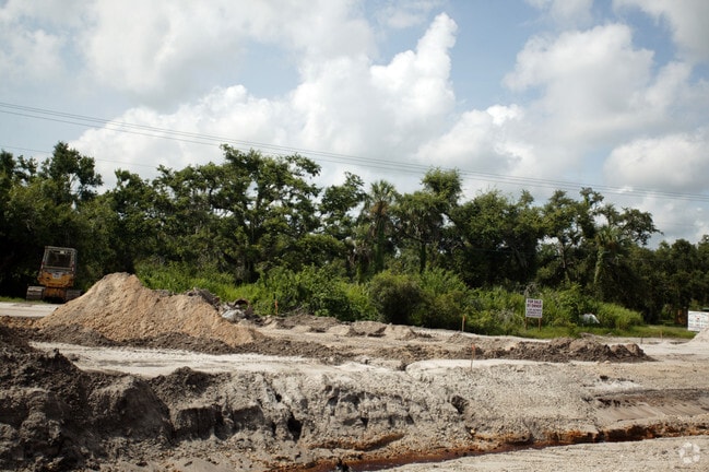

Property Detail
39480 Washington Loop Rd
402325278003
A PORTION OF THE SE 1/4 OF THE SE 1/4 OF THE NE 1/4 OF SEC 25 TWNSP 40 S RANGE 23 E COMM AT THE SW CORNER OF THE SE 1/4 OF THE SE 1/4 OF THE NE 1/4 OF SEC 25 THNC NE ALONG THE W LINE OF THE SE 1/4 OF THE SE 1/4 OF SEC 25 25.00 FT THNC CONTINUE NE ALO
Commercialacreage
Charlotte
CG
Florida
AE The base floodplain where base flood elevations are provided. AE Zones are now used on new format FIRMs instead of A1-A30 Zones.
2.80 AC
2024
Charlotte County
2025
Southwest Florida
010200
Punta Gorda, FL
NEARBY LISTINGS FOR SALE OR LEASE
DEMOGRAPHICS near 39480 Washington Loop Rd
1 mile
3 mile
5 mile
2025 Total Population
671
6,217
22,815
2030 Population
744
6,870
25,201
Pop Growth 2025-2030
+ 10.88%
+ 10.50%
+ 10.46%
Average Age
52
50
50
2025 Total Households
326
2,816
10,162
HH Growth 2025-2030
+ 11.04%
+ 10.26%
+ 10.39%
Median Household Inc
$32,173
$60,750
$64,633
Avg Household Size
2.00
2.20
2.20
2025 Avg HH Vehicles
2.00
2.00
2.00
Median Home Value
$213,636
$361,325
$336,008
Median Year Built
1987
1991
1996
Nearby Places
Map Layers
Map Styles
 Street
 Aerial
Transit
 Traffic
 Biking
Places
Listings with unknown addresses are not visible on the map
- Restaurants
- Banks
- Shops
- Fitness
- Groceries
PUBLIC TRANSPORTATION
AIRPORT
Punta Gorda
Drive
Walk
Distance
Punta Gorda
11 min
6.4 mi
Freight Ports
Port Manatee
Drive
Walk
Distance
Port Manatee
88 min
74.6 mi
Nearby Properties
Address
Land Use
TOTAL SIZE
Lot Size
Zoning
Address
Land Use
TOTAL SIZE
Lot Size
Zoning
66,461 SF
10.86 AC
CG
Address
Land Use
TOTAL SIZE
Lot Size
Zoning
1,556 SF
23.08 AC
CG
Address
Land Use
TOTAL SIZE
Lot Size
Zoning
642 AC
ES
Address
Land Use
TOTAL SIZE
Lot Size
Zoning
31,194 SF
7.93 AC
CG
Address
Land Use
TOTAL SIZE
Lot Size
Zoning
34,854 SF
655 AC
ES
Address
Land Use
TOTAL SIZE
Lot Size
Zoning
8,750 SF
21.19 AC
CG
Address
Land Use
TOTAL SIZE
Lot Size
Zoning
720 SF
314 AC
PD
Address
Land Use
TOTAL SIZE
Lot Size
Zoning
2,400 SF
1.65 AC
IG
Address
Land Use
TOTAL SIZE
Lot Size
Zoning
16,969 SF
81.30 AC
EM
Address
Land Use
TOTAL SIZE
Lot Size
Zoning
18,256 SF
5.20 AC
RE1
Address
Land Use
TOTAL SIZE
Lot Size
Zoning
21,609 SF
20 AC
AG
Address
Land Use
TOTAL SIZE
Lot Size
Zoning
13.53 AC
CG
Address
Land Use
TOTAL SIZE
Lot Size
Zoning
18,144 SF
2.73 AC
IG
Address
Land Use
TOTAL SIZE
Lot Size
Zoning
10 AC
ECAP
Address
Land Use
TOTAL SIZE
Lot Size
Zoning
10 AC
ECAP
Address
Land Use
TOTAL SIZE
Lot Size
Zoning
10 AC
ECAP
Address
Land Use
TOTAL SIZE
Lot Size
Zoning
1,960 SF
2.03 AC
IG
Address
Land Use
TOTAL SIZE
Lot Size
Zoning
249.65 AC
ES
Address
Land Use
TOTAL SIZE
Lot Size
Zoning
1,416 SF
3.85 AC
RMF5
Address
Land Use
TOTAL SIZE
Lot Size
Zoning
8.97 AC
ECAP
Address
Land Use
TOTAL SIZE
Lot Size
Zoning
4,926 SF
8.10 AC
PKR
Address
Land Use
TOTAL SIZE
Lot Size
Zoning
15,000 SF
1.50 AC
IG
Address
Land Use
TOTAL SIZE
Lot Size
Zoning
8,823 SF
73.60 AC
RE1
Address
Land Use
TOTAL SIZE
Lot Size
Zoning
3,280 SF
1.06 AC
CG
Address
Land Use
TOTAL SIZE
Lot Size
Zoning
10,500 SF
0.97 AC
CG
Address
Land Use
TOTAL SIZE
Lot Size
Zoning
12,360 SF
1.59 AC
CG
Address
Land Use
TOTAL SIZE
Lot Size
Zoning
5,400 SF
7.09 AC
CG
Address
Land Use
TOTAL SIZE
Lot Size
Zoning
11,776 SF
0.90 AC
IG
Address
Land Use
TOTAL SIZE
Lot Size
Zoning
6,960 SF
0.86 AC
CG
Address
Land Use
TOTAL SIZE
Lot Size
Zoning
8,500 SF
0.76 AC
IG
The World's #1 Commercial Real Estate Marketplace
Connect with us
© 2026 CoStar Group
The information above has been obtained from sources believed reliable. While we do not doubt its accuracy we have not verified it and make no guarantee, warranty or representation about it. It is your responsibility to independently confirm its accuracy and completeness. Any projections, opinions, assumptions, or estimates used are for example only and do not represent the current or future performance of the property. The value of this transaction to you depends on tax and other factors which should be evaluated by your tax, financial, and legal advisors. You and your advisors should conduct a careful, independent investigation of the property to determine to your satisfaction the suitability of the property for your needs.