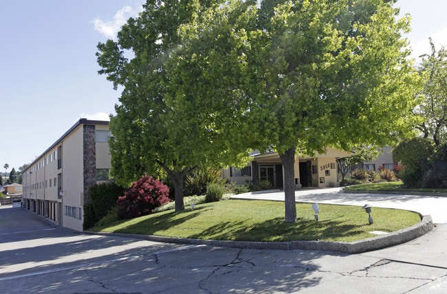
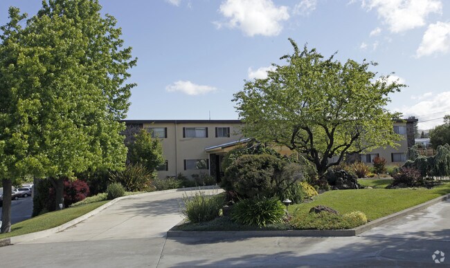
Property Record
3958 Castro Valley Blvd, Castro Valley, CA 94546

NEARBY LISTINGS FOR SALE OR LEASE
Property Detail
3958 Castro Valley Blvd
084C-0661-005-04
LOT: 00004 BLK: 0005 AR: 084C PAGE: 0661
Multifamilydwelling
Alameda
X
California
06001C0279G
1.90 AC
2024
East Outer Fremont
2025
East Bay/Oakland
430800
Oakland-Hayward-Berkeley, CA
32,776 SF
DEMOGRAPHICS near 3958 Castro Valley Blvd
1 Mile
3 Mile
5 Mile
2024 Total Population
23,879
150,164
318,936
2029 Population
23,091
145,231
308,361
Pop Growth 2024-2029
(3.30%)
(3.29%)
(3.32%)
Average Age
41
40
40
2024 Total Households
8,624
50,632
103,671
HH Growth 2024-2029
(3.50%)
(3.46%)
(3.51%)
Median Household Inc
$102,236
$102,033
$97,786
Avg Household Size
2.70
2.80
3.00
2024 Avg HH Vehicles
2.00
2.00
2.00
Median Home Value
$771,173
$833,601
$778,241
Median Year Built
1963
1968
1966
Nearby Places
Map Layers
Map Styles
 Street
 Aerial
- Restaurants
- Banks
- Shops
- Fitness
- Groceries
PUBLIC TRANSPORTATION
TRANSIT/SUBWAY
Castro Valley Station (Daly City to Dublin/Pleasanton - Bay Area Rapid Transit (BART), Dublin/Pleasanton - Millbrae - Bay Area Rapid Transit (BART), Dublin/Pleasanton to Daly City - Bay Area Rapid Transit (BART))
DRIVE
WALK
Distance
Castro Valley Station (Daly City to Dublin/Pleasanton - Bay Area Rapid Transit (BART), Dublin/Pleasanton - Millbrae - Bay Area Rapid Transit (BART), Dublin/Pleasanton to Daly City - Bay Area Rapid Transit (BART))
5 min
16 min
0.8 mi
COMMUTER RAIL
Hayward Amtrak (Capitol Corridor - Amtrak)
DRIVE
WALK
Distance
Hayward Amtrak (Capitol Corridor - Amtrak)
8 min
3.2 mi
Hayward (Capitol Corridor - Capitol Corridor Joint Powers Authority)
DRIVE
WALK
Distance
Hayward (Capitol Corridor - Capitol Corridor Joint Powers Authority)
8 min
3.2 mi
AIRPORT
Metro Oakland International
DRIVE
WALK
Distance
Metro Oakland International
16 min
10.8 mi
San Francisco International
DRIVE
WALK
Distance
San Francisco International
36 min
25.3 mi
Norman Y Mineta San Jose International
DRIVE
WALK
Distance
Norman Y Mineta San Jose International
40 min
29.9 mi
Freight Ports
Port of Oakland
DRIVE
WALK
Distance
Port of Oakland
21 min
15.4 mi
Nearby Properties
Address
Land Use
TOTAL SIZE
Lot Size
Zoning
Address
Land Use
TOTAL SIZE
Lot Size
Zoning
4.90 AC
Address
Land Use
TOTAL SIZE
Lot Size
Zoning
2.48 AC
Address
Land Use
TOTAL SIZE
Lot Size
Zoning
470,929 SF
31.62 AC
Address
Land Use
TOTAL SIZE
Lot Size
Zoning
1.50 AC
Address
Land Use
TOTAL SIZE
Lot Size
Zoning
187,926 SF
1.19 AC
Address
Land Use
TOTAL SIZE
Lot Size
Zoning
297,592 SF
11.65 AC
Address
Land Use
TOTAL SIZE
Lot Size
Zoning
310,072 SF
14.96 AC
Address
Land Use
TOTAL SIZE
Lot Size
Zoning
228,736 SF
5.95 AC
Address
Land Use
TOTAL SIZE
Lot Size
Zoning
169,371 SF
4.63 AC
Address
Land Use
TOTAL SIZE
Lot Size
Zoning
116,750 SF
4.72 AC
Address
Land Use
TOTAL SIZE
Lot Size
Zoning
119,800 SF
5.72 AC
Address
Land Use
TOTAL SIZE
Lot Size
Zoning
57,497 SF
4.92 AC
Address
Land Use
TOTAL SIZE
Lot Size
Zoning
120,441 SF
1.34 AC
Address
Land Use
TOTAL SIZE
Lot Size
Zoning
152,950 SF
4.96 AC
Address
Land Use
TOTAL SIZE
Lot Size
Zoning
115,648 SF
11.19 AC
Address
Land Use
TOTAL SIZE
Lot Size
Zoning
92,534 SF
3.04 AC
Address
Land Use
TOTAL SIZE
Lot Size
Zoning
137,422 SF
5.56 AC
RH
Address
Land Use
TOTAL SIZE
Lot Size
Zoning
25,000 SF
1.24 AC
Address
Land Use
TOTAL SIZE
Lot Size
Zoning
124,513 SF
7.52 AC
Address
Land Use
TOTAL SIZE
Lot Size
Zoning
42,359 SF
3.79 AC
Address
Land Use
TOTAL SIZE
Lot Size
Zoning
61,355 SF
4.31 AC
Address
Land Use
TOTAL SIZE
Lot Size
Zoning
52,110 SF
2.06 AC
Address
Land Use
TOTAL SIZE
Lot Size
Zoning
56,410 SF
5.01 AC
Address
Land Use
TOTAL SIZE
Lot Size
Zoning
46,540 SF
2.92 AC
R5D
Address
Land Use
TOTAL SIZE
Lot Size
Zoning
78,326 SF
6.88 AC
Address
Land Use
TOTAL SIZE
Lot Size
Zoning
138,960 SF
2.62 AC
Address
Land Use
TOTAL SIZE
Lot Size
Zoning
5,688 SF
1.36 AC
Address
Land Use
TOTAL SIZE
Lot Size
Zoning
67,434 SF
3.68 AC
Address
Land Use
TOTAL SIZE
Lot Size
Zoning
48,998 SF
3.28 AC
Address
Land Use
TOTAL SIZE
Lot Size
Zoning
61,578 SF
2.53 AC
The World's #1 Commercial Real Estate Marketplace
Connect with us
© 2025 CoStar Group
The information above has been obtained from sources believed reliable. While we do not doubt its accuracy we have not verified it and make no guarantee, warranty or representation about it. It is your responsibility to independently confirm its accuracy and completeness. Any projections, opinions, assumptions, or estimates used are for example only and do not represent the current or future performance of the property. The value of this transaction to you depends on tax and other factors which should be evaluated by your tax, financial, and legal advisors. You and your advisors should conduct a careful, independent investigation of the property to determine to your satisfaction the suitability of the property for your needs.