Property Record
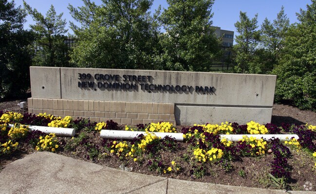
399 Grove St, Herndon, VA 20170

NEARBY LISTINGS FOR SALE OR LEASE
Property Detail
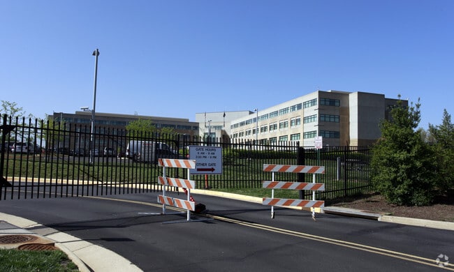
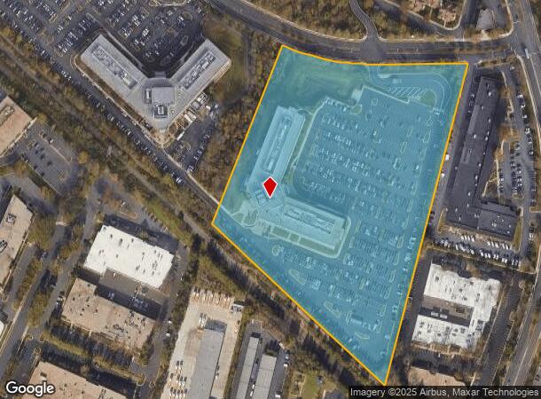
399 Grove St
Washington-Arlington-Alexandria, DC-VA-MD-WV
New Dominion Technology Park
0171-02-0026
NEW DOMINION TECHNOLOGY PARK PCL A
Officebuilding
Fairfax
X
Virginia
51059C0130E
26
2024
14.76 AC
2025
Herndon
480801
Washington, DC
245,682 SF
DEMOGRAPHICS near 399 Grove St
1 Mile
3 Mile
5 Mile
2024 Total Population
14,785
144,035
228,034
2029 Population
14,560
143,691
229,579
Pop Growth 2024-2029
(1.52%)
(0.24%)
+ 0.68%
Average Age
40
38
39
2024 Total Households
6,482
56,007
83,221
HH Growth 2024-2029
(1.33%)
(0.15%)
+ 0.59%
Median Household Inc
$133,425
$130,664
$141,123
Avg Household Size
2.20
2.50
2.70
2024 Avg HH Vehicles
2.00
2.00
2.00
Median Home Value
$647,051
$615,221
$663,511
Median Year Built
1994
1987
1987
Nearby Places
Map Layers
Map Styles
 Street
 Aerial
- Restaurants
- Banks
- Shops
- Fitness
- Groceries
PUBLIC TRANSPORTATION
AIRPORT
Washington Dulles International
DRIVE
WALK
Distance
Washington Dulles International
16 min
6.6 mi
Ronald Reagan Washington Ntl
DRIVE
WALK
Distance
Ronald Reagan Washington Ntl
40 min
25.4 mi
Freight Ports
Port of Baltimore
DRIVE
WALK
Distance
Port of Baltimore
80 min
57.4 mi
Nearby Properties
Address
Land Use
TOTAL SIZE
Lot Size
Zoning
Address
Land Use
TOTAL SIZE
Lot Size
Zoning
6.67 AC
400
Address
Land Use
TOTAL SIZE
Lot Size
Zoning
1,071,881 SF
373
Address
Land Use
TOTAL SIZE
Lot Size
Zoning
643,232 SF
2.81 AC
373
Address
Land Use
TOTAL SIZE
Lot Size
Zoning
473,458 SF
13.74 AC
540
Address
Land Use
TOTAL SIZE
Lot Size
Zoning
1,096,572 SF
85.06 AC
110
Address
Land Use
TOTAL SIZE
Lot Size
Zoning
446,810 SF
1.12 AC
373
Address
Land Use
TOTAL SIZE
Lot Size
Zoning
450,397 SF
1.07 AC
373
Address
Land Use
TOTAL SIZE
Lot Size
Zoning
275,809 SF
0.75 AC
373
Address
Land Use
TOTAL SIZE
Lot Size
Zoning
332,957 SF
12.68 AC
550
Address
Land Use
TOTAL SIZE
Lot Size
Zoning
532,480 SF
4.62 AC
373
Address
Land Use
TOTAL SIZE
Lot Size
Zoning
425,073 SF
19.02 AC
330
Address
Land Use
TOTAL SIZE
Lot Size
Zoning
469,276 SF
11.42 AC
373
Address
Land Use
TOTAL SIZE
Lot Size
Zoning
498,299 SF
7.40 AC
400
Address
Land Use
TOTAL SIZE
Lot Size
Zoning
560,356 SF
4.33 AC
372
Address
Land Use
TOTAL SIZE
Lot Size
Zoning
357,437 SF
3.76 AC
350
Address
Land Use
TOTAL SIZE
Lot Size
Zoning
407,812 SF
33.12 AC
373
Address
Land Use
TOTAL SIZE
Lot Size
Zoning
429,038 SF
11.41 AC
400
Address
Land Use
TOTAL SIZE
Lot Size
Zoning
337,921 SF
13.57 AC
373
Address
Land Use
TOTAL SIZE
Lot Size
Zoning
437,235 SF
3.33 AC
373
Address
Land Use
TOTAL SIZE
Lot Size
Zoning
396,112 SF
15.92 AC
330
Address
Land Use
TOTAL SIZE
Lot Size
Zoning
490,340 SF
18.30 AC
320
Address
Land Use
TOTAL SIZE
Lot Size
Zoning
264,888 SF
8.59 AC
596
Address
Land Use
TOTAL SIZE
Lot Size
Zoning
411,519 SF
3.48 AC
350
Address
Land Use
TOTAL SIZE
Lot Size
Zoning
491,841 SF
19.21 AC
320
Address
Land Use
TOTAL SIZE
Lot Size
Zoning
519,708 SF
18.73 AC
316
Address
Land Use
TOTAL SIZE
Lot Size
Zoning
263,767 SF
2.34 AC
373
Address
Land Use
TOTAL SIZE
Lot Size
Zoning
408,315 SF
5.06 AC
400
Address
Land Use
TOTAL SIZE
Lot Size
Zoning
394,900 SF
5.30 AC
373
Address
Land Use
TOTAL SIZE
Lot Size
Zoning
492,219 SF
16.89 AC
330
The World's #1 Commercial Real Estate Marketplace
Connect with us
© 2026 CoStar Group
The information above has been obtained from sources believed reliable. While we do not doubt its accuracy we have not verified it and make no guarantee, warranty or representation about it. It is your responsibility to independently confirm its accuracy and completeness. Any projections, opinions, assumptions, or estimates used are for example only and do not represent the current or future performance of the property. The value of this transaction to you depends on tax and other factors which should be evaluated by your tax, financial, and legal advisors. You and your advisors should conduct a careful, independent investigation of the property to determine to your satisfaction the suitability of the property for your needs.