Property Record
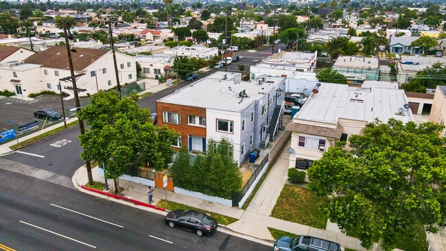
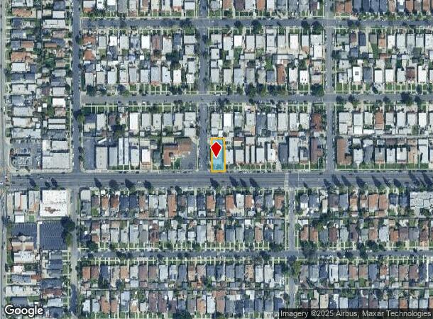
1951 W Martin Luther King Jr Blvd, Los Angeles, CA 90062

This Property Is For Sale
NEARBY LISTINGS FOR SALE OR LEASE
Property Detail
1951 W Martin Luther King Jr Blvd
Los Angeles-Long Beach-Glendale, CA
4463
5035-006-011
TRACT NO 4463 LOT 160
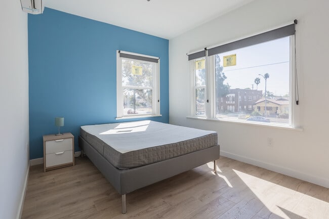
Multifamilydwelling
Los Angeles
X
California
06037C1614G
160
2024
0.21 AC
2025
Leimert Park
231400
Los Angeles
4,762 SF
DEMOGRAPHICS near 1951 W Martin Luther King Jr Blvd
1 Mile
3 Mile
5 Mile
2024 Total Population
46,364
428,657
1,223,921
2029 Population
44,712
413,269
1,186,675
Pop Growth 2024-2029
(3.56%)
(3.59%)
(3.04%)
Average Age
39
38
38
2024 Total Households
14,835
135,568
436,271
HH Growth 2024-2029
(3.75%)
(3.69%)
(2.95%)
Median Household Inc
$57,780
$49,865
$55,849
Avg Household Size
3.00
3.00
2.60
2024 Avg HH Vehicles
2.00
2.00
1.00
Median Home Value
$729,554
$745,817
$795,944
Median Year Built
1946
1948
1956
Nearby Places
Map Layers
Map Styles
 Street
 Aerial
- Restaurants
- Banks
- Shops
- Fitness
- Groceries
PUBLIC TRANSPORTATION
TRANSIT/SUBWAY
Expo/Western (Expo Line - Los Angeles County Metropolitan Transportation Authority (Metro))
DRIVE
WALK
Distance
Expo/Western (Expo Line - Los Angeles County Metropolitan Transportation Authority (Metro))
2 min
16 min
0.8 mi
COMMUTER RAIL
DRIVE
WALK
Distance
12 min
6.2 mi
Union Station (91 Line - Southern California Regional Rail Authority (Metrolink), Antelope Valley Line - Southern California Regional Rail Authority (Metrolink), Orange County Line - Southern California Regional Rail Authority (Metrolink), Riverside Line - Southern California Regional Rail Authority (Metrolink), San Bernardino Line - Southern California Regional Rail Authority (Metrolink), Ventura County Line - Southern California Regional Rail Authority (Metrolink))
DRIVE
WALK
Distance
Union Station (91 Line - Southern California Regional Rail Authority (Metrolink), Antelope Valley Line - Southern California Regional Rail Authority (Metrolink), Orange County Line - Southern California Regional Rail Authority (Metrolink), Riverside Line - Southern California Regional Rail Authority (Metrolink), San Bernardino Line - Southern California Regional Rail Authority (Metrolink), Ventura County Line - Southern California Regional Rail Authority (Metrolink))
16 min
7.5 mi
AIRPORT
Los Angeles International
DRIVE
WALK
Distance
Los Angeles International
17 min
8.8 mi
Bob Hope
DRIVE
WALK
Distance
Bob Hope
28 min
15.8 mi
Long Beach (Daugherty Field)
DRIVE
WALK
Distance
Long Beach (Daugherty Field)
29 min
21.3 mi
Freight Ports
Port of Long Beach
DRIVE
WALK
Distance
Port of Long Beach
32 min
23.2 mi
Nearby Properties
Address
Land Use
TOTAL SIZE
Lot Size
Zoning
Address
Land Use
TOTAL SIZE
Lot Size
Zoning
969,516 SF
14.75 AC
Address
Land Use
TOTAL SIZE
Lot Size
Zoning
1,178,786 SF
3.89 AC
LAC2
Address
Land Use
TOTAL SIZE
Lot Size
Zoning
420,864 SF
63.07 AC
LAUSC-1A
Address
Land Use
TOTAL SIZE
Lot Size
Zoning
256,059 SF
Address
Land Use
TOTAL SIZE
Lot Size
Zoning
200,689 SF
5.79 AC
LAUSC-1A
Address
Land Use
TOTAL SIZE
Lot Size
Zoning
337,025 SF
14.59 AC
LAUSC-1A
Address
Land Use
TOTAL SIZE
Lot Size
Zoning
666,499 SF
10.63 AC
LAC2
Address
Land Use
TOTAL SIZE
Lot Size
Zoning
298,630 SF
4.64 AC
LAUSC-1B
Address
Land Use
TOTAL SIZE
Lot Size
Zoning
786,423 SF
11.74 AC
LAC2
Address
Land Use
TOTAL SIZE
Lot Size
Zoning
377,946 SF
5.03 AC
LAUSC-1A
Address
Land Use
TOTAL SIZE
Lot Size
Zoning
190,164 SF
1.18 AC
LAR4
Address
Land Use
TOTAL SIZE
Lot Size
Zoning
152,000 SF
1.04 AC
LAC2
Address
Land Use
TOTAL SIZE
Lot Size
Zoning
690,514 SF
LACM
Address
Land Use
TOTAL SIZE
Lot Size
Zoning
102,877 SF
8.69 AC
LAC2
Address
Land Use
TOTAL SIZE
Lot Size
Zoning
112,636 SF
24.20 AC
LAUSC-1A
Address
Land Use
TOTAL SIZE
Lot Size
Zoning
343,879 SF
4.26 AC
LAC2
Address
Land Use
TOTAL SIZE
Lot Size
Zoning
284,335 SF
2.01 AC
LAM1
Address
Land Use
TOTAL SIZE
Lot Size
Zoning
203,272 SF
14.53 AC
LAC2
Address
Land Use
TOTAL SIZE
Lot Size
Zoning
199,495 SF
1.54 AC
LAR4
Address
Land Use
TOTAL SIZE
Lot Size
Zoning
188,146 SF
1.54 AC
LAUSC-1A
Address
Land Use
TOTAL SIZE
Lot Size
Zoning
1 AC
LAC2
Address
Land Use
TOTAL SIZE
Lot Size
Zoning
1 AC
LAC2
Address
Land Use
TOTAL SIZE
Lot Size
Zoning
95,639 SF
0.53 AC
LAC2
Address
Land Use
TOTAL SIZE
Lot Size
Zoning
116,827 SF
0.64 AC
LAC2
Address
Land Use
TOTAL SIZE
Lot Size
Zoning
145,567 SF
1.35 AC
LAC2
Address
Land Use
TOTAL SIZE
Lot Size
Zoning
57,488 SF
4.30 AC
LAPF
Address
Land Use
TOTAL SIZE
Lot Size
Zoning
564,529 SF
2.67 AC
LAUSC-1B
Address
Land Use
TOTAL SIZE
Lot Size
Zoning
51,666 SF
19.19 AC
LARD5
Address
Land Use
TOTAL SIZE
Lot Size
Zoning
220,083 SF
4.95 AC
LAR3
Address
Land Use
TOTAL SIZE
Lot Size
Zoning
185,343 SF
1.27 AC
LAC1.5
The World's #1 Commercial Real Estate Marketplace
Connect with us
© 2025 CoStar Group
The information above has been obtained from sources believed reliable. While we do not doubt its accuracy we have not verified it and make no guarantee, warranty or representation about it. It is your responsibility to independently confirm its accuracy and completeness. Any projections, opinions, assumptions, or estimates used are for example only and do not represent the current or future performance of the property. The value of this transaction to you depends on tax and other factors which should be evaluated by your tax, financial, and legal advisors. You and your advisors should conduct a careful, independent investigation of the property to determine to your satisfaction the suitability of the property for your needs.