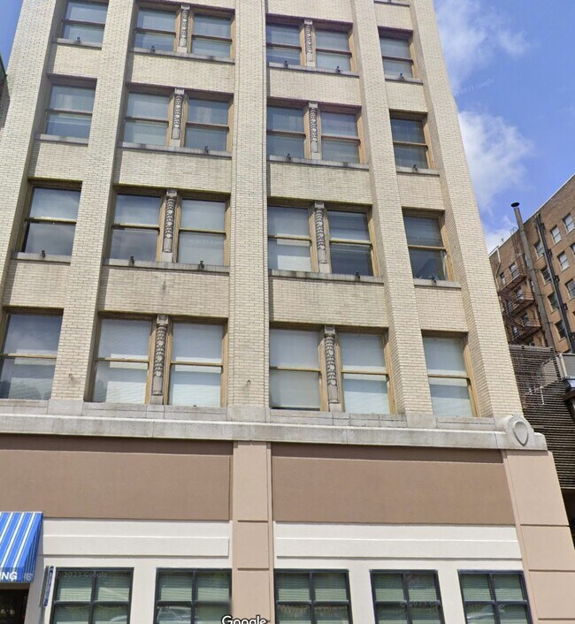
Property Record
119 S 5Th St, Springfield, IL 62701
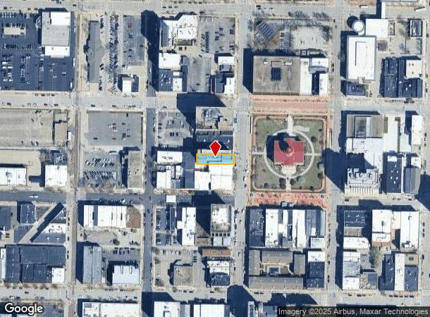
NEARBY LISTINGS FOR SALE OR LEASE
Property Detail
119 S 5Th St
14-34.0-104-021
OLD TOWN PLAT N 40 5/6' L 7 B 14
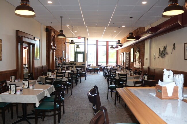
Commercialnec
Sangamon
X
Illinois
17167C0242F
0.15 AC
2024
Downtown Springfield
2024
Other Market Areas
001400
Springfield, IL
DEMOGRAPHICS near 119 S 5Th St
1 Mile
3 Mile
5 Mile
2024 Total Population
13,140
79,926
121,574
2029 Population
13,353
80,054
121,143
Pop Growth 2024-2029
+ 1.62%
+ 0.16%
(0.35%)
Average Age
39
40
41
2024 Total Households
6,255
36,508
54,737
HH Growth 2024-2029
+ 1.76%
+ 0.04%
(0.45%)
Median Household Inc
$30,672
$49,130
$58,320
Avg Household Size
1.90
2.10
2.10
2024 Avg HH Vehicles
1.00
1.00
2.00
Median Home Value
$78,524
$98,486
$132,468
Median Year Built
1951
1956
1965
Nearby Places
Map Layers
Map Styles
 Street
 Aerial
- Restaurants
- Banks
- Shops
- Fitness
- Groceries
PUBLIC TRANSPORTATION
COMMUTER RAIL
Springfield (Lincoln Service - Amtrak, Lincoln Service Missouri River Runner - Amtrak, Texas Eagle - Amtrak)
DRIVE
WALK
Distance
Springfield (Lincoln Service - Amtrak, Lincoln Service Missouri River Runner - Amtrak, Texas Eagle - Amtrak)
1 min
3 min
0.2 mi
AIRPORT
Abraham Lincoln Capital
DRIVE
WALK
Distance
Abraham Lincoln Capital
10 min
4.2 mi
Freight Ports
Port Milwaukee
DRIVE
WALK
Distance
Port Milwaukee
316 min
275.3 mi
SALE & LEASE HISTORY
LISTING DATE
SALE/LEASE

Jun 08, 2020
For Sale
Nearby Properties
Address
Land Use
TOTAL SIZE
Lot Size
Zoning
Address
Land Use
TOTAL SIZE
Lot Size
Zoning
2.36 AC
Address
Land Use
TOTAL SIZE
Lot Size
Zoning
4.50 AC
Address
Land Use
TOTAL SIZE
Lot Size
Zoning
1.90 AC
Address
Land Use
TOTAL SIZE
Lot Size
Zoning
3.17 AC
Address
Land Use
TOTAL SIZE
Lot Size
Zoning
1.16 AC
Address
Land Use
TOTAL SIZE
Lot Size
Zoning
1.05 AC
Address
Land Use
TOTAL SIZE
Lot Size
Zoning
Address
Land Use
TOTAL SIZE
Lot Size
Zoning
Address
Land Use
TOTAL SIZE
Lot Size
Zoning
Address
Land Use
TOTAL SIZE
Lot Size
Zoning
12.82 AC
Address
Land Use
TOTAL SIZE
Lot Size
Zoning
Address
Land Use
TOTAL SIZE
Lot Size
Zoning
Address
Land Use
TOTAL SIZE
Lot Size
Zoning
Address
Land Use
TOTAL SIZE
Lot Size
Zoning
15.99 AC
Address
Land Use
TOTAL SIZE
Lot Size
Zoning
1.22 AC
Address
Land Use
TOTAL SIZE
Lot Size
Zoning
Address
Land Use
TOTAL SIZE
Lot Size
Zoning
0.29 AC
Address
Land Use
TOTAL SIZE
Lot Size
Zoning
Address
Land Use
TOTAL SIZE
Lot Size
Zoning
15.24 AC
Address
Land Use
TOTAL SIZE
Lot Size
Zoning
6.34 AC
Address
Land Use
TOTAL SIZE
Lot Size
Zoning
Address
Land Use
TOTAL SIZE
Lot Size
Zoning
Address
Land Use
TOTAL SIZE
Lot Size
Zoning
Address
Land Use
TOTAL SIZE
Lot Size
Zoning
9.42 AC
Address
Land Use
TOTAL SIZE
Lot Size
Zoning
2.46 AC
Address
Land Use
TOTAL SIZE
Lot Size
Zoning
1.39 AC
Address
Land Use
TOTAL SIZE
Lot Size
Zoning
Address
Land Use
TOTAL SIZE
Lot Size
Zoning
2.38 AC
Address
Land Use
TOTAL SIZE
Lot Size
Zoning
80.30 AC
Address
Land Use
TOTAL SIZE
Lot Size
Zoning
2.32 AC
The World's #1 Commercial Real Estate Marketplace
Connect with us
© 2025 CoStar Group
The information above has been obtained from sources believed reliable. While we do not doubt its accuracy we have not verified it and make no guarantee, warranty or representation about it. It is your responsibility to independently confirm its accuracy and completeness. Any projections, opinions, assumptions, or estimates used are for example only and do not represent the current or future performance of the property. The value of this transaction to you depends on tax and other factors which should be evaluated by your tax, financial, and legal advisors. You and your advisors should conduct a careful, independent investigation of the property to determine to your satisfaction the suitability of the property for your needs.