Property Record
40 Cherry St, Naugatuck, CT 06770


Property Detail
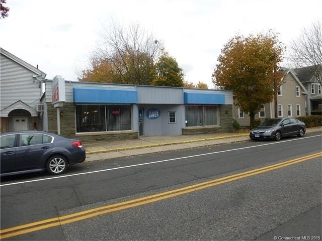
40 Cherry St
NAUG-000003-W002426-000042
Naugatuck Vly
Restaurantbuilding
Connecticut
R8
4710
C and X Area of minimal flood hazard, usually depicted on FIRMs as above the 500-year flood level.
0.10 AC
2025
Naugatuck
2025
Westchester/So Connecticut
345300
New Haven, CT
1,964 SF
NEARBY LISTINGS FOR SALE OR LEASE
DEMOGRAPHICS near 40 Cherry St
1 mile
3 mile
5 mile
2025 Total Population
10,750
41,209
100,875
2030 Population
10,896
42,278
103,677
Pop Growth 2025-2030
+ 1.36%
+ 2.59%
+ 2.78%
Average Age
40
41
41
2025 Total Households
4,388
16,412
39,924
HH Growth 2025-2030
+ 1.32%
+ 2.56%
+ 2.77%
Median Household Inc
$84,807
$88,470
$75,992
Avg Household Size
2.40
2.40
2.50
2025 Avg HH Vehicles
2.00
2.00
2.00
Median Home Value
$259,267
$271,024
$290,232
Median Year Built
1953
1970
1966
Nearby Places
Map Layers
Map Styles
 Street
 Aerial
Transit
 Traffic
 Biking
Places
Listings with unknown addresses are not visible on the map
- Restaurants
- Banks
- Shops
- Fitness
- Groceries
PUBLIC TRANSPORTATION
TRANSIT/SUBWAY
Naugatuck Station (New Haven Line - Metro-North Commuter Railroad Company (Metro-North))
Drive
Walk
Distance
Naugatuck Station (New Haven Line - Metro-North Commuter Railroad Company (Metro-North))
2 min
14 min
0.7 mi
COMMUTER RAIL
Naugatuck Station (New Haven Line - Metro-North Commuter Railroad Company (Metro-North))
Drive
Walk
Distance
Naugatuck Station (New Haven Line - Metro-North Commuter Railroad Company (Metro-North))
2 min
14 min
0.7 mi
Beacon Falls Station (New Haven Line - Metro-North Commuter Railroad Company (Metro-North))
Drive
Walk
Distance
Beacon Falls Station (New Haven Line - Metro-North Commuter Railroad Company (Metro-North))
7 min
4.1 mi
AIRPORT
Tweed/New Haven
Drive
Walk
Distance
Tweed/New Haven
39 min
22.4 mi
Bradley International
Drive
Walk
Distance
Bradley International
69 min
47.8 mi
Freight Ports
Port of New Haven
Drive
Walk
Distance
Port of New Haven
33 min
20.2 mi
SALE & LEASE HISTORY
LISTING DATE
SALE/LEASE

Nov 10, 2016
For Sale
Nearby Properties
Address
Land Use
TOTAL SIZE
Lot Size
Zoning
Address
Land Use
TOTAL SIZE
Lot Size
Zoning
17,181 SF
18.82 AC
R30
Address
Land Use
TOTAL SIZE
Lot Size
Zoning
268,279 SF
52.80 AC
RA1
Address
Land Use
TOTAL SIZE
Lot Size
Zoning
14,607 SF
9.24 AC
R8
Address
Land Use
TOTAL SIZE
Lot Size
Zoning
145,226 SF
28.56 AC
R8
Address
Land Use
TOTAL SIZE
Lot Size
Zoning
Address
Land Use
TOTAL SIZE
Lot Size
Zoning
13,440 SF
15.60 AC
RA1
Address
Land Use
TOTAL SIZE
Lot Size
Zoning
8.24 AC
Address
Land Use
TOTAL SIZE
Lot Size
Zoning
21.65 AC
Address
Land Use
TOTAL SIZE
Lot Size
Zoning
112,055 SF
14.19 AC
RA1
Address
Land Use
TOTAL SIZE
Lot Size
Zoning
5.40 AC
R15
Address
Land Use
TOTAL SIZE
Lot Size
Zoning
13,114 SF
7.70 AC
Address
Land Use
TOTAL SIZE
Lot Size
Zoning
46,302 SF
5 AC
R15
Address
Land Use
TOTAL SIZE
Lot Size
Zoning
52,250 SF
14.32 AC
RA1
Address
Land Use
TOTAL SIZE
Lot Size
Zoning
5.32 AC
RA1
Address
Land Use
TOTAL SIZE
Lot Size
Zoning
81,710 SF
10.86 AC
NHRDD
Address
Land Use
TOTAL SIZE
Lot Size
Zoning
41,056 SF
6.17 AC
RA1
Address
Land Use
TOTAL SIZE
Lot Size
Zoning
59,580 SF
12.45 AC
R8
Address
Land Use
TOTAL SIZE
Lot Size
Zoning
29.04 AC
R-3
Address
Land Use
TOTAL SIZE
Lot Size
Zoning
64,968 SF
1.60 AC
B-2
Address
Land Use
TOTAL SIZE
Lot Size
Zoning
106,949 SF
16.50 AC
R15
Address
Land Use
TOTAL SIZE
Lot Size
Zoning
717.07 AC
RA1
Address
Land Use
TOTAL SIZE
Lot Size
Zoning
37,842 SF
9.07 AC
I1
Address
Land Use
TOTAL SIZE
Lot Size
Zoning
6.47 AC
R15
Address
Land Use
TOTAL SIZE
Lot Size
Zoning
193,112 SF
12 AC
R8
Address
Land Use
TOTAL SIZE
Lot Size
Zoning
5 AC
RA1
Address
Land Use
TOTAL SIZE
Lot Size
Zoning
1.69 AC
RA1
Address
Land Use
TOTAL SIZE
Lot Size
Zoning
18,750 SF
4.16 AC
I1
Address
Land Use
TOTAL SIZE
Lot Size
Zoning
77,274 SF
5.99 AC
R8
Address
Land Use
TOTAL SIZE
Lot Size
Zoning
67,076 SF
22.98 AC
PD
Address
Land Use
TOTAL SIZE
Lot Size
Zoning
60,000 SF
13 AC
R8
The World's #1 Commercial Real Estate Marketplace
Connect with us
© 2026 CoStar Group
The information above has been obtained from sources believed reliable. While we do not doubt its accuracy we have not verified it and make no guarantee, warranty or representation about it. It is your responsibility to independently confirm its accuracy and completeness. Any projections, opinions, assumptions, or estimates used are for example only and do not represent the current or future performance of the property. The value of this transaction to you depends on tax and other factors which should be evaluated by your tax, financial, and legal advisors. You and your advisors should conduct a careful, independent investigation of the property to determine to your satisfaction the suitability of the property for your needs.