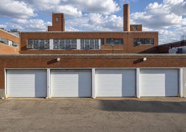
Property Record
40 Jacksonville Rd, Warminster, PA 18974


Current Lease Availabilities
Property Detail
40 Jacksonville Rd
49-009-016
15.194A NW COR SR332&LR09 033
Lumberwoodproductmanufacturingincludingfurniture
Bucks
I
Pennsylvania
AE The base floodplain where base flood elevations are provided. AE Zones are now used on new format FIRMs instead of A1-A30 Zones.
15.19 AC
2025
Bucks
2026
Philadelphia
101605
Philadelphia-Camden-Wilmington, PA-NJ-DE-MD
138,300 SF
NEARBY LISTINGS FOR SALE OR LEASE
DEMOGRAPHICS near 40 Jacksonville Rd
1 mile
3 mile
5 mile
2025 Total Population
18,090
90,619
191,430
2030 Population
18,441
92,644
194,490
Pop Growth 2025-2030
+ 1.94%
+ 2.23%
+ 1.60%
Average Age
41
44
43
2025 Total Households
7,548
37,245
73,361
HH Growth 2025-2030
+ 2.03%
+ 2.44%
+ 1.75%
Median Household Inc
$92,247
$93,869
$108,146
Avg Household Size
2.30
2.40
2.50
2025 Avg HH Vehicles
2.00
2.00
2.00
Median Home Value
$371,099
$407,988
$446,639
Median Year Built
1963
1969
1969
Nearby Places
Map Layers
Map Styles
 Street
 Aerial
Layers
 Traffic
 Biking
Places
Listings with unknown addresses are not visible on the map
- Restaurants
- Banks
- Shops
- Fitness
- Groceries
PUBLIC TRANSPORTATION
COMMUTER RAIL
Hatboro (R2 - Southeastern Pennsylvania Transportation Authority Regional Rail (SEPTA Regional Rail))
Drive
Walk
Distance
Hatboro (R2 - Southeastern Pennsylvania Transportation Authority Regional Rail (SEPTA Regional Rail))
2 min
17 min
0.9 mi
Warminster (R2 - Southeastern Pennsylvania Transportation Authority Regional Rail (SEPTA Regional Rail))
Drive
Walk
Distance
Warminster (R2 - Southeastern Pennsylvania Transportation Authority Regional Rail (SEPTA Regional Rail))
3 min
18 min
1.0 mi
AIRPORT
Trenton Mercer
Drive
Walk
Distance
Trenton Mercer
36 min
20.4 mi
Philadelphia International
Drive
Walk
Distance
Philadelphia International
54 min
31.6 mi
Freight Ports
Port of Philadelphia
Drive
Walk
Distance
Port of Philadelphia
31 min
17.3 mi
Nearby Properties
Address
Land Use
TOTAL SIZE
Lot Size
Zoning
Address
Land Use
TOTAL SIZE
Lot Size
Zoning
1,006.32 AC
I1
Address
Land Use
TOTAL SIZE
Lot Size
Zoning
377,044 SF
58.73 AC
INST
Address
Land Use
TOTAL SIZE
Lot Size
Zoning
297,172 SF
37.55 AC
R4
Address
Land Use
TOTAL SIZE
Lot Size
Zoning
571,213 SF
67.31 AC
M
Address
Land Use
TOTAL SIZE
Lot Size
Zoning
272,344 SF
9.76 AC
I2
Address
Land Use
TOTAL SIZE
Lot Size
Zoning
343,852 SF
8.42 AC
I
Address
Land Use
TOTAL SIZE
Lot Size
Zoning
251,655 SF
48.95 AC
SC
Address
Land Use
TOTAL SIZE
Lot Size
Zoning
257,010 SF
34.12 AC
INST
Address
Land Use
TOTAL SIZE
Lot Size
Zoning
84,400 SF
4.70 AC
I
Address
Land Use
TOTAL SIZE
Lot Size
Zoning
309,264 SF
9.93 AC
I
Address
Land Use
TOTAL SIZE
Lot Size
Zoning
420,736 SF
29.47 AC
LI
Address
Land Use
TOTAL SIZE
Lot Size
Zoning
256,679 SF
14 AC
MI
Address
Land Use
TOTAL SIZE
Lot Size
Zoning
344,636 SF
25.02 AC
R7
Address
Land Use
TOTAL SIZE
Lot Size
Zoning
110,198 SF
12.18 AC
R2
Address
Land Use
TOTAL SIZE
Lot Size
Zoning
273,531 SF
11.11 AC
INST
Address
Land Use
TOTAL SIZE
Lot Size
Zoning
123,538 SF
12.32 AC
CC
Address
Land Use
TOTAL SIZE
Lot Size
Zoning
171,179 SF
6.12 AC
C2
Address
Land Use
TOTAL SIZE
Lot Size
Zoning
94,059 SF
19.22 AC
R4
Address
Land Use
TOTAL SIZE
Lot Size
Zoning
205,254 SF
4.71 AC
HR
Address
Land Use
TOTAL SIZE
Lot Size
Zoning
205,254 SF
4.71 AC
HR
Address
Land Use
TOTAL SIZE
Lot Size
Zoning
120,549 SF
10 AC
C2
Address
Land Use
TOTAL SIZE
Lot Size
Zoning
149,423 SF
12.70 AC
I1
Address
Land Use
TOTAL SIZE
Lot Size
Zoning
91,814 SF
38.63 AC
RC
Address
Land Use
TOTAL SIZE
Lot Size
Zoning
212,660 SF
10.08 AC
I2
Address
Land Use
TOTAL SIZE
Lot Size
Zoning
174,835 SF
16.22 AC
M
Address
Land Use
TOTAL SIZE
Lot Size
Zoning
193,590 SF
14.23 AC
I1
Address
Land Use
TOTAL SIZE
Lot Size
Zoning
126,660 SF
17.26 AC
C2
Address
Land Use
TOTAL SIZE
Lot Size
Zoning
321,959 SF
12.66 AC
I2
Address
Land Use
TOTAL SIZE
Lot Size
Zoning
213,350 SF
11.78 AC
R7
Address
Land Use
TOTAL SIZE
Lot Size
Zoning
182,364 SF
21.06 AC
M
The World's #1 Commercial Real Estate Marketplace
Connect with us
© 2026 CoStar Group
The information above has been obtained from sources believed reliable. While we do not doubt its accuracy we have not verified it and make no guarantee, warranty or representation about it. It is your responsibility to independently confirm its accuracy and completeness. Any projections, opinions, assumptions, or estimates used are for example only and do not represent the current or future performance of the property. The value of this transaction to you depends on tax and other factors which should be evaluated by your tax, financial, and legal advisors. You and your advisors should conduct a careful, independent investigation of the property to determine to your satisfaction the suitability of the property for your needs.