Property Record
4017 Rawlins St, Cheyenne, WY 82001


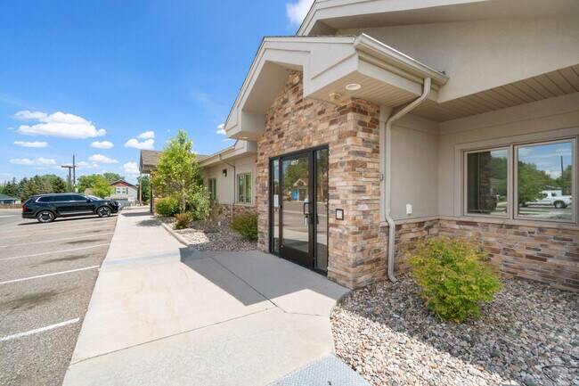
Property Detail
4017 Rawlins St
Cheyenne, WY
2ND FILING
1-2699-0001-0002-1
Laramie
Commercialnec
Wyoming
B and X Area of moderate flood hazard, usually the area between the limits of the 100-year and 500-year floods.
2,4
2025
0.96 AC
2026
I-80 Corridor/Cheyenne
001502
Other Market Areas
10,356 SF
NEARBY LISTINGS FOR SALE OR LEASE
DEMOGRAPHICS near 4017 Rawlins St
1 mile
3 mile
5 mile
2025 Total Population
10,973
41,966
79,134
2030 Population
11,000
42,048
79,362
Pop Growth 2025-2030
+ 0.25%
+ 0.20%
+ 0.29%
Average Age
41
40
40
2025 Total Households
4,828
17,836
33,714
HH Growth 2025-2030
+ 0.62%
+ 0.38%
+ 0.43%
Median Household Inc
$66,590
$74,720
$73,198
Avg Household Size
2.20
2.30
2.30
2025 Avg HH Vehicles
2.00
2.00
2.00
Median Home Value
$300,101
$318,648
$322,725
Median Year Built
1987
1976
1977
Nearby Places
Map Layers
Map Styles
 Street
 Aerial
Layers
 Traffic
 Biking
Places
Listings with unknown addresses are not visible on the map
- Restaurants
- Banks
- Shops
- Fitness
- Groceries
SALE & LEASE HISTORY
LISTING DATE
SALE/LEASE

Nov 06, 2021
For Sale
May 15, 2024
For Lease
Jul 31, 2025
For Lease
Apr 24, 2024
For Sale
Nearby Properties
Address
Land Use
TOTAL SIZE
Lot Size
Zoning
Address
Land Use
TOTAL SIZE
Lot Size
Zoning
240.51 AC
A2
Address
Land Use
TOTAL SIZE
Lot Size
Zoning
1,120,931 SF
149.20 AC
Address
Land Use
TOTAL SIZE
Lot Size
Zoning
639,397 SF
67.52 AC
Address
Land Use
TOTAL SIZE
Lot Size
Zoning
243,960 SF
60.52 AC
Address
Land Use
TOTAL SIZE
Lot Size
Zoning
265,882 SF
12.16 AC
Address
Land Use
TOTAL SIZE
Lot Size
Zoning
91,021 SF
7.40 AC
Address
Land Use
TOTAL SIZE
Lot Size
Zoning
210,717 SF
18.28 AC
Address
Land Use
TOTAL SIZE
Lot Size
Zoning
180,600 SF
13.72 AC
HI
Address
Land Use
TOTAL SIZE
Lot Size
Zoning
156,244 SF
4.75 AC
Address
Land Use
TOTAL SIZE
Lot Size
Zoning
114,342 SF
59.95 AC
HI
Address
Land Use
TOTAL SIZE
Lot Size
Zoning
219,227 SF
21.97 AC
CB
Address
Land Use
TOTAL SIZE
Lot Size
Zoning
323,835 SF
Address
Land Use
TOTAL SIZE
Lot Size
Zoning
109,096 SF
4.03 AC
MR2
Address
Land Use
TOTAL SIZE
Lot Size
Zoning
193,881 SF
21.36 AC
CB
Address
Land Use
TOTAL SIZE
Lot Size
Zoning
109,744 SF
7.04 AC
Address
Land Use
TOTAL SIZE
Lot Size
Zoning
142,588 SF
3.54 AC
PUD
Address
Land Use
TOTAL SIZE
Lot Size
Zoning
37,714 SF
4.29 AC
Address
Land Use
TOTAL SIZE
Lot Size
Zoning
69,941 SF
4.31 AC
LI
Address
Land Use
TOTAL SIZE
Lot Size
Zoning
81,948 SF
9.39 AC
CB
Address
Land Use
TOTAL SIZE
Lot Size
Zoning
88,107 SF
10.73 AC
Address
Land Use
TOTAL SIZE
Lot Size
Zoning
96,088 SF
8.34 AC
Address
Land Use
TOTAL SIZE
Lot Size
Zoning
69,103 SF
17.34 AC
Address
Land Use
TOTAL SIZE
Lot Size
Zoning
79,186 SF
3.09 AC
Address
Land Use
TOTAL SIZE
Lot Size
Zoning
148,152 SF
15.54 AC
CB
Address
Land Use
TOTAL SIZE
Lot Size
Zoning
136,525 SF
13.38 AC
CB
Address
Land Use
TOTAL SIZE
Lot Size
Zoning
137,640 SF
14.43 AC
CB
Address
Land Use
TOTAL SIZE
Lot Size
Zoning
73,980 SF
8.08 AC
Address
Land Use
TOTAL SIZE
Lot Size
Zoning
83,059 SF
8.88 AC
CB
Address
Land Use
TOTAL SIZE
Lot Size
Zoning
59,223 SF
9.91 AC
HI
Address
Land Use
TOTAL SIZE
Lot Size
Zoning
135,125 SF
8.87 AC
The World's #1 Commercial Real Estate Marketplace
Connect with us
© 2026 CoStar Group
The information above has been obtained from sources believed reliable. While we do not doubt its accuracy we have not verified it and make no guarantee, warranty or representation about it. It is your responsibility to independently confirm its accuracy and completeness. Any projections, opinions, assumptions, or estimates used are for example only and do not represent the current or future performance of the property. The value of this transaction to you depends on tax and other factors which should be evaluated by your tax, financial, and legal advisors. You and your advisors should conduct a careful, independent investigation of the property to determine to your satisfaction the suitability of the property for your needs.