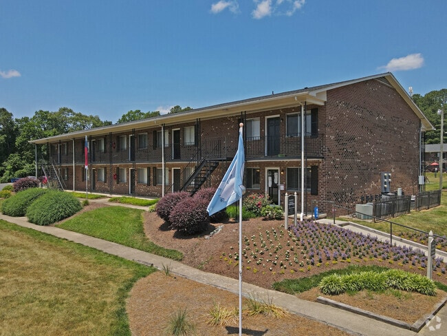
Property Record
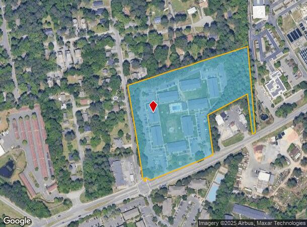
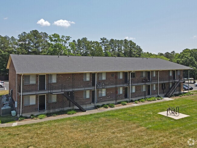
404 Jones Ferry Rd, Carrboro, NC 27510
NEARBY LISTINGS FOR SALE OR LEASE
Property Detail
404 Jones Ferry Rd
9778558604
N/E INT JONES FERRY & DAVIE RDS
Multifamilydwelling
Orange
X
North Carolina
3710977800K
8.73 AC
2025
Greater Chapel Hill
2025
Raleigh/Durham
010707
Durham-Chapel Hill, NC
10,672 SF
DEMOGRAPHICS near 404 Jones Ferry Rd
1 Mile
3 Mile
5 Mile
2024 Total Population
14,024
55,968
99,355
2029 Population
13,081
52,345
94,194
Pop Growth 2024-2029
(6.72%)
(6.47%)
(5.19%)
Average Age
35
33
37
2024 Total Households
6,806
20,146
38,547
HH Growth 2024-2029
(6.85%)
(7.49%)
(5.51%)
Median Household Inc
$53,864
$66,284
$84,830
Avg Household Size
2.00
2.20
2.30
2024 Avg HH Vehicles
1.00
2.00
2.00
Median Home Value
$372,167
$473,726
$467,855
Median Year Built
1982
1985
1989
Nearby Places
Map Layers
Map Styles
 Street
 Aerial
- Restaurants
- Banks
- Shops
- Fitness
- Groceries
PUBLIC TRANSPORTATION
AIRPORT
Raleigh-Durham International
DRIVE
WALK
Distance
Raleigh-Durham International
32 min
20.1 mi
Freight Ports
Port of Wilmington
DRIVE
WALK
Distance
Port of Wilmington
192 min
164.3 mi
Nearby Properties
Address
Land Use
TOTAL SIZE
Lot Size
Zoning
Address
Land Use
TOTAL SIZE
Lot Size
Zoning
215,860 SF
12.28 AC
Address
Land Use
TOTAL SIZE
Lot Size
Zoning
264,710 SF
32.50 AC
R1
Address
Land Use
TOTAL SIZE
Lot Size
Zoning
208,406 SF
120.44 AC
R1
Address
Land Use
TOTAL SIZE
Lot Size
Zoning
4,128 SF
678.68 AC
R1
Address
Land Use
TOTAL SIZE
Lot Size
Zoning
81,191 SF
12.33 AC
OI4
Address
Land Use
TOTAL SIZE
Lot Size
Zoning
55,318 SF
9.05 AC
R4
Address
Land Use
TOTAL SIZE
Lot Size
Zoning
134,448 SF
59.23 AC
Address
Land Use
TOTAL SIZE
Lot Size
Zoning
119,585 SF
62.30 AC
Address
Land Use
TOTAL SIZE
Lot Size
Zoning
21,078 SF
227.43 AC
OI3R2
Address
Land Use
TOTAL SIZE
Lot Size
Zoning
26,328 SF
13.86 AC
OR3
Address
Land Use
TOTAL SIZE
Lot Size
Zoning
361,420 SF
1.68 AC
Address
Land Use
TOTAL SIZE
Lot Size
Zoning
85,652 SF
16.49 AC
R1R5
Address
Land Use
TOTAL SIZE
Lot Size
Zoning
17,640 SF
11.51 AC
R4R5C
Address
Land Use
TOTAL SIZE
Lot Size
Zoning
119,517 SF
28.28 AC
R20
Address
Land Use
TOTAL SIZE
Lot Size
Zoning
24,820 SF
1 AC
Address
Land Use
TOTAL SIZE
Lot Size
Zoning
143,750 SF
1.32 AC
OI3OI4
Address
Land Use
TOTAL SIZE
Lot Size
Zoning
174,922 SF
4.59 AC
OI4
Address
Land Use
TOTAL SIZE
Lot Size
Zoning
15,916 SF
46.02 AC
R10RSIR
Address
Land Use
TOTAL SIZE
Lot Size
Zoning
12,328 SF
16.37 AC
R75
Address
Land Use
TOTAL SIZE
Lot Size
Zoning
78,028 SF
32.60 AC
Address
Land Use
TOTAL SIZE
Lot Size
Zoning
22,328 SF
19.48 AC
Address
Land Use
TOTAL SIZE
Lot Size
Zoning
82,064 SF
1.41 AC
Address
Land Use
TOTAL SIZE
Lot Size
Zoning
42,628 SF
6.12 AC
Address
Land Use
TOTAL SIZE
Lot Size
Zoning
45,320 SF
0.66 AC
TC1TC2
Address
Land Use
TOTAL SIZE
Lot Size
Zoning
71,856 SF
20.37 AC
R10R3
Address
Land Use
TOTAL SIZE
Lot Size
Zoning
12,014 SF
10.38 AC
R75
Address
Land Use
TOTAL SIZE
Lot Size
Zoning
48,690 SF
15.69 AC
OR3R75
Address
Land Use
TOTAL SIZE
Lot Size
Zoning
102,399 SF
11.69 AC
R20
Address
Land Use
TOTAL SIZE
Lot Size
Zoning
35,988 SF
14.52 AC
R75
Address
Land Use
TOTAL SIZE
Lot Size
Zoning
86,478 SF
8.60 AC
B1CCT
The World's #1 Commercial Real Estate Marketplace
Connect with us
© 2026 CoStar Group
The information above has been obtained from sources believed reliable. While we do not doubt its accuracy we have not verified it and make no guarantee, warranty or representation about it. It is your responsibility to independently confirm its accuracy and completeness. Any projections, opinions, assumptions, or estimates used are for example only and do not represent the current or future performance of the property. The value of this transaction to you depends on tax and other factors which should be evaluated by your tax, financial, and legal advisors. You and your advisors should conduct a careful, independent investigation of the property to determine to your satisfaction the suitability of the property for your needs.