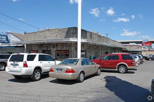
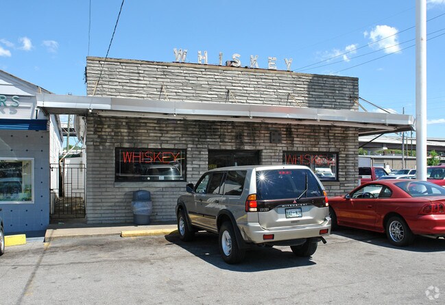
Property Record
5304 Charlotte Ave, Nashville, TN 37209
NEARBY LISTINGS FOR SALE OR LEASE
Property Detail
5304 Charlotte Ave
091-15-0-008
West Nashville
Stripcommercialcenter
PT BLK 194 WEST NASHVILLE NO 1
AE
Davidson
47037C0238J
Tennessee
2025
0.56 AC
2025
Bellevue/W Nashville
013400
Nashville
7,364 SF
Nashville-Davidson--Murfreesboro--Franklin, TN
DEMOGRAPHICS near 5304 Charlotte Ave
1 Mile
3 Mile
5 Mile
2024 Total Population
12,485
76,961
196,858
2029 Population
12,507
77,505
199,620
Pop Growth 2024-2029
+ 0.18%
+ 0.71%
+ 1.40%
Average Age
34
37
37
2024 Total Households
5,813
34,785
91,024
HH Growth 2024-2029
(0.31%)
+ 0.62%
+ 1.74%
Median Household Inc
$74,412
$65,728
$71,766
Avg Household Size
2.10
2.00
1.90
2024 Avg HH Vehicles
2.00
2.00
2.00
Median Home Value
$483,965
$521,331
$545,520
Median Year Built
1988
1986
1999
Nearby Places
Map Layers
Map Styles
 Street
 Aerial
- Restaurants
- Banks
- Shops
- Fitness
- Groceries
PUBLIC TRANSPORTATION
COMMUTER RAIL
Riverfront (East Corridor Line - Tennessee Regional Transportation Authority Music City Star (Music City Star))
DRIVE
WALK
Distance
Riverfront (East Corridor Line - Tennessee Regional Transportation Authority Music City Star (Music City Star))
8 min
4.8 mi
AIRPORT
Nashville International
DRIVE
WALK
Distance
Nashville International
20 min
13.6 mi
Freight Ports
Port of Mobile
DRIVE
WALK
Distance
Port of Mobile
488 min
448.4 mi
Nearby Properties
Address
Land Use
TOTAL SIZE
Lot Size
Zoning
Address
Land Use
TOTAL SIZE
Lot Size
Zoning
6,216 SF
131.92 AC
MULTI-ZONE
Address
Land Use
TOTAL SIZE
Lot Size
Zoning
289,697 SF
10.18 AC
MUI-A
Address
Land Use
TOTAL SIZE
Lot Size
Zoning
30,648 SF
37.73 AC
ORI
Address
Land Use
TOTAL SIZE
Lot Size
Zoning
1,339,972 SF
16.18 AC
ORI
Address
Land Use
TOTAL SIZE
Lot Size
Zoning
17.48 AC
MUG
Address
Land Use
TOTAL SIZE
Lot Size
Zoning
57,264 SF
7.80 AC
MUI
Address
Land Use
TOTAL SIZE
Lot Size
Zoning
24.42 AC
ORI
Address
Land Use
TOTAL SIZE
Lot Size
Zoning
148,222 SF
25.86 AC
MULTI-ZONE
Address
Land Use
TOTAL SIZE
Lot Size
Zoning
15.48 AC
MUI
Address
Land Use
TOTAL SIZE
Lot Size
Zoning
208,992 SF
6.09 AC
MUG
Address
Land Use
TOTAL SIZE
Lot Size
Zoning
17.03 AC
ORI
Address
Land Use
TOTAL SIZE
Lot Size
Zoning
556,277 SF
1.85 AC
SP
Address
Land Use
TOTAL SIZE
Lot Size
Zoning
76,787 SF
3.86 AC
3ZZ
Address
Land Use
TOTAL SIZE
Lot Size
Zoning
3.48 AC
Address
Land Use
TOTAL SIZE
Lot Size
Zoning
184,700 SF
14.20 AC
RM40
Address
Land Use
TOTAL SIZE
Lot Size
Zoning
9.31 AC
MULTI-ZONE
Address
Land Use
TOTAL SIZE
Lot Size
Zoning
153,434 SF
3.08 AC
ORI
Address
Land Use
TOTAL SIZE
Lot Size
Zoning
301.19 AC
MULTI-ZONE
Address
Land Use
TOTAL SIZE
Lot Size
Zoning
80,280 SF
2.20 AC
OVUDO
Address
Land Use
TOTAL SIZE
Lot Size
Zoning
285,887 SF
0.80 AC
MULTIZONE
Address
Land Use
TOTAL SIZE
Lot Size
Zoning
315,636 SF
1.56 AC
MUG
Address
Land Use
TOTAL SIZE
Lot Size
Zoning
984,601 SF
3.74 AC
MULTIZONE
Address
Land Use
TOTAL SIZE
Lot Size
Zoning
133,157 SF
1.05 AC
ORI
Address
Land Use
TOTAL SIZE
Lot Size
Zoning
361,179 SF
1.94 AC
SP
Address
Land Use
TOTAL SIZE
Lot Size
Zoning
572,162 SF
1.27 AC
MUI-A
Address
Land Use
TOTAL SIZE
Lot Size
Zoning
121,769 SF
4.64 AC
MULTI-ZONE
Address
Land Use
TOTAL SIZE
Lot Size
Zoning
226,728 SF
10.15 AC
MUG-A
Address
Land Use
TOTAL SIZE
Lot Size
Zoning
291,619 SF
MUIA
Address
Land Use
TOTAL SIZE
Lot Size
Zoning
377,977 SF
2.66 AC
MUG-A
Address
Land Use
TOTAL SIZE
Lot Size
Zoning
5.17 AC
ORI
The World's #1 Commercial Real Estate Marketplace
Connect with us
© 2025 CoStar Group
The information above has been obtained from sources believed reliable. While we do not doubt its accuracy we have not verified it and make no guarantee, warranty or representation about it. It is your responsibility to independently confirm its accuracy and completeness. Any projections, opinions, assumptions, or estimates used are for example only and do not represent the current or future performance of the property. The value of this transaction to you depends on tax and other factors which should be evaluated by your tax, financial, and legal advisors. You and your advisors should conduct a careful, independent investigation of the property to determine to your satisfaction the suitability of the property for your needs.