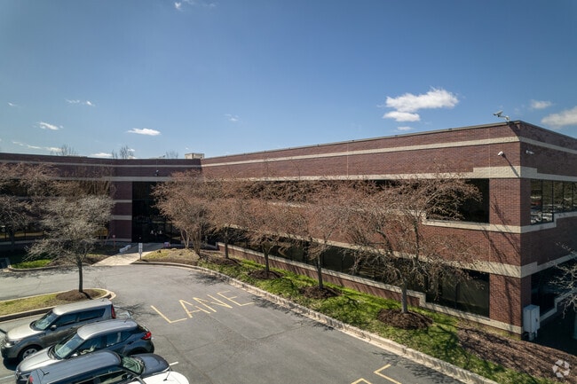
Property Record
405 Silverside Rd, Wilmington, DE 19809


Save to a Folder
{{folder.Name}}
{{folder.ListingIds.length}} Properties
{{folder.ListingIds.length}} Property
Create a New Folder
Current Lease Availabilities
Property Detail
405 Silverside Rd
06-105.00-282
New Castle
Officebuilding
Delaware
ON
1c
B and X Area of moderate flood hazard, usually the area between the limits of the 100-year and 500-year floods.
5.04 AC
2025
North New Castle County
2025
Philadelphia
010400
Philadelphia-Camden-Wilmington, PA-NJ-DE-MD
60,078 SF
NEARBY LISTINGS FOR SALE OR LEASE
DEMOGRAPHICS near 405 Silverside Rd
1 mile
3 mile
5 mile
2025 Total Population
8,973
66,816
172,495
2030 Population
9,140
68,073
176,853
Pop Growth 2025-2030
+ 1.86%
+ 1.88%
+ 2.53%
Average Age
43
43
42
2025 Total Households
3,714
28,157
71,421
HH Growth 2025-2030
+ 1.99%
+ 2.04%
+ 2.67%
Median Household Inc
$96,498
$96,276
$84,235
Avg Household Size
2.30
2.30
2.30
2025 Avg HH Vehicles
2.00
2.00
2.00
Median Home Value
$346,129
$371,281
$360,692
Median Year Built
1957
1962
1960
Nearby Places
Map Layers
Map Styles
 Street
 Aerial
Layers
 Traffic
 Biking
Places
Listings with unknown addresses are not visible on the map
- Restaurants
- Banks
- Shops
- Fitness
- Groceries
PUBLIC TRANSPORTATION
COMMUTER RAIL
Claymont Transportation Center (Wilmington/Newark Line - SEPTA)
Drive
Walk
Distance
Claymont Transportation Center (Wilmington/Newark Line - SEPTA)
8 min
3.1 mi
Marcus Hook (R2 - Southeastern Pennsylvania Transportation Authority Regional Rail (SEPTA Regional Rail))
Drive
Walk
Distance
Marcus Hook (R2 - Southeastern Pennsylvania Transportation Authority Regional Rail (SEPTA Regional Rail))
12 min
5.1 mi
AIRPORT
Philadelphia International
Drive
Walk
Distance
Philadelphia International
26 min
16.1 mi
Freight Ports
Port of Wilmington, RI
Drive
Walk
Distance
Port of Wilmington, RI
15 min
7.7 mi
Nearby Properties
Address
Land Use
TOTAL SIZE
Lot Size
Zoning
Address
Land Use
TOTAL SIZE
Lot Size
Zoning
Address
Land Use
TOTAL SIZE
Lot Size
Zoning
393,718 SF
42.16 AC
NCGA
Address
Land Use
TOTAL SIZE
Lot Size
Zoning
16,002 SF
16.91 AC
CR
Address
Land Use
TOTAL SIZE
Lot Size
Zoning
240,690 SF
18.44 AC
NCAP
Address
Land Use
TOTAL SIZE
Lot Size
Zoning
170.76 AC
S
Address
Land Use
TOTAL SIZE
Lot Size
Zoning
359,520 SF
28.18 AC
HI
Address
Land Use
TOTAL SIZE
Lot Size
Zoning
258.38 AC
HI
Address
Land Use
TOTAL SIZE
Lot Size
Zoning
212,522 SF
16.04 AC
OR
Address
Land Use
TOTAL SIZE
Lot Size
Zoning
324,733 SF
17.70 AC
NCAP
Address
Land Use
TOTAL SIZE
Lot Size
Zoning
205,529 SF
42.34 AC
S
Address
Land Use
TOTAL SIZE
Lot Size
Zoning
141,066 SF
36.52 AC
S
Address
Land Use
TOTAL SIZE
Lot Size
Zoning
297,333 SF
11.95 AC
NCAP
Address
Land Use
TOTAL SIZE
Lot Size
Zoning
231,920 SF
23.52 AC
S
Address
Land Use
TOTAL SIZE
Lot Size
Zoning
212,428 SF
12.52 AC
NCAP
Address
Land Use
TOTAL SIZE
Lot Size
Zoning
297,108 SF
5.74 AC
NCAP
Address
Land Use
TOTAL SIZE
Lot Size
Zoning
247,640 SF
11.73 AC
NCAP
Address
Land Use
TOTAL SIZE
Lot Size
Zoning
282,932 SF
20.12 AC
NCAP
Address
Land Use
TOTAL SIZE
Lot Size
Zoning
291,946 SF
21.27 AC
26R-2
Address
Land Use
TOTAL SIZE
Lot Size
Zoning
184,263 SF
7.07 AC
NCAP
Address
Land Use
TOTAL SIZE
Lot Size
Zoning
132,400 SF
7.79 AC
OR
Address
Land Use
TOTAL SIZE
Lot Size
Zoning
109,145 SF
10.57 AC
S
Address
Land Use
TOTAL SIZE
Lot Size
Zoning
187,209 SF
13.88 AC
NCAP
Address
Land Use
TOTAL SIZE
Lot Size
Zoning
197,332 SF
12.13 AC
S
Address
Land Use
TOTAL SIZE
Lot Size
Zoning
114,192 SF
7.84 AC
CR
Address
Land Use
TOTAL SIZE
Lot Size
Zoning
244,483 SF
10.01 AC
OR
Address
Land Use
TOTAL SIZE
Lot Size
Zoning
105,735 SF
113.29 AC
HI
Address
Land Use
TOTAL SIZE
Lot Size
Zoning
232,890 SF
4.30 AC
NCAP
Address
Land Use
TOTAL SIZE
Lot Size
Zoning
99,418 SF
7.17 AC
OR
Address
Land Use
TOTAL SIZE
Lot Size
Zoning
320,089 SF
26.02 AC
CR
Address
Land Use
TOTAL SIZE
Lot Size
Zoning
191,222 SF
8.44 AC
NCAP
The World's #1 Commercial Real Estate Marketplace
Connect with us
© 2026 CoStar Group
The information above has been obtained from sources believed reliable. While we do not doubt its accuracy we have not verified it and make no guarantee, warranty or representation about it. It is your responsibility to independently confirm its accuracy and completeness. Any projections, opinions, assumptions, or estimates used are for example only and do not represent the current or future performance of the property. The value of this transaction to you depends on tax and other factors which should be evaluated by your tax, financial, and legal advisors. You and your advisors should conduct a careful, independent investigation of the property to determine to your satisfaction the suitability of the property for your needs.