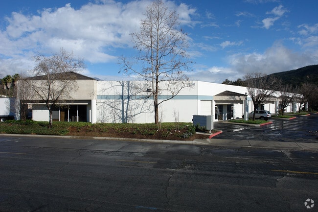
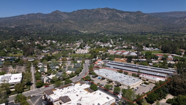
Property Record
406 Bryant Cir, Ojai, CA 93023


Property Detail
406 Bryant Cir
024-0-120-225
TRACT 3786 LOT 2
Industrialgeneral
VENTURA
M1
California
B and X Area of moderate flood hazard, usually the area between the limits of the 100-year and 500-year floods.
2.08 AC
2024
Ventura
2025
Los Angeles
000902
Oxnard-Thousand Oaks-Ventura, CA
29,708 SF
NEARBY LISTINGS FOR SALE OR LEASE
DEMOGRAPHICS near 406 Bryant Cir
1 mile
3 mile
5 mile
2025 Total Population
4,875
14,272
24,260
2030 Population
4,786
14,112
24,037
Pop Growth 2025-2030
(1.83%)
(1.12%)
(0.92%)
Average Age
46
46
46
2025 Total Households
2,043
5,696
9,504
HH Growth 2025-2030
(2.06%)
(1.32%)
(1.10%)
Median Household Inc
$82,265
$85,759
$89,148
Avg Household Size
2.30
2.40
2.50
2025 Avg HH Vehicles
2.00
2.00
2.00
Median Home Value
$1,023,765
$940,125
$872,143
Median Year Built
1961
1965
1966
Nearby Places
Map Layers
Map Styles
 Street
 Aerial
Transit
 Traffic
 Biking
Places
Listings with unknown addresses are not visible on the map
- Restaurants
- Banks
- Shops
- Fitness
- Groceries
SALE & LEASE HISTORY
LISTING DATE
SALE/LEASE

Nov 30, 2017
For Lease
Apr 15, 2024
For Sale
Nearby Properties
Address
Land Use
TOTAL SIZE
Lot Size
Zoning
Address
Land Use
TOTAL SIZE
Lot Size
Zoning
182.91 AC
Address
Land Use
TOTAL SIZE
Lot Size
Zoning
6.23 AC
Address
Land Use
TOTAL SIZE
Lot Size
Zoning
2.01 AC
C1
Address
Land Use
TOTAL SIZE
Lot Size
Zoning
25,301 SF
1.74 AC
BP
Address
Land Use
TOTAL SIZE
Lot Size
Zoning
28.32 AC
RE20
Address
Land Use
TOTAL SIZE
Lot Size
Zoning
5.05 AC
CR
Address
Land Use
TOTAL SIZE
Lot Size
Zoning
534.56 AC
OS40AC
Address
Land Use
TOTAL SIZE
Lot Size
Zoning
4,271 SF
9.49 AC
RE5AC
Address
Land Use
TOTAL SIZE
Lot Size
Zoning
1.93 AC
CPD
Address
Land Use
TOTAL SIZE
Lot Size
Zoning
Address
Land Use
TOTAL SIZE
Lot Size
Zoning
126.17 AC
OS20AC
Address
Land Use
TOTAL SIZE
Lot Size
Zoning
148.90 AC
OS40AC
Address
Land Use
TOTAL SIZE
Lot Size
Zoning
12.68 AC
PL
Address
Land Use
TOTAL SIZE
Lot Size
Zoning
1,440 SF
98.32 AC
AE
Address
Land Use
TOTAL SIZE
Lot Size
Zoning
1,028 SF
4.87 AC
Address
Land Use
TOTAL SIZE
Lot Size
Zoning
54,259 SF
2.56 AC
M1
Address
Land Use
TOTAL SIZE
Lot Size
Zoning
2,690 SF
0.80 AC
Address
Land Use
TOTAL SIZE
Lot Size
Zoning
9.70 AC
Address
Land Use
TOTAL SIZE
Lot Size
Zoning
494 SF
8.72 AC
OS20AC
Address
Land Use
TOTAL SIZE
Lot Size
Zoning
35,318 SF
2.59 AC
BP
Address
Land Use
TOTAL SIZE
Lot Size
Zoning
3,779 SF
42.97 AC
AE
Address
Land Use
TOTAL SIZE
Lot Size
Zoning
3,452 SF
21.55 AC
AE
Address
Land Use
TOTAL SIZE
Lot Size
Zoning
100 SF
0.61 AC
C1
Address
Land Use
TOTAL SIZE
Lot Size
Zoning
36.30 AC
RA20AC
Address
Land Use
TOTAL SIZE
Lot Size
Zoning
4,701 SF
40 AC
AE80AC
Address
Land Use
TOTAL SIZE
Lot Size
Zoning
7.09 AC
Address
Land Use
TOTAL SIZE
Lot Size
Zoning
1,200 SF
51.18 AC
AE
Address
Land Use
TOTAL SIZE
Lot Size
Zoning
2,395 SF
44.63 AC
The World's #1 Commercial Real Estate Marketplace
Connect with us
© 2026 CoStar Group
The information above has been obtained from sources believed reliable. While we do not doubt its accuracy we have not verified it and make no guarantee, warranty or representation about it. It is your responsibility to independently confirm its accuracy and completeness. Any projections, opinions, assumptions, or estimates used are for example only and do not represent the current or future performance of the property. The value of this transaction to you depends on tax and other factors which should be evaluated by your tax, financial, and legal advisors. You and your advisors should conduct a careful, independent investigation of the property to determine to your satisfaction the suitability of the property for your needs.