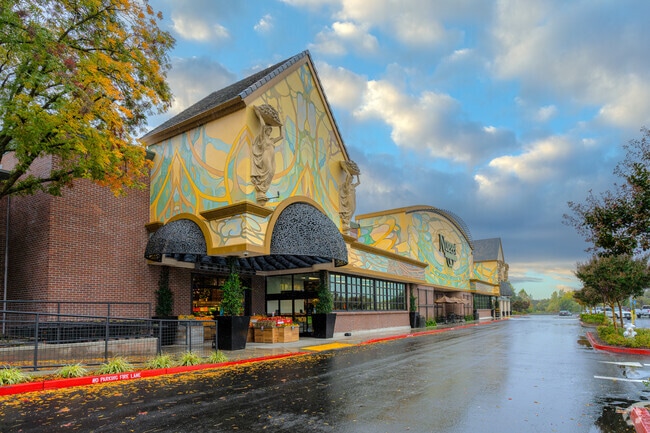
Property Record
4080 Douglas Blvd, Granite Bay, CA 95746


Save to a Folder
{{folder.Name}}
{{folder.ListingIds.length}} Properties
{{folder.ListingIds.length}} Property
Create a New Folder
Property Detail
4080 Douglas Blvd
048-440-002
POR PCL B PM 22-131
Regionalshoppingcenterormallwithanchorstore
Placer
CPDDC
California
B and X Area of moderate flood hazard, usually the area between the limits of the 100-year and 500-year floods.
b
0
4 AC
2026
Roseville/Rocklin
020605
Sacramento
46,571 SF
Sacramento-Roseville-Folsom, CA
NEARBY LISTINGS FOR SALE OR LEASE
DEMOGRAPHICS near 4080 Douglas Blvd
1 mile
3 mile
5 mile
2025 Total Population
10,812
70,207
223,428
2030 Population
11,346
72,944
230,058
Pop Growth 2025-2030
+ 4.94%
+ 3.90%
+ 2.97%
Average Age
41
43
42
2025 Total Households
3,986
26,613
83,289
HH Growth 2025-2030
+ 4.92%
+ 3.95%
+ 3.06%
Median Household Inc
$125,568
$107,267
$102,873
Avg Household Size
2.60
2.60
2.60
2025 Avg HH Vehicles
2.00
2.00
2.00
Median Home Value
$845,012
$740,591
$660,574
Median Year Built
1995
1987
1984
Nearby Places
Map Layers
Map Styles
 Street
 Aerial
Layers
 Traffic
 Biking
Places
Listings with unknown addresses are not visible on the map
- Restaurants
- Banks
- Shops
- Fitness
- Groceries
PUBLIC TRANSPORTATION
COMMUTER RAIL
Roseville Amtrak (California Zephyr - Amtrak, Capitol Corridor - Amtrak)
Drive
Walk
Distance
Roseville Amtrak (California Zephyr - Amtrak, Capitol Corridor - Amtrak)
10 min
4.2 mi
Rocklin Amtrak Station (Capitol Corridor - Amtrak)
Drive
Walk
Distance
Rocklin Amtrak Station (Capitol Corridor - Amtrak)
9 min
5.0 mi
AIRPORT
Sacramento International
Drive
Walk
Distance
Sacramento International
38 min
27.2 mi
Freight Ports
Port of Stockton
Drive
Walk
Distance
Port of Stockton
80 min
67.4 mi
Nearby Properties
Address
Land Use
TOTAL SIZE
Lot Size
Zoning
Address
Land Use
TOTAL SIZE
Lot Size
Zoning
1,444,630 SF
53.20 AC
Address
Land Use
TOTAL SIZE
Lot Size
Zoning
350,573 SF
26.30 AC
Address
Land Use
TOTAL SIZE
Lot Size
Zoning
638,040 SF
38.70 AC
Address
Land Use
TOTAL SIZE
Lot Size
Zoning
277,602 SF
26.49 AC
Address
Land Use
TOTAL SIZE
Lot Size
Zoning
325,462 SF
29.50 AC
Address
Land Use
TOTAL SIZE
Lot Size
Zoning
328,416 SF
17.80 AC
Address
Land Use
TOTAL SIZE
Lot Size
Zoning
105,730 SF
7.20 AC
Address
Land Use
TOTAL SIZE
Lot Size
Zoning
174,840 SF
19.70 AC
Address
Land Use
TOTAL SIZE
Lot Size
Zoning
223,623 SF
12.70 AC
Address
Land Use
TOTAL SIZE
Lot Size
Zoning
28,798 SF
12.52 AC
Address
Land Use
TOTAL SIZE
Lot Size
Zoning
288,628 SF
11.90 AC
Address
Land Use
TOTAL SIZE
Lot Size
Zoning
143,809 SF
14.40 AC
Address
Land Use
TOTAL SIZE
Lot Size
Zoning
120,983 SF
17.60 AC
Address
Land Use
TOTAL SIZE
Lot Size
Zoning
121,000 SF
17.20 AC
Address
Land Use
TOTAL SIZE
Lot Size
Zoning
98,506 SF
1.58 AC
Address
Land Use
TOTAL SIZE
Lot Size
Zoning
142,063 SF
8.70 AC
Address
Land Use
TOTAL SIZE
Lot Size
Zoning
118,155 SF
3.80 AC
Address
Land Use
TOTAL SIZE
Lot Size
Zoning
119,417 SF
11 AC
Address
Land Use
TOTAL SIZE
Lot Size
Zoning
126,521 SF
11 AC
Address
Land Use
TOTAL SIZE
Lot Size
Zoning
104,219 SF
11.45 AC
Address
Land Use
TOTAL SIZE
Lot Size
Zoning
96,522 SF
19.90 AC
FBX
Address
Land Use
TOTAL SIZE
Lot Size
Zoning
10,800 SF
6.70 AC
RAB100
Address
Land Use
TOTAL SIZE
Lot Size
Zoning
4,896 SF
0.31 AC
Address
Land Use
TOTAL SIZE
Lot Size
Zoning
109,098 SF
5.50 AC
Address
Land Use
TOTAL SIZE
Lot Size
Zoning
75,226 SF
3.50 AC
Address
Land Use
TOTAL SIZE
Lot Size
Zoning
153,746 SF
15.20 AC
Address
Land Use
TOTAL SIZE
Lot Size
Zoning
111,418 SF
10.90 AC
Address
Land Use
TOTAL SIZE
Lot Size
Zoning
80,966 SF
21.80 AC
Address
Land Use
TOTAL SIZE
Lot Size
Zoning
97,703 SF
9.60 AC
Address
Land Use
TOTAL SIZE
Lot Size
Zoning
72,750 SF
2.20 AC
The World's #1 Commercial Real Estate Marketplace
Connect with us
© 2026 CoStar Group
The information above has been obtained from sources believed reliable. While we do not doubt its accuracy we have not verified it and make no guarantee, warranty or representation about it. It is your responsibility to independently confirm its accuracy and completeness. Any projections, opinions, assumptions, or estimates used are for example only and do not represent the current or future performance of the property. The value of this transaction to you depends on tax and other factors which should be evaluated by your tax, financial, and legal advisors. You and your advisors should conduct a careful, independent investigation of the property to determine to your satisfaction the suitability of the property for your needs.