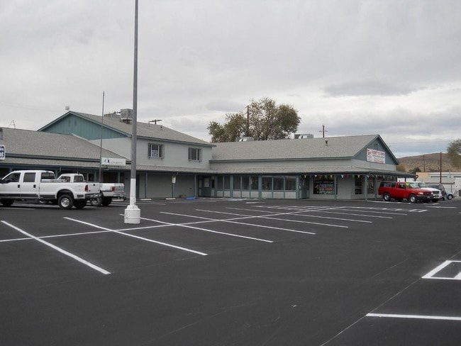
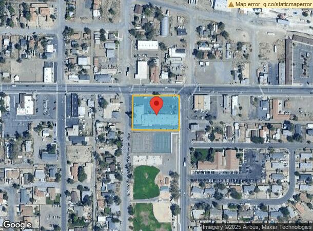
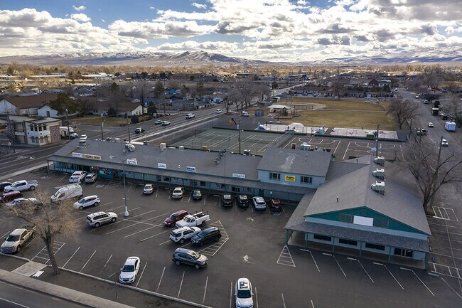
Property Record
95 W Main St, Fernley, NV 89408
NEARBY LISTINGS FOR SALE OR LEASE
Property Detail
95 W Main St
020-034-02
LOT 14-20-24 FR NE4
Commercialnec
Lyon
X
Nevada
32031C3135G
20
2026
1.28 AC
2025
Lyon County
960106
Reno/Sparks
17,618 SF
Fernley, NV
DEMOGRAPHICS near 95 W Main St
1 Mile
3 Mile
5 Mile
2024 Total Population
5,704
19,382
21,760
2029 Population
6,238
21,321
23,934
Pop Growth 2024-2029
+ 9.36%
+ 10.00%
+ 9.99%
Average Age
38
38
38
2024 Total Households
2,163
6,964
7,775
HH Growth 2024-2029
+ 9.39%
+ 9.99%
+ 9.99%
Median Household Inc
$80,861
$81,873
$82,312
Avg Household Size
2.60
2.80
2.80
2024 Avg HH Vehicles
2.00
2.00
2.00
Median Home Value
$247,561
$315,180
$321,540
Median Year Built
1991
2000
2000
Nearby Places
Map Layers
Map Styles
 Street
 Aerial
- Restaurants
- Banks
- Shops
- Fitness
- Groceries
PUBLIC TRANSPORTATION
AIRPORT
Reno/Tahoe International
DRIVE
WALK
Distance
Reno/Tahoe International
61 min
38.5 mi
SALE & LEASE HISTORY
LISTING DATE
SALE/LEASE

Mar 01, 2021
For Sale
Mar 01, 2021
For Lease
Nearby Properties
Address
Land Use
TOTAL SIZE
Lot Size
Zoning
Address
Land Use
TOTAL SIZE
Lot Size
Zoning
813,600 SF
61.66 AC
Address
Land Use
TOTAL SIZE
Lot Size
Zoning
267.40 AC
M1
Address
Land Use
TOTAL SIZE
Lot Size
Zoning
28.88 AC
RR1
Address
Land Use
TOTAL SIZE
Lot Size
Zoning
633,850 SF
44.79 AC
I
Address
Land Use
TOTAL SIZE
Lot Size
Zoning
465,120 SF
24.16 AC
I
Address
Land Use
TOTAL SIZE
Lot Size
Zoning
8,799 SF
11.67 AC
MF30
Address
Land Use
TOTAL SIZE
Lot Size
Zoning
588,560 SF
34.94 AC
MULT
Address
Land Use
TOTAL SIZE
Lot Size
Zoning
112,125 SF
57.15 AC
GR20
Address
Land Use
TOTAL SIZE
Lot Size
Zoning
399,984 SF
49.22 AC
I
Address
Land Use
TOTAL SIZE
Lot Size
Zoning
6,792 SF
21.50 AC
MU
Address
Land Use
TOTAL SIZE
Lot Size
Zoning
118,270 SF
28.47 AC
I
Address
Land Use
TOTAL SIZE
Lot Size
Zoning
172,724 SF
22.27 AC
I
Address
Land Use
TOTAL SIZE
Lot Size
Zoning
259,500 SF
37.26 AC
I
Address
Land Use
TOTAL SIZE
Lot Size
Zoning
157,615 SF
16.36 AC
C2
Address
Land Use
TOTAL SIZE
Lot Size
Zoning
170,560 SF
9.94 AC
Address
Land Use
TOTAL SIZE
Lot Size
Zoning
128,409 SF
13.14 AC
C2
Address
Land Use
TOTAL SIZE
Lot Size
Zoning
4,000 SF
34.40 AC
I
Address
Land Use
TOTAL SIZE
Lot Size
Zoning
20,935 SF
29.04 AC
MULT
Address
Land Use
TOTAL SIZE
Lot Size
Zoning
181,720 SF
10.94 AC
I
Address
Land Use
TOTAL SIZE
Lot Size
Zoning
56,228 SF
24.98 AC
I
Address
Land Use
TOTAL SIZE
Lot Size
Zoning
54,726 SF
10 AC
RR1
Address
Land Use
TOTAL SIZE
Lot Size
Zoning
4,474 SF
6.23 AC
PF
Address
Land Use
TOTAL SIZE
Lot Size
Zoning
52,100 SF
4.91 AC
C2
Address
Land Use
TOTAL SIZE
Lot Size
Zoning
115,200 SF
6.18 AC
I
Address
Land Use
TOTAL SIZE
Lot Size
Zoning
188,220 SF
12.17 AC
I
Address
Land Use
TOTAL SIZE
Lot Size
Zoning
165,424 SF
8.32 AC
I
Address
Land Use
TOTAL SIZE
Lot Size
Zoning
20,357 SF
74.69 AC
A
Address
Land Use
TOTAL SIZE
Lot Size
Zoning
111,142 SF
19.32 AC
I
Address
Land Use
TOTAL SIZE
Lot Size
Zoning
19,714 SF
6.98 AC
TC
Address
Land Use
TOTAL SIZE
Lot Size
Zoning
42,175 SF
10.32 AC
I
The World's #1 Commercial Real Estate Marketplace
Connect with us
© 2025 CoStar Group
The information above has been obtained from sources believed reliable. While we do not doubt its accuracy we have not verified it and make no guarantee, warranty or representation about it. It is your responsibility to independently confirm its accuracy and completeness. Any projections, opinions, assumptions, or estimates used are for example only and do not represent the current or future performance of the property. The value of this transaction to you depends on tax and other factors which should be evaluated by your tax, financial, and legal advisors. You and your advisors should conduct a careful, independent investigation of the property to determine to your satisfaction the suitability of the property for your needs.