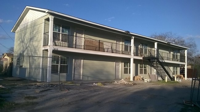
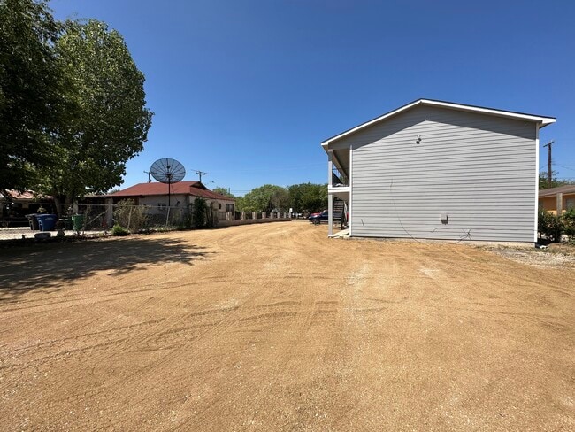
Property Record
410 Nw 36Th St, San Antonio, TX 78237

NEARBY LISTINGS FOR SALE OR LEASE
Property Detail
410 Nw 36Th St
San Antonio-New Braunfels, TX
Lakeview Gardens 2 Bl 8251
08251-001-0081
NCB 8251 BLK 1 LOT E 276.11 OF N 71.75 FT OF 8
Multifamilydwelling
Bexar
X
Texas
48029C0380G
81
2024
0.46 AC
2025
Memorial Heights
171200
San Antonio
4,160 SF
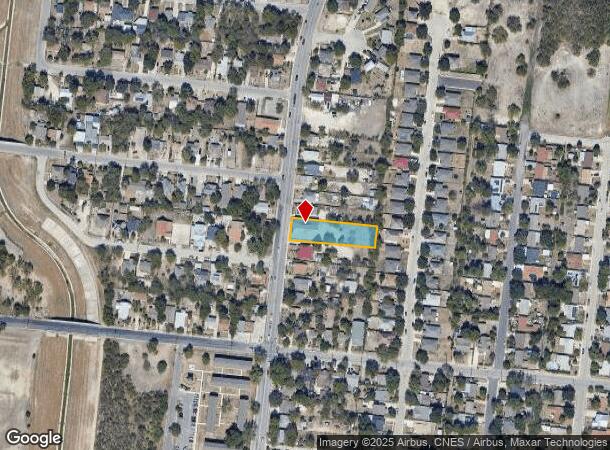
DEMOGRAPHICS near 410 Nw 36Th St
1 Mile
3 Mile
5 Mile
2024 Total Population
17,435
126,103
340,971
2029 Population
18,411
133,335
361,204
Pop Growth 2024-2029
+ 5.60%
+ 5.73%
+ 5.93%
Average Age
37
37
37
2024 Total Households
5,539
41,929
122,719
HH Growth 2024-2029
+ 5.72%
+ 5.87%
+ 6.34%
Median Household Inc
$34,541
$37,812
$40,312
Avg Household Size
3.10
2.90
2.60
2024 Avg HH Vehicles
2.00
2.00
2.00
Median Home Value
$92,517
$115,444
$138,788
Median Year Built
1965
1963
1967
Nearby Places
Map Layers
Map Styles
 Street
 Aerial
- Restaurants
- Banks
- Shops
- Fitness
- Groceries
PUBLIC TRANSPORTATION
COMMUTER RAIL
DRIVE
WALK
Distance
13 min
6.4 mi
AIRPORT
San Antonio International
DRIVE
WALK
Distance
San Antonio International
17 min
10.7 mi
SALE & LEASE HISTORY
LISTING DATE
SALE/LEASE

Sep 15, 2023
For Sale
Mar 02, 2020
For Sale
Jan 17, 2017
For Sale
Nearby Properties
Address
Land Use
TOTAL SIZE
Lot Size
Zoning
Address
Land Use
TOTAL SIZE
Lot Size
Zoning
324,044 SF
16.87 AC
Address
Land Use
TOTAL SIZE
Lot Size
Zoning
326,820 SF
12.57 AC
Address
Land Use
TOTAL SIZE
Lot Size
Zoning
442,263 SF
37.97 AC
Address
Land Use
TOTAL SIZE
Lot Size
Zoning
726,948 SF
16.86 AC
Address
Land Use
TOTAL SIZE
Lot Size
Zoning
66,404 SF
44.45 AC
Address
Land Use
TOTAL SIZE
Lot Size
Zoning
352,890 SF
19.97 AC
Address
Land Use
TOTAL SIZE
Lot Size
Zoning
245,371 SF
20.50 AC
Address
Land Use
TOTAL SIZE
Lot Size
Zoning
Address
Land Use
TOTAL SIZE
Lot Size
Zoning
186,948 SF
9.58 AC
Address
Land Use
TOTAL SIZE
Lot Size
Zoning
325,718 SF
38.35 AC
Address
Land Use
TOTAL SIZE
Lot Size
Zoning
110,468 SF
6.82 AC
Address
Land Use
TOTAL SIZE
Lot Size
Zoning
223,148 SF
19.15 AC
Address
Land Use
TOTAL SIZE
Lot Size
Zoning
99,538 SF
11.89 AC
Address
Land Use
TOTAL SIZE
Lot Size
Zoning
102,456 SF
7.35 AC
Address
Land Use
TOTAL SIZE
Lot Size
Zoning
173,363 SF
10.29 AC
Address
Land Use
TOTAL SIZE
Lot Size
Zoning
163,925 SF
7.44 AC
Address
Land Use
TOTAL SIZE
Lot Size
Zoning
315,630 SF
10.19 AC
Address
Land Use
TOTAL SIZE
Lot Size
Zoning
195,120 SF
19.77 AC
Address
Land Use
TOTAL SIZE
Lot Size
Zoning
187,200 SF
17.85 AC
Address
Land Use
TOTAL SIZE
Lot Size
Zoning
9,109 SF
714.90 AC
Address
Land Use
TOTAL SIZE
Lot Size
Zoning
143,212 SF
14.85 AC
Address
Land Use
TOTAL SIZE
Lot Size
Zoning
132,291 SF
7 AC
Address
Land Use
TOTAL SIZE
Lot Size
Zoning
133,892 SF
7.41 AC
Address
Land Use
TOTAL SIZE
Lot Size
Zoning
155,130 SF
13.89 AC
Address
Land Use
TOTAL SIZE
Lot Size
Zoning
222,095 SF
10.01 AC
Address
Land Use
TOTAL SIZE
Lot Size
Zoning
250,580 SF
11.06 AC
Address
Land Use
TOTAL SIZE
Lot Size
Zoning
249,640 SF
Address
Land Use
TOTAL SIZE
Lot Size
Zoning
197,650 SF
20.69 AC
Address
Land Use
TOTAL SIZE
Lot Size
Zoning
198,545 SF
9.36 AC
Address
Land Use
TOTAL SIZE
Lot Size
Zoning
117,770 SF
6.76 AC
The World's #1 Commercial Real Estate Marketplace
Connect with us
© 2025 CoStar Group
The information above has been obtained from sources believed reliable. While we do not doubt its accuracy we have not verified it and make no guarantee, warranty or representation about it. It is your responsibility to independently confirm its accuracy and completeness. Any projections, opinions, assumptions, or estimates used are for example only and do not represent the current or future performance of the property. The value of this transaction to you depends on tax and other factors which should be evaluated by your tax, financial, and legal advisors. You and your advisors should conduct a careful, independent investigation of the property to determine to your satisfaction the suitability of the property for your needs.